


We are going to have partly cloudy to mostly clear skies tonight with a chance of light rain showers, mainly in locations north of Great Falls, as a cold front begins to approach our area. The wind is also going to start to pick up late tonight as sustained wind speeds after midnight are going to be between 10 and 25 mph in north-central Montana. It is also going to feel nice outside tonight as lows are going to be in the mid to upper 40s and low to mid 50s in most locations.
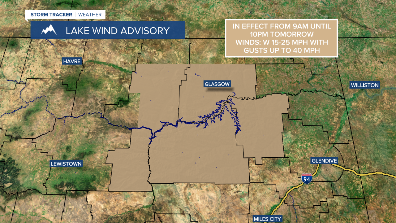
For tomorrow, the big story is going to be the wind as sustained wind speeds are going to be between 15 and 35 mph for most of the day, and wind gusts up to 50 mph are going to be possible at times in the valleys, while wind gusts up to 60+ mph are going to be possible at times along the Rocky Mountain Front. There is also a Lake Wind Advisory in effect for Fort Peck Lake from 9am until 10pm tomorrow. A Red Flag Warning is also in effect for southern and eastern Montana from 12pm until 8pm tomorrow as the combination of gusty winds and low relative humidity may allow new and/or existing fires to spread and/or grow rapidly.

We are also going to have partly cloudy skies tomorrow with a slight chance of rain showers, mainly during the afternoon and evening, as a dry cold front passes through our area. The temperatures tomorrow are also going to be near average for this time of year as highs are going to be in the upper 60s and low to mid 70s in most locations.
On Thursday, we are going to have decreasing clouds with a few isolated light rain showers around, mainly during the morning and mainly in locations east of I-15. We are then going to have mostly to partly cloudy skies with a slight chance of rain showers and thunderstorms, mainly in Glacier County, on Friday. It is also going to be cooler on Thursday than it is going to be tomorrow as highs are only going to be in the mid to upper 60s in most locations. The temperatures are then going to warm back up some on Friday as highs are going to be in the upper 60s and low to mid 70s in most locations. Breezy conditions are also expected Friday afternoon and evening as sustained wind speeds are going to be between 10 and 25 mph.
Saturday is then going to have increasing clouds with some isolated rain showers around, generally in locations along the Continental Divide, as another cold front passes through our area. It is also going to be windy on Saturday, especially during the afternoon and evening, as sustained wind speeds are going to be between 15 and 30 mph, and wind gusts up to 50 mph are going to be possible at times.
There are then going to be some scattered valley rain and mountain rain/snow showers around on Sunday and Monday as a storm system passes through our area. Light to moderate snow accumulations are possible in the mountains over these two days. The temperatures are also going to cool down some over these two days as highs on Sunday are going to be in the mid to upper 60s in most locations, and highs on Monday are going to be in the mid to upper 50s and low 60s in most locations. It is also going to be a bit breezy on these two days, especially during the afternoon and evening, as sustained wind speeds are going to be between 10 and 20 mph.
For next Tuesday, we are going to have mostly sunny skies with a chance of valley rain and mountain rain/snow showers as this storm system leaves our area. It is also going to be cool next Tuesday as highs are going to be in the upper 50s and low 60s in most locations.


