


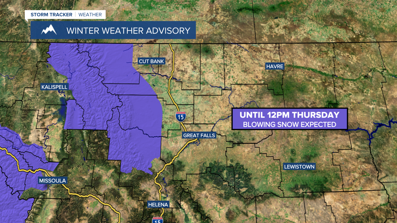
A WINTER WEATHER ADVISORY is in effect for the Rocky Mountain Front until 12pm Thursday. Blowing snow is expected.
A HIGH WIND WARNING is in effect for Glacier County, northern Lewis and Clark County, western/central Pondera County, western/central Teton County, and western Toole County until 6pm Thursday. Sustained wind speeds are going to be between 35 and 55 mph, and wind gusts up to 70 mph (85 mph along the Rocky Mountain Front) are going to be possible at times.

It is going to be very windy tonight and tomorrow along the Rocky Mountain Front as wind gusts up to 85 mph are going to be possible at times. East of the Rocky Mountain Front, we are going to have increasing wind tonight and gusty to strong winds around tomorrow as wind gusts up to 50 mph are going to be possible at times. Widespread gusty to strong winds are then expected tomorrow night and Friday as wind gusts up to 50 mph are going to be possible at times. Also, the wind is going to be coming out of the west or southwest in most locations from tonight through Friday.
We are also going to have increasing clouds and mostly dry conditions tonight. We are then going to have mostly to partly cloudy skies tomorrow with a few widely scattered snow and rain showers around, especially in the mountains. It is also going to be chilly tonight as lows are going to be in the teens and 20s. It is then going to be warmer tomorrow than it was today as highs are going to be in the 40s and mid to upper 30s.
On Friday, there are going to be a few scattered snow showers around as a disturbance passes through our area. We are also going to have partly cloudy skies and cooler temperatures on Friday as highs are going to be in the 30s and low 40s.
Partly cloudy skies and mostly dry conditions are then expected on Saturday as high pressure is going to be in control of our weather. There is also only going to be a little bit of a breeze around on Saturday as sustained wind speeds are going to be between 5 and 20 mph. It is also going to be cool on Saturday as highs are going to be in the 30s in most locations.
On Sunday, there are going to be areas of snow around in central Montana and we are going to have a chance to see some snow in north-central Montana as a storm system begins to approach our area. There are then going to be areas of snow around throughout central and north-central Montana on Monday as this storm system passes through our area.
The temperatures are also going to cool down some over these two days as highs are going to be in the upper 20s and low 30s on Sunday, and the low to mid 20s on Monday. It is also going to be breezy on Sunday as sustained wind speeds are going to be between 10 and 20 mph, and it is going to be a little breezy on Monday as sustained wind speeds are going to be between 10 and 15 mph.
There are then going to be some isolated snow showers around on Tuesday and Wednesday. We are also going to have mostly to partly cloudy skies on these two days. It is also going to be chilly on these two days as highs are going to be in the 20s and low 30s.


