


This evening, we are going to have partly cloudy skies with a few showers/storms along the Hi-Line. It is then going to be mainly clear and mainly dry tonight. It is also going to be breezy tonight along the northern half of the Rocky Mountain Front, and it is going to be breezy early on tonight in Valley County as sustained wind speeds are going to be between 10 and 20 mph. We are also going to have pleasant temperatures tonight as lows are going to be in the 50s in most locations.
Check out the weekend forecast:
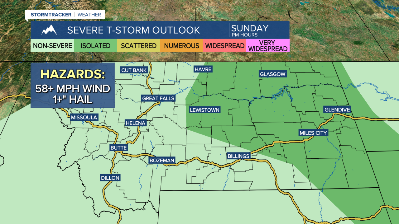
There are going to be scattered showers and thunderstorms around this weekend, mainly during the PM hours, as a couple disturbances impact the state. These showers/storms will be traveling towards the northeast, impacting central Montana (including the Helena area) mainly during the afternoon and evening and impacting north-central Montana mainly during the late afternoon, evening, and early nighttime hours. The highest coverage of showers/storms this weekend will be in central Montana, including around the Helena and Lewistown areas.

A couple of the thunderstorms that develop this weekend, specifically within eastern Montana, may be severe with damaging winds (58+ mph) and/or large hail (1+” in diameter). Severe or not, gusty winds, brief heavy rain, small hail, and frequent lightning will be possible with all the thunderstorms that do develop, so please keep an eye to the sky when you are outdoors. New fire starts due to lightning strikes are also possible this weekend.
Although there will be some showers and thunderstorms around this weekend, a majority of the weekend will be dry, and not everyone will see this precipitation, so there is no need to cancel any outdoor plans that you may have. We are also going to have partly to mostly sunny skies this weekend, with the cloud cover increasing as we go through each day. Tomorrow will be the sunnier day of the weekend.
It is also going to be very warm this weekend as highs are going to be in the 80s and low to mid 90s tomorrow, and the mid to upper 70s, 80s, and low 90s on Sunday, with the coolest temperatures on Sunday around Helena and along the Rocky Mountain Front. It will also be breezy along the Divide/the Rocky Mountain Front and out to I-15 tomorrow as sustained wind speeds are going to be between 10 and 25 mph. Elsewhere, there will just be a little breeze around tomorrow as sustained wind speeds are going to be between 5 and 20 mph. Little to no wind is then expected on Sunday, although it will continue to be breezy along the Rocky Mountain Front.
There will be a bit of haze around this weekend in north-central Montana due to smoke from local and regional wildfires. The visibility will be reduced some from this smoke, but the air quality won’t be impacted much as most locations should have “good” or “moderate” air quality. Around Bozeman, Butte, and Helena, expect periods of smoke and poor air quality (unhealthy for sensitive groups or unhealthy for everyone) this weekend due to smoke from the Windy Rock fire in Powell County and the Cloudrest fire as well as the Bivens Creek fire in the Tobacco Root mountains.

Another disturbance will impact Montana on Monday producing some isolated showers and thunderstorms during the afternoon and evening, mainly in the mountains and in locations east of I-15. We are also going to have mostly sunny skies on Monday. Lots of sunshine and dry conditions are then expected for the rest of next week as an upper-level ridge is going to be in control of our weather. It is also going to be hot for the beginning of next week as highs are going to be in the mid to upper 80s and low to mid 90s Monday through Wednesday, with Tuesday being the hottest day. The temperatures will then cool down some for the end of next week as highs are going to be in the 80s on Thursday and the mid to upper 70s and low to mid 80s on Friday.


