


There are going to be some scattered valley rain and mountain rain/snow showers around tonight, especially before midnight, as a disturbance continues to work its way through our area. A few isolated thunderstorms are also possible tonight. We are also going to have cloudy skies and cool temperatures tonight as lows are going to be in the mid to upper 30s and low to mid 40s in most locations.
For tomorrow, we are going to have decreasing clouds with some isolated valley rain and mountain rain/snow showers around, mainly during the morning and mainly in locations east of I-15, as this disturbance leaves our area. We are then going to have partly cloudy skies with some isolated valley rain and mountain rain/snow showers around on Sunday as the next storm system begins to approach our area.
The temperatures this weekend are going to continue to be near average for this time of year as highs are going to be in the mid to upper 50s and low 60s in most locations. It is also going to be breezy tomorrow, especially during the afternoon and evening, as sustained wind speeds are going to be between 10 and 25 mph. It is then going to be breezy/windy on Sunday, especially during the afternoon and evening, as sustained wind speeds are going to be between 10 and 30 mph, and wind gusts up to 40+ mph are going to be possible at times.
A strong storm system is then going to pass through our area on Monday and Tuesday. There is a lot of moisture associated with this storm system, but a lot of that moisture is going to remain to the south and west of a line from Cut Bank to Great Falls to Glasgow. That means that in north-central Montana (including Great Falls), there are just going to be some scattered rain and snow showers around on these two days, while a mix of snow and rain is likely in south-central (including Helena) and southern Montana on these two days.
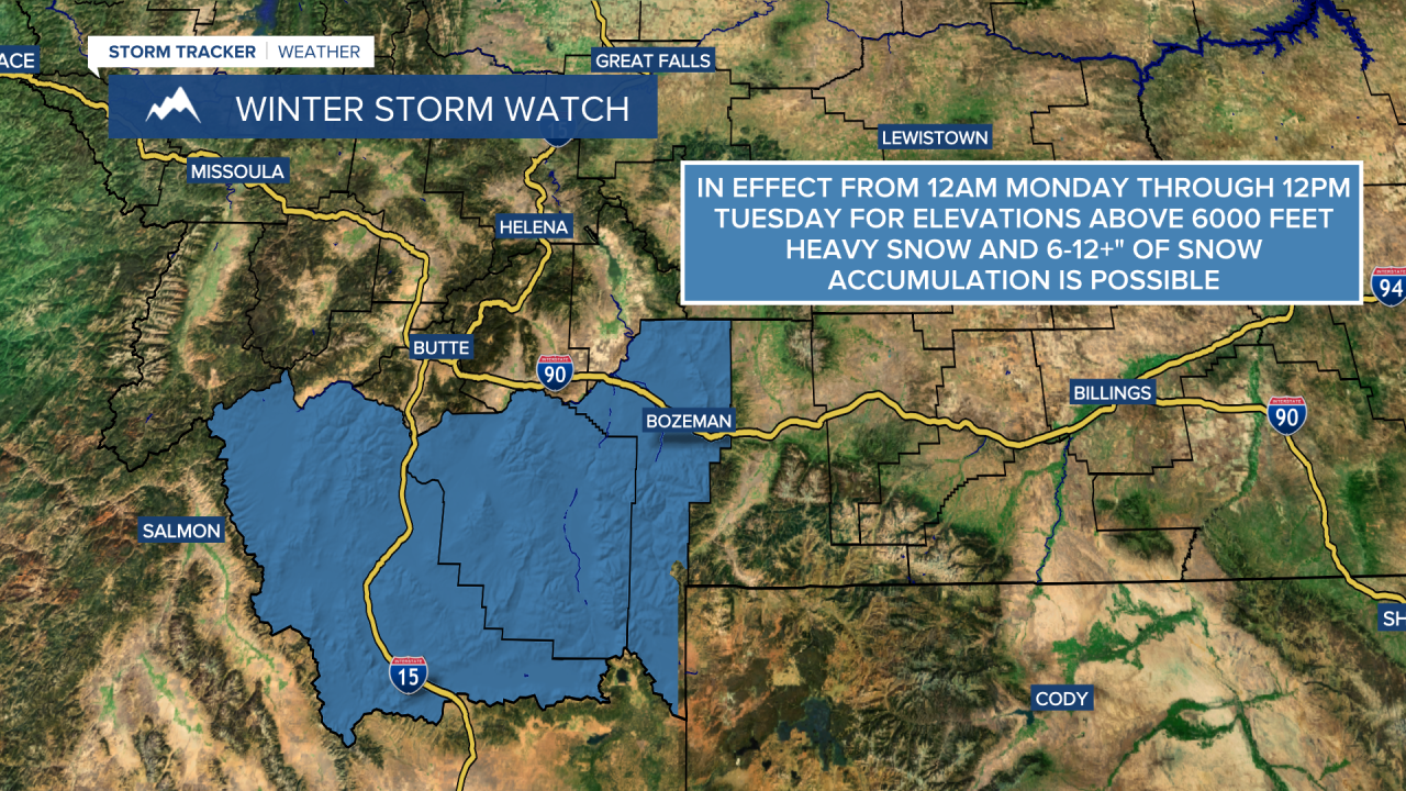
In north-central Montana, not much, if any, snow accumulation is expected between Sunday evening and Tuesday evening. However, the further south you go, the more snow that is expected as Helena and Lewistown may pick up a coating to 3 inches of snow accumulation; the mountains around Helena and Lewistown may pick up 2-6+” of snow accumulation; and the southern part of Montana may receive 3-7” of snow accumulation in the lower elevations and 6-12+” of snow accumulation in the higher elevations. There is also a Winter Storm Watch in effect for elevations above 6000 feet in Beaverhead County, Gallatin County, and Madison County from 12am Monday through 12pm Tuesday.

It is also going to be chilly on Monday and Tuesday as highs are only going to be in the upper 30s and low to mid 40s in most locations. There is also going to be a little bit of a breeze around on Monday and Tuesday, especially during the PM hours, as sustained wind speeds are going to be between 10 and 15 mph.
We are then going to have partly cloudy to mostly sunny skies with a slight chance of rain and snow showers on Wednesday, Thursday, and Friday as we continue to remain in an unsettled weather pattern. It is also going to be a little bit warmer on these three days than it is going to be on Monday and Tuesday as highs are on Wednesday and Thursday going to be in the upper 40s and low 50s in most locations, and highs on Friday are going to be in the mid 50s in most locations. There is also going to be a bit of a breeze around on these three days, especially during the PM hours, as sustained wind speeds are going to be between 10 and 20 mph.


