


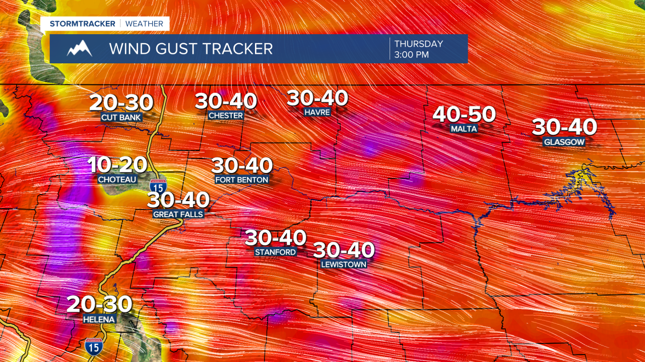
A FIRE WEATHER WATCH is in effect for portions of north-central and northeastern Montana from 11am until 7pm Thursday. Elevated fire danger is expected on Thursday due to the combination of gusty winds, warm temperatures, and low relative humidity.

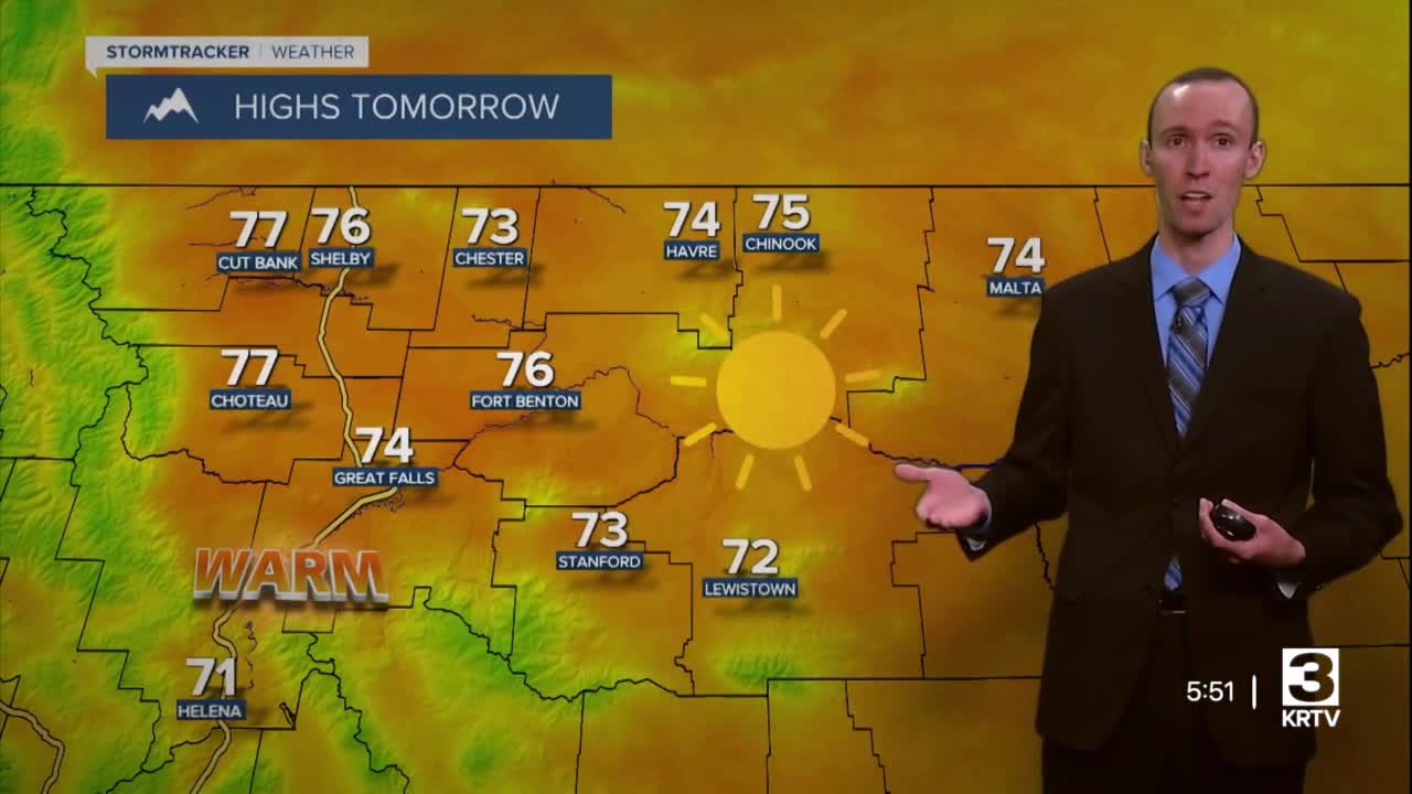
It is going to be chilly tonight as lows are going to be in the 30s in most locations. We are also going to have clear skies tonight. For tomorrow, we are going to have picture-perfect fall weather as we are going to have mainly sunny skies, dry conditions, little wind, and warm temperatures (highs in the 70s in most locations). This is going to be the last picture-perfect fall day that we are going to have for the foreseeable future, so make sure you spend as much time outdoors as possible enjoying this awesome weather!
On Thursday, we are going to have increasing clouds with a few isolated showers around during the afternoon and evening as a cold front passes through our area. We are also going to have gusty winds around on Thursday as sustained wind speeds are going to be between 10 and 30 mph, and wind gusts up to 50 mph are going to be possible at times. This wind is initially going to be coming out of the WSW, but behind the cold front, the wind will shift direction to come out of the NW. It is also going to be mild on Thursday as highs are going to be in the mid to upper 60s and low to mid 70s, and the combination of gusty winds, warm temperatures, and low relative humidity is going to create elevated fire danger.
It is then going to be cooler and breezy on Friday as highs are going to be in the 60s and sustained wind speeds are going to be between 10 and 25 mph. This wind is going to be coming out of the WSW. We are also going to have mostly cloudy skies on Friday with some isolated rain and mountain rain/snow showers around, generally during the afternoon/evening and generally in the mountains.
For this weekend and early next week, cooler and wetter weather is expected as an upper-level trough is going to be in control of our weather. On Saturday, we are going to have overcast skies with rain and mountain snow/rain showers around. The snow levels are also going to be getting lower as the day goes on. We are then going to have mostly cloudy skies on Sunday with scattered rain/snow showers around in the lower elevations and scattered snow showers around in the mountains. Also, snow levels Sunday morning may be as low as 2500 feet.
Some more scattered rain and snow showers are then possible on Monday. We are then going to have partly cloudy skies with some isolated rain and snow showers around on Tuesday, especially in the mountains. On these two days, snow is going to be possible in all locations during the morning, but the snow levels will rise some as the day goes on.
The temperatures are also going to cool down A LOT this weekend as highs are going to be in the 50s and upper 40s on Saturday, and the upper 30s and low to mid 40s on Sunday. Highs are then going to be in the 40s and low 50s early next week. Also, lows Saturday night through Monday night are going to be in the mid to upper 20s and low to mid 30s, so a freeze and/or frost is expected in all locations. It is also going to be a bit breezy this weekend and early next week as sustained wind speeds are going to be between 10 and 20 mph, and wind gusts over 30 mph are going to be possible at times.


