


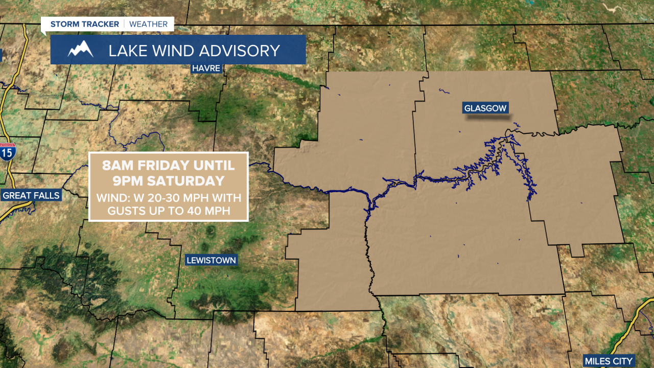
A LAKE WIND ADVISORY is in effect for Fort Peck Lake from 8am Friday until 9pm Saturday.
The wind will diminish some as we head into tonight, but it will continue to be breezy in some areas as sustained wind speeds are going to be between 10 and 25 mph. It is then going to be even windier tomorrow than it was today as sustained wind speeds are going to be between 15 and 35 mph, and widespread wind gusts over 40 mph are expected, with wind gusts over 50 mph possible at times. This wind is also going to be coming out of the west in most locations tonight and tomorrow.

There are also going to be some isolated showers and thunderstorms around tonight, generally in locations along the Rocky Mountain Front and along the Hi-Line. There are then going to be scattered showers and a few thunderstorms around tomorrow, especially during the afternoon and evening, as a cold front passes through our area. There is also going to be some snow in the mountains tomorrow and light snow accumulations are possible.
We are also going to have decreasing clouds early tonight followed by increasing clouds later tonight. We are then going to have partly cloudy skies tomorrow. It is also going to be mild tonight as lows are going to be in the mid to upper 40s and low to mid 50s. It is then going to be cooler tomorrow than it was today as highs are going to be in the 50s and 60s.
Saturday is then going to be the nicer day of the weekend as we are going to have partly to mostly sunny skies, mostly dry conditions (just a few isolated showers/storms around), and pleasant temperatures as highs are going to be in the upper 50s and low to mid 60s. We are also going to have less wind around on Saturday, although it is still going to be breezy as sustained wind speeds are going to be between 10 and 25 mph, and wind gusts up to 40 mph are possible.
Rain and mountain rain/snow showers are then likely on Sunday, especially during the afternoon and evening, as a disturbance passes through our area. We are also going to have partly to mostly cloudy skies and cooler temperatures on Sunday as highs are going to be in the 50s and low to mid 60s. There is also going to be a bit of a breeze around on Sunday as sustained wind speeds are going to be between 10 and 20 mph.
There are then going to be scattered rain and mountain rain/snow showers around on Monday, generally during the afternoon and evening, as another disturbance passes through our area. Isolated thunderstorms are also possible on Monday. We are then going to be in between disturbances on Tuesday so there are just going to be some isolated showers and thunderstorms around. We are also going to have partly to mostly cloudy skies on these two days.
The temperatures on these two days are also going to be a bit below average for this time of year as highs are going to be in the 50s and low to mid 60s. It is also going to be a little breezy on these two days as sustained wind speeds are going to be between 5 and 20 mph.
More rain and mountain snow/rain showers are then expected on Wednesday and Thursday as a stronger storm system impacts our area. We are also going to have below average temperatures on these two days as highs are going to be in the 50s and low 60s in most locations. There is also going to be a bit of a breeze around on these two days as sustained wind speeds are going to be between 10 and 20 mph.


