A WINTER STORM WARNING is in effect for some of the mountains in southern Montana and northern Wyoming until 12am/6am Friday. Up to 6 inches of new snow accumulation is possible.

We are going to have overcast to mostly cloudy skies tonight with some patchy areas of fog around. There are also going to be a few scattered showers around tonight, generally before midnight and especially in the mountains. It is also going to be cool/chilly tonight as lows are going to be in the mid to upper 30s and low 40s in most locations.
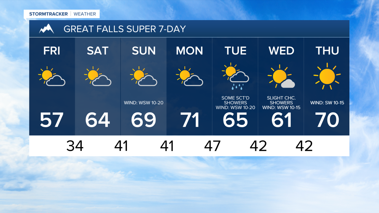
For tomorrow, we are going to have decreasing clouds with some patchy areas of fog around during the morning. A few isolated showers are also possible tomorrow, but most locations are going to remain dry. It is also going to be a bit warmer tomorrow than it was today as highs are going to be in the 50s in most locations.
For this weekend and Monday, we are going to have nice fall weather as an upper-level ridge is going to be in control of our weather. On these three days, we are going to have partly cloudy skies and mostly dry conditions. The temperatures are also going to warm back up some over these three days as highs are going to be in the upper 50s and low to mid 60s on Saturday; the mid to upper 60s and low 70s on Sunday; and the mid to upper 60s and low to mid 70s on Monday. There is also going to be a breeze around on Sunday as sustained wind speeds are going to be between 10 and 20 mph.
There are then going to be some scattered showers around on Tuesday and there are going to be some isolated showers around on Wednesday, generally during the morning and generally in locations east of I-15, as the next storm system works its way through our area. The temperatures are also going to cool down some over these two days as highs are going to be in the 60s on Tuesday, and the mid to upper 50s and low 60s on Wednesday. It is also going to be breezy on Tuesday as sustained wind speeds are going to be between 10 and 25 mph, and wind gusts up to 40 mph are possible.
Lots of sunshine and mild temperatures (highs in the mid to upper 60s and low 70s) are then expected on Thursday as an upper-level ridge is going to be in control of our weather.