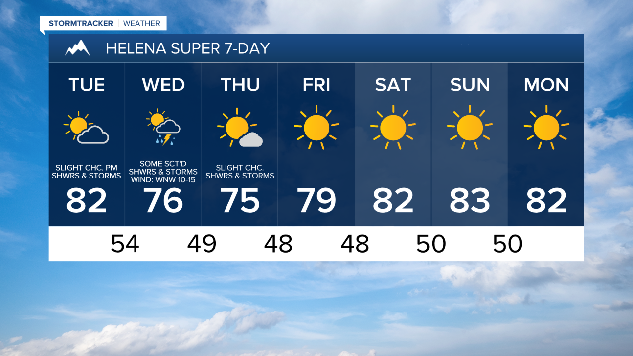
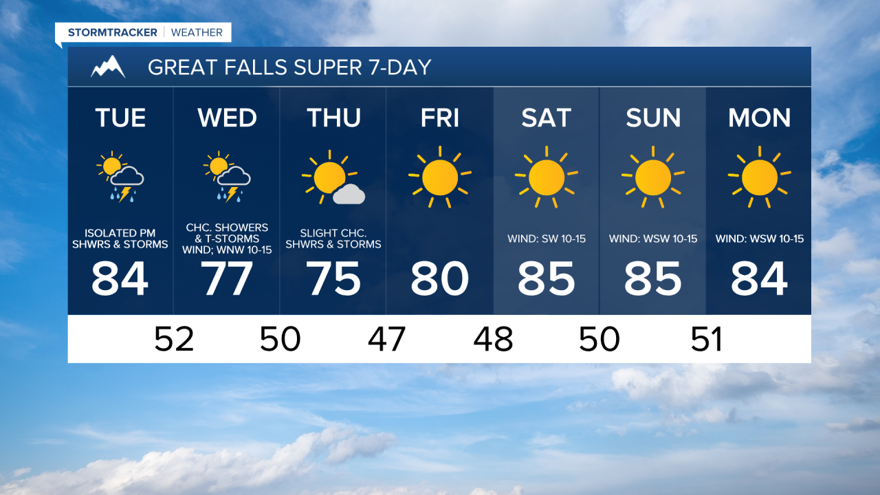
We are going to have increasing clouds and mainly dry conditions tonight. It is also going to be warmer tonight than it was last night as lows are going to be in the upper 40s and low to mid 50s in most locations.
For tomorrow, we are going to have partly to mostly cloudy skies with some isolated showers and thunderstorms around during the afternoon and evening as a disturbance passes through our area. It is also going to be warm tomorrow as highs are going to be in the upper 70s and low to mid 80s in most locations. There is also going to be a little breeze around tomorrow in northeastern Montana and along the Rocky Mountain Front as wind gusts up to 30 mph are possible.
There are then going to be some scattered showers and thunderstorms around on Wednesday, especially in locations east of I-15, as a stronger disturbance passes through our area. We are also going to have partly to mostly cloudy skies on Wednesday. It is also going to be a bit cooler and a bit breezy on Wednesday as highs are going to range from the mid 60s to the low 80s, and sustained wind speeds are going to be between 10 and 20 mph.
On Thursday, we are going to have mostly sunny skies with a slight chance of showers and thunderstorms, mainly in locations east of I-15, as Wednesday’s disturbance leaves our area. It is also going to feel really nice outside on Thursday as highs are going to be in the 70s in most locations.
Lots of sunshine and dry conditions are then expected from Friday through Monday as an upper-level ridge is going to be in control of our weather. It is also going to be warm on these four days as highs are going to be in the mid to upper 70s and low to mid 80s on Friday, and the 80s and upper 70s on Saturday, Sunday, and Monday. It is also going to be a little breezy this weekend and on Monday as sustained wind speeds are going to be between 5 and 20 mph.