


Winter Weather Alerts are in effect for a lot of western and central Montana, including both the mountains and the lower elevations, for Sunday (10/12/2025) into Monday (10/13/2025).
Snow levels dropped as we went through Saturday night, with some lower elevation locations waking up to their first accumulating snowfall of the season this morning, while the mountains picked up several inches of snow overnight.
A lot of the roads throughout the state are just wet, but roads are slick/snow-covered in some areas, mainly at and above mountain pass level. The below image was MacDonald Pass at 9:30am on Sunday.

As we go through today, heavy snow will continue in the mountains and there is going to be scattered rain/snow around in the lower elevations. A more widespread area of snow will develop and impact portions of central and western Montana from Sunday evening through Monday morning, and this is when the bulk of the lower elevation snow accumulation will occur.

Roads will likely be slick/snow-covered in a lot of areas within central and western Montana Monday morning, so please use extreme caution when driving to work and school.
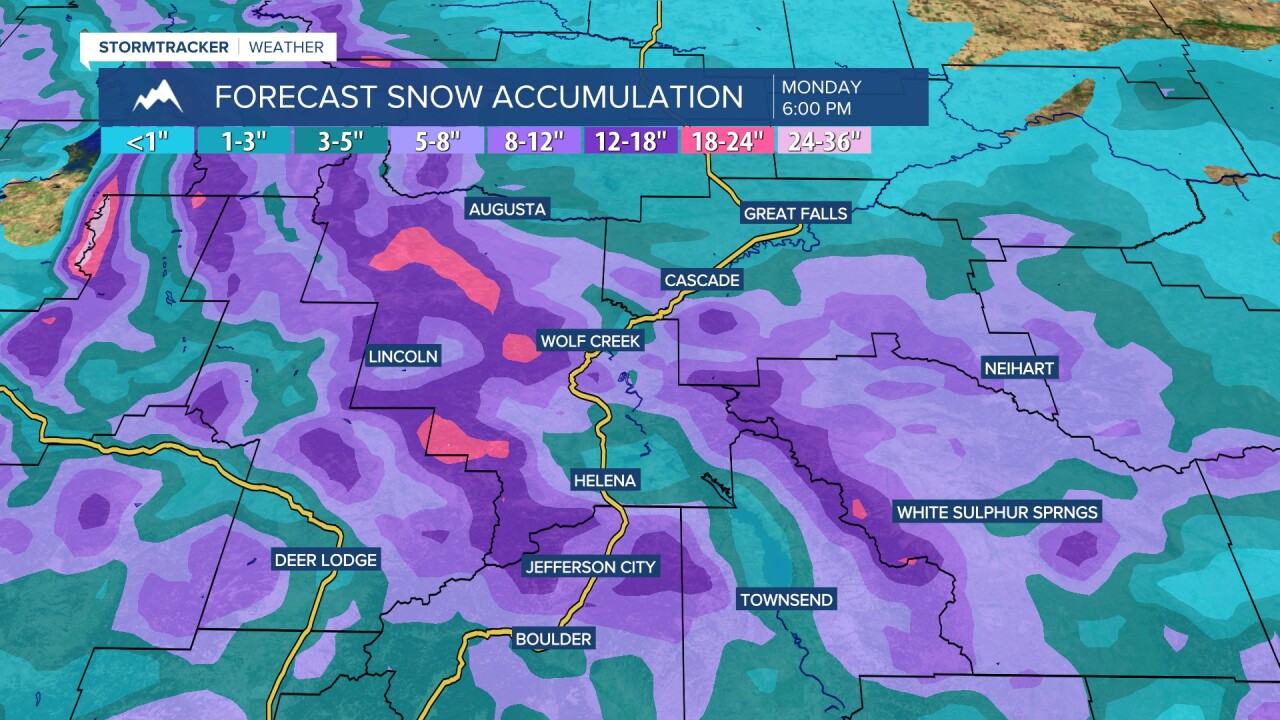
Some of the mountains may receive up to 20" of snow, with the highest amounts expected in the Rockies. In the lower elevations, up to 4" of snow is possible, with up to 8" of snow possible in lower elevation locations near the mountains, including the high plains along the Rocky Mountain Front and along I-15 south of Cascade to Helena.

Due to this snow, Winter Weather Alerts are in effect for a lot of western and central Montana through noon on Monday.


