


A widespread high wind event develop east of the Continental Divide after sunset Monday through Tuesday morning. A mild stretch of weather before an abrupt cooldown and widespread accumulating snow late week.
Today's Forecast:
Highs will be similar to yesterday, steady in the upper 30s and 40s. Cloudy with widely scattered rain and mountain snow showers. While snow levels will be fairly high, an inch or two of snow could fall over the mountain passes.
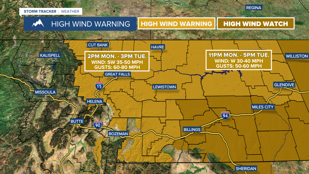
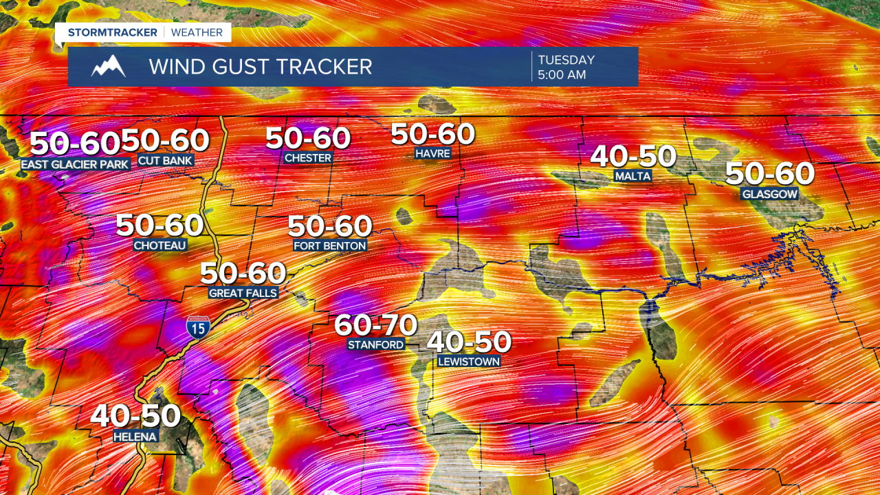
Winds ramp up this afternoon and evening, with the strongest gusts occurring late evening through midday Tuesday in central Montana and early Tuesday morning through Tuesday afternoon in eastern Montana. Frequent 50-60+ mph gusts across central and eastern Montana, with isolated stronger gusts over 70 mph. The strongest wind gusts will be for the Rocky Mountain Front and in Judith Basin county. Secure any loose objects, holiday decorations or trash cans on your property before heading to bed. Travel is going to be very difficult for high-profile vehicles and there is a blow-over risk on north-south oriented roads and highways.

High temperatures will be in the 40s in central and eastern Montana and lower 50s in Helena. During the morning and early afternoon, a front drops in from the north which will diminish the wind but it could bring a burst of rain and snow to central Montana and a quick inch or two of snowfall under the heavier snow bands.
Very mild temperatures return into Wednesday, with highs in the upper 40s and lower 50s in central Montana, upper 30s and 40s on the Hi-Line and 20s and lower 30s in northeast Montana. Rain and snow showers are possible during the morning.
It will turn colder and snowier by Thursday and Friday. Falling temperatures and rain changing over to snow throughout the day Thursday. Models are in agreement for a widespread several inches of snow across central Montana. High temperatures will fall into the 0s and 10s by Friday and Saturday, but milder air moves back north into Sunday.


