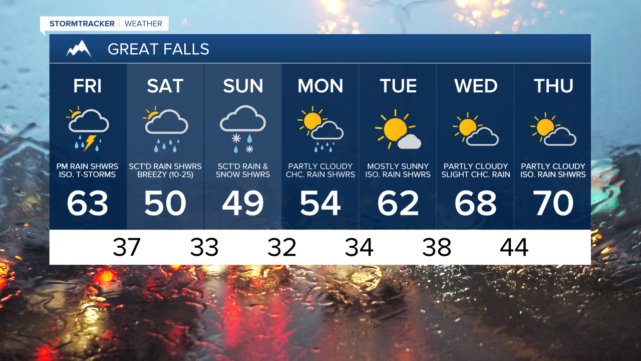
Rain showers are likely tomorrow, especially after 11am, as a cold front works its way through our area. A couple isolated thunderstorms are also possible tomorrow afternoon and evening, and the main hazards with any thunderstorms that do develop tomorrow will be heavy rainfall, small-sized hail, and gusty winds. There are then going to continue to be rain showers around tomorrow night as this cold front continues to work its way eastward across Montana and into the Dakotas. This rain will also mix in with and eventually switch over to snow tomorrow night in the higher elevations.

The storm system associated with this cold front is then going to park itself over our area this weekend, which is going to allow us to continue to have cool, wet, and unsettled weather. On Saturday, there will be scattered valley rain and mountain rain/snow showers around in north-central Montana, and valley rain and mountain rain/snow showers are likely throughout the day in eastern Montana. Scattered valley rain and mountain rain/snow showers are then going to continue to be around our area Saturday night and Sunday before we start to dry out a bit Sunday night. It is also possible late Saturday night and Sunday morning that the valleys could see some snow as temperatures are going to be near freezing, although little to no snow accumulation is expected.
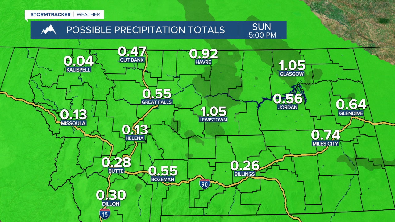
Now the exact placement of this storm system is going to determine how much rainfall and snowfall a given location receives, but in general, locations in the mountains can expect to receive several inches of snow accumulation over the next three days, and locations in the valleys can expect to receive .25 inches to an inch of liquid precipitation over the next three days.
The temperatures are also going to be a lot cooler over the next three days than they were today as highs tomorrow are going to be in the low to mid 60s, and highs on Saturday and Sunday are going to be in the upper 40s and low 50s. Lows tomorrow night and Saturday night are also going to be back in the 30s in most locations. It is also going to be a little breezy tomorrow as sustained wind speeds are going to be between 5 and 20 mph, and wind gusts are going to be between 20 and 30 mph. It is then going to be breezy/windy on Saturday as sustained wind speeds are going to be between 10 and 25 mph, and wind gusts are going to be between 30 and 45 mph.
Monday is then going to be drier than this weekend is going to be, but there are still going to be some scattered valley rain and mountain rain/snow showers around as this storm system continues to hang out over our area. Tuesday is then going to have mostly sunny skies with some isolated rain showers around as this storm system finally begins to leave our area. Partly to mostly cloudy skies and dry conditions are then expected on Wednesday before another storm system brings a chance of more rain showers to our area on Thursday. The temperatures are also going to warm up a lot next week as highs on Monday are going to be in the mid 50s; highs on Tuesday are going to be in the low to mid 60s; and highs on Wednesday and Thursday are going to be in the upper 60s and low 70s.