We are going to have mainly clear skies and mainly dry conditions tonight. It is also going to be mild tonight as lows are going to be in the 50s and low 60s.
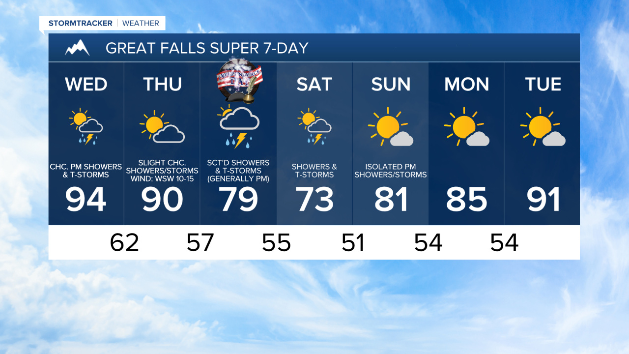
For tomorrow, we are going to have increasing clouds with some scattered showers and thunderstorms around, mainly during the PM hours, as some monsoonal moisture works its way into our area. A few of the thunderstorms that develop tomorrow may be severe with damaging winds (58+ mph). There is also going to be a bit of a breeze around tomorrow along the Rocky Mountain Front and eastern portions of the Hi-Line as sustained wind speeds are going to be between 10 and 20 mph.
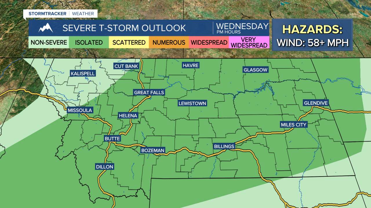
It is also going to be very hot tomorrow as highs are going to be in the mid to upper 80s and low to mid 90s in central Montana and the upper 80s, 90s, and low 100s in north-central Montana. A HEAT ADVISORY is in effect for portions of eastern Montana from 9am until 9pm on Wednesday due to this heat.

On Thursday, we are going to have partly to mostly cloudy skies with some scattered showers and thunderstorms around, generally during the afternoon/evening and generally in central Montana, including around Helena and Lewistown, as some more monsoonal moisture works its way into our area. It is also going to be slightly cooler, but still pretty hot on Thursday as highs are going to be in the 80s and upper 70s around Helena and the 80s and low to mid 90s in north-central Montana. There is also going to be a breeze around on Thursday along the Rocky Mountain Front and in Glacier County as sustained wind speeds are going to be between 10 and 25 mph. Elsewhere, it is going to be a little breezy on Thursday as sustained wind speeds are going to be between 5 and 20 mph.
Showers and thunderstorms are then likely on Friday around Helena, and there are going to be scattered showers and thunderstorms around on Friday in north-central Montana, generally in southern portions of north-central Montana, as a disturbance begins to impact our area. Most of this precipitation will occur during the PM hours, so some of the fireworks shows may be impacted. If you will be outdoors at all on Friday, keep the rain gear handy.
Showers and thunderstorms are then likely on Saturday in north-central Montana, especially during the morning, and there are going to be scattered showers and thunderstorms around the Helena area on Saturday as this disturbance continues to impact our area. We are also going to have partly to mostly cloudy skies on these two days.
Cooler temperatures are expected on Friday and Saturday as highs are going to be back in the mid to upper 70s and low to mid 80s on Friday and the mid to upper 60s and low to mid 70s on Saturday. There is also going to be a bit of a breeze around in some areas on Friday as sustained wind speeds are going to be between 10 and 20 mph.
We are then going to have partly to mostly sunny skies on Sunday with a few scattered showers and thunderstorms around, generally during the afternoon and evening. We are also going to have near average temperatures on Sunday as highs are going to be in the mid to upper 70s and low 80s.
Early next week, we are going to have mostly sunny skies and mostly dry conditions as an upper-level ridge begins to build back into our area. The temperatures are also going to warm back up over these two days as highs are going to be in the low to mid 80s on Monday and the mid to upper 80s and low to mid 90s on Tuesday.