


Good Morning! Today is Tuesday, October 13, 2026. Here is today’s forecast:
A powerful storm system impacted Montana from Saturday through Monday morning, bringing significantly colder temperatures and widespread rain/snow to the state. Snow totals with this storm were very impressive as several locations in central Montana received around or over a foot of snow! The below graphics show some of the updated snow totals from this storm.
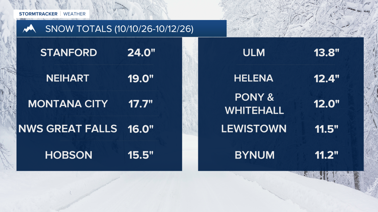
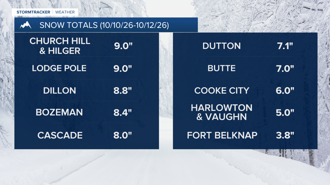
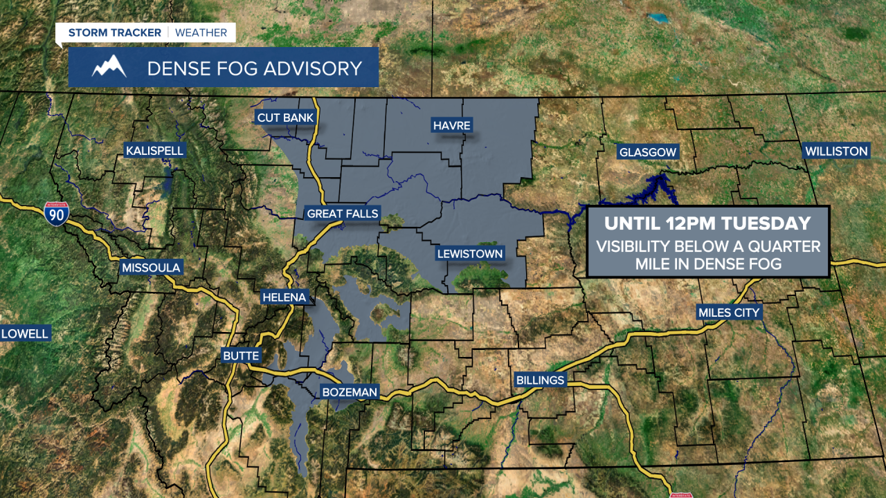
Today, there will be some cloud cover and areas of fog around during the morning, and some of the fog will be locally dense. A DENSE FOG ADVISORY is in effect for the plains of north-central Montana and the valleys of central and southwestern Montana until 12pm today. As the morning goes on, the fog will burn off and the cloud cover will diminish, with lots of sunshine expected from the late morning through the evening. Although still chilly, it will be warmer today than it was yesterday as highs are going to be in the 40s and low 50s.
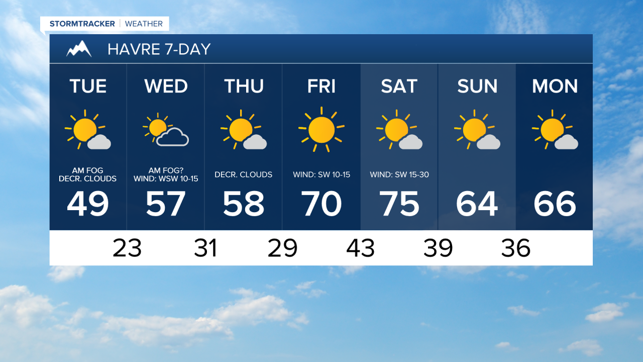
Skies will be partly to mostly sunny tomorrow, with the cloud cover increasing as the day goes on. There will also be patchy fog around tomorrow morning. The warming trend continues tomorrow with highs in the 50s in most spots. Along the Rocky Mountain Front, breezy conditions are expected tomorrow with sustained winds of 10 to 25 mph. Elsewhere, there will be a little breeze around tomorrow with sustained winds of 5 to 20 mph.
On Thursday, it is going to be mostly sunny, with the cloud cover decreasing as the day goes on. Patchy fog is also possible during the morning. Highs on Thursday will be in the 50s and there will be little to no wind.
Much warmer temperatures are expected Friday, this weekend, and on Monday as highs will be in the 60s and low to mid 70s, with the warmest temperatures expected on Saturday. Friday will feature abundant sunshine, while partly to mostly sunny skies are expected this weekend and on Monday.
The wind will also return with the warmer temperatures. It will be breezy in some areas on Friday with sustained winds of 10 to 25 mph. Widespread gusty winds are then expected on Saturday with sustained winds of 10 to 30 mph, and gusts over 40 mph are possible. Lighter winds return for Sunday and Monday.
The next chance of precipitation arrives for the middle of next week as another upper-level trough builds into our region.



Have a tremendous Tuesday!
Chief Meteorologist Ryan Dennis
