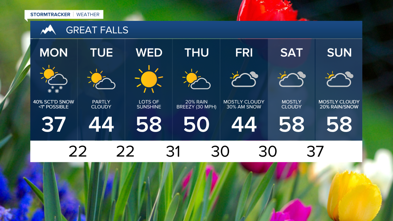
After a cool, rainy, and eventually snowy end to the weekend, things will start to turn around as soon as this afternoon. Temperatures will still be on the cool side with highs running well below average. Regardless, many areas will still see some sunshine today which will help to melt the snow that has fallen. We're still awaiting final reports of snowfall around the area and will bring those to you later this evening.

In the meantime, roads are hazardous, especially in the higher elevations (at pass level) and on bridges across the area. A light slushy accumulation on the roads is likely in some areas, with standing water also a possibility. Take some extra time this morning to get to your destination. A winter weather advisory is still in effect until Noon today, with the possibility of a trace to a couple of more inches of snow in some locations.
Things will begin to moderate tomorrow and into Wednesday with temperatures approaching average once again by Wednesday. It won't last long though. By Friday we may be running 15-20 degrees below average once again with another cold air mass heading this way.
Thankfully this system was rich in moisture, so several areas saw some beneficial precipitation, however much more is needed in North-East Montana to really put a dent in the drought situation. We're keeping a close eye on several more disturbances later this week that could produce additional amounts of beneficial moisture to this area.