



Good Morning! Today is Wednesday, September 2, 2026. Here is today’s forecast:
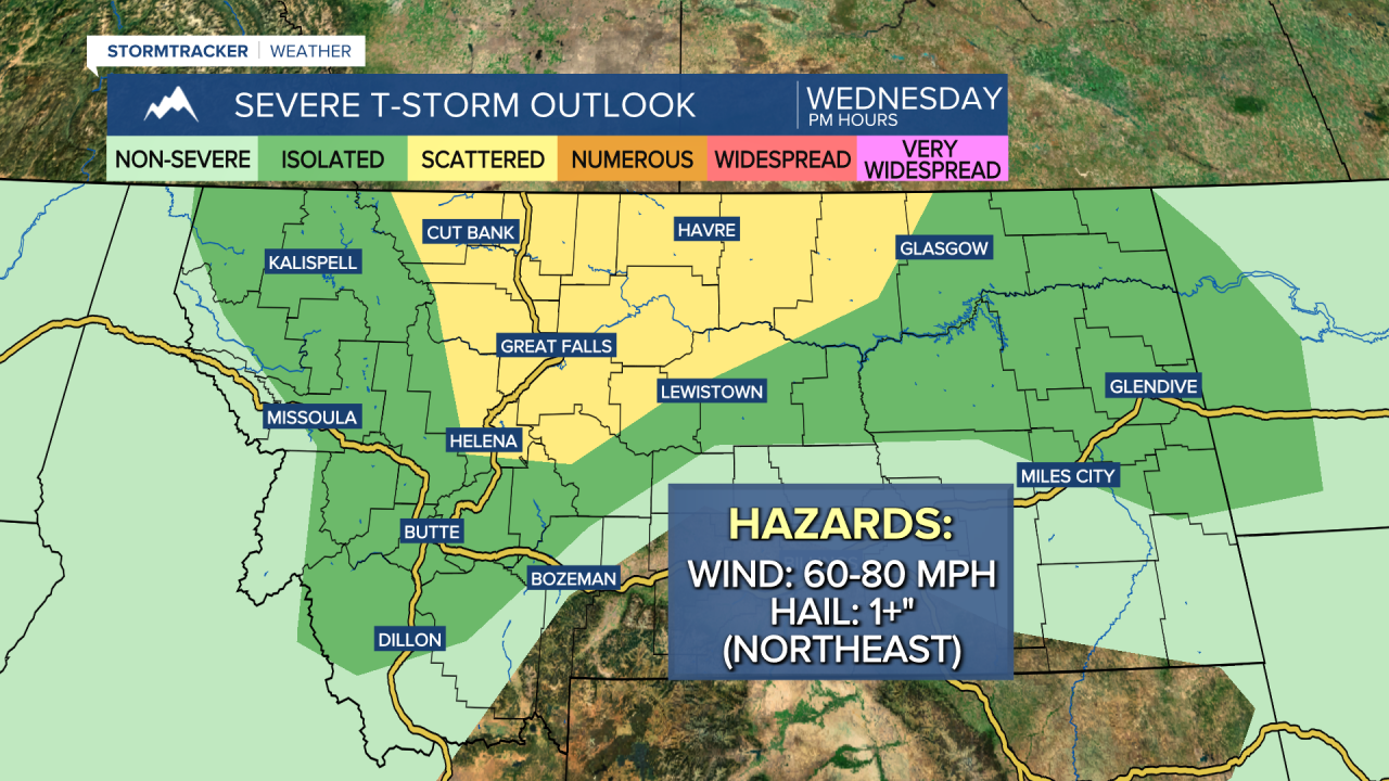
There are going to be scattered showers and thunderstorms around this afternoon through early tonight as a shortwave passes through our area. Storms will first develop over the higher terrain during the early afternoon before moving northeast and north across the plains.
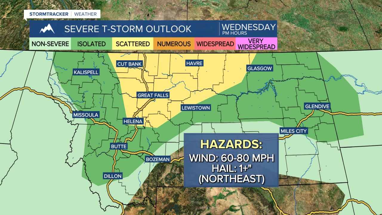
Some of the thunderstorms that develop later today, especially across north-central Montana, will be severe with strong, damaging winds. Wind gusts of 60 to 80 mph are possible. A few storms in northeastern Montana may also produce large hail (1+” in diameter). Severe or not, all storms that develop will be capable of producing frequent lightning, small to medium-sized hail, gusty to strong winds, and brief, heavy rainfall, so keep an eye to the sky if you will be outdoors at all later on today.
Today's storms will be fast-moving, but they could pack a punch. Here is the expected timing for select locations:
Cut Bank: 3-7pm
Glasgow: 5-10pm
Great Falls: 3-6pm
Havre: 4-8pm
Helena: 2-5pm
Lewistown: 2-6pm
Skies will be partly cloudy today, with a wide range of temperatures across our area. Highs will range from the low 70s near the Rocky Mountain Front and around Helena to the low 90s in northeastern Montana. Gusty winds will also develop this afternoon and evening, with the strongest wind expected in central Montana and in western portions of north-central Montana. Sustained wind speeds will be between 10 and 30 mph, and gusts over 40 mph are possible.
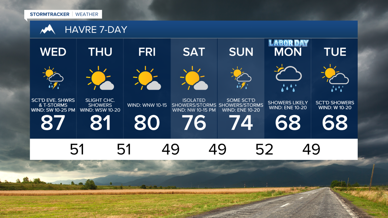
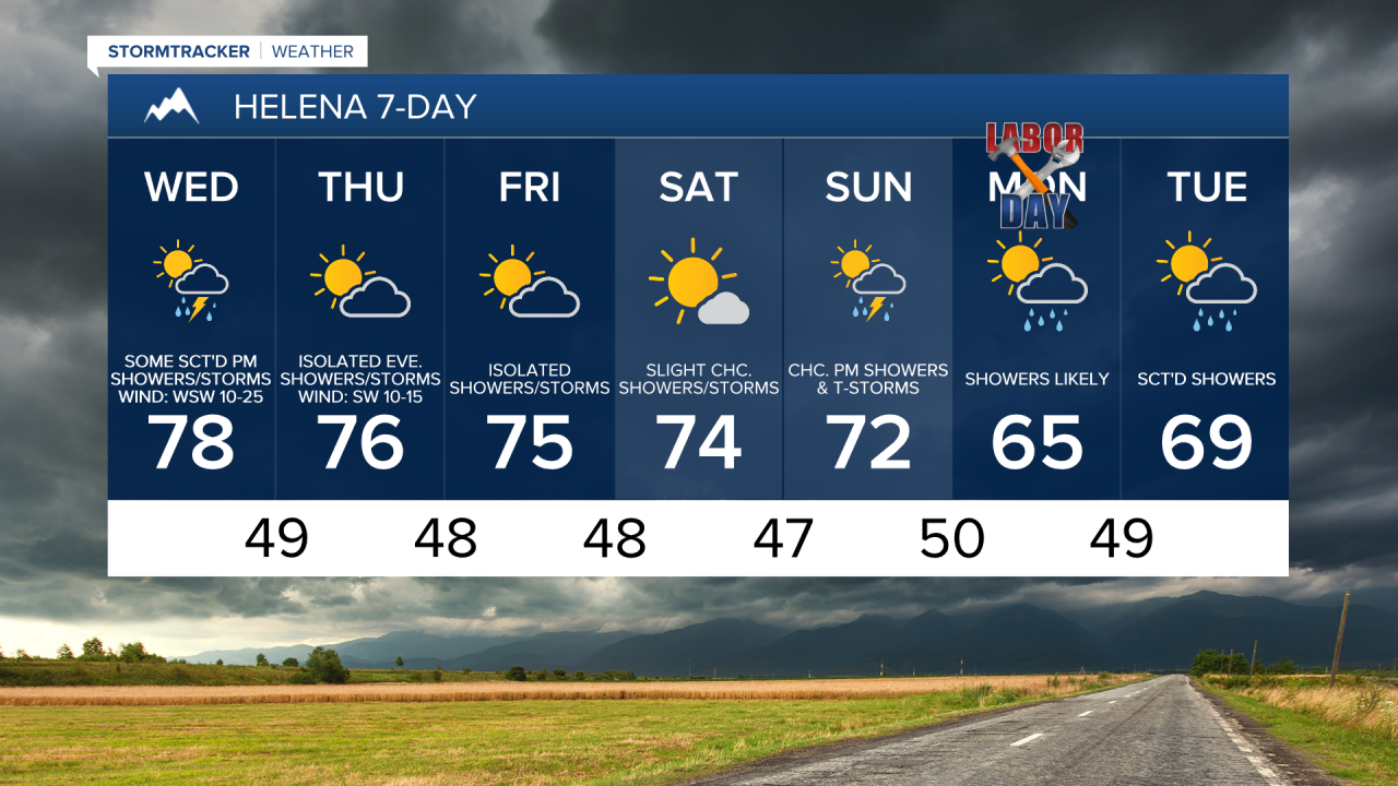
Tomorrow will be partly to mostly sunny and mostly dry, just a few isolated showers and thunderstorms around, generally in the mountains and around the Helena area and generally during the afternoon and evening. It is also going to be breezy tomorrow, especially during the afternoon and evening, as sustained wind speeds are going to be between 10 and 25 mph, and gusts up to 40 mph are possible. Highs tomorrow will be in the 70s and low to mid 80s in most spots.
On Friday, it is going to be partly to mostly sunny and there will be a few showers and thunderstorms around, generally in central Montana and in western portions of north-central Montana. Highs on Friday will range from the upper 60s near the Rockies to the mid 90s in northeastern Montana. There will also be a little breeze around on Friday as sustained wind speeds are going to be between 5 and 20 mph.
Saturday will be the nicest day of the holiday weekend as it is going to be mostly sunny and mostly dry, just some isolated showers and thunderstorms around. It is also going to feel nice outside on Saturday as highs are going to be in the 70s and low to mid 80s (60s along the Rocky Mountain Front) and there will just be a little breeze around.
Sunday will be partly cloudy with a few scattered showers and thunderstorms around, especially during the afternoon and evening. It will also be a little cooler on Sunday as highs are going to be in the 60s, 70s, and low 80s.
Early next week is shaping up to be cooler and wetter as a storm system moves through the region. Rain showers are likely on Labor Day, with additional scattered showers expected on Tuesday. A few thunderstorms will also be possible on these two days.
It will be a lot cooler early next week as highs are going to be in the 60s and upper 50s in most locations. There will also be a little bit of a breeze around on these two days as sustained wind speeds are going to be between 5 and 20 mph.


Have a wonderful Wednesday!
Chief Meteorologist Ryan Dennis
