



Good Morning! Today is Tuesday, August 18, 2026. Here is today’s forecast:
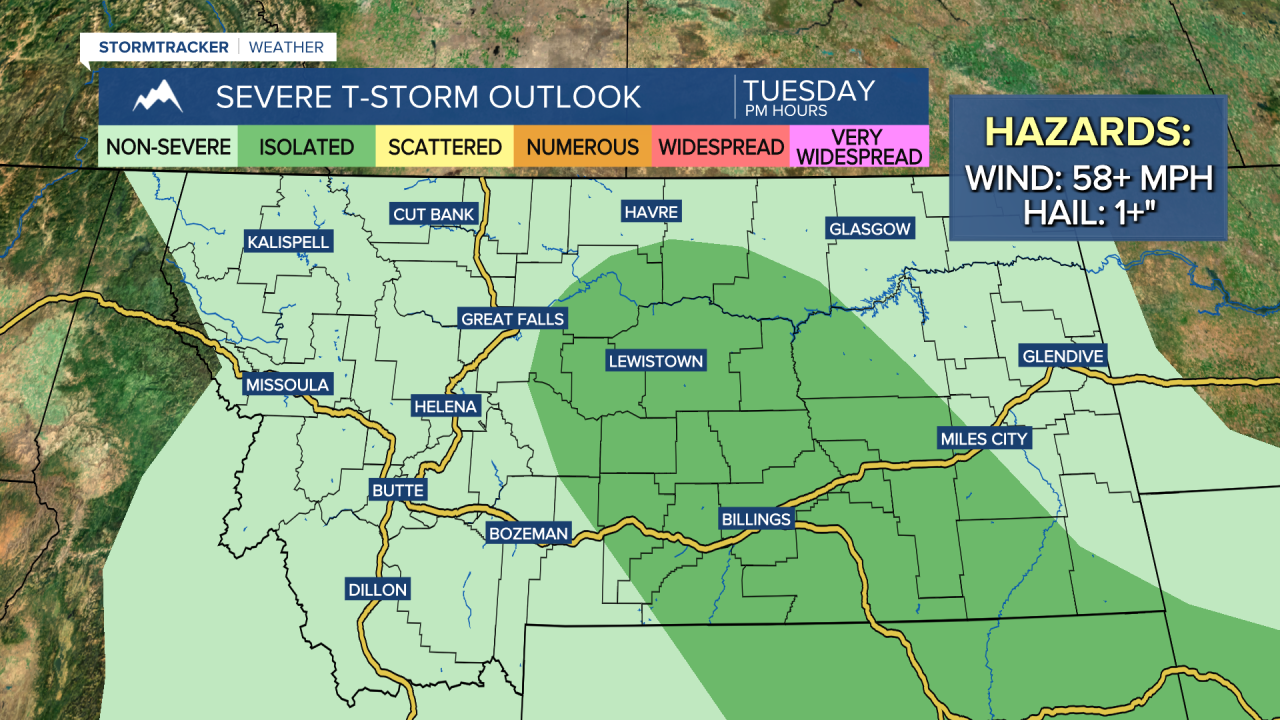
There are going to be scattered showers and thunderstorms around this afternoon through early tonight, and today's storm coverage will be more widespread than yesterday's storm coverage was. There will also be a few isolated showers and thunderstorms around this morning.
A few of the thunderstorms that develop later on today may be severe with damaging winds (58+ mph) and/or large hail (1+” in diameter), so make sure you keep an eye to the sky if you will be outdoors at all. It is also going to be partly cloudy today.

Highs today will be in the upper 70s and low to mid 80s, so it will be another warm day. Along the Rocky Mountain Front and the Continental Divide, it will be breezy today as sustained wind speeds are going to be between 10 and 20 mph. East of the Rocky Mountain Front, it will be a little breezy today (especially between the Rocky Mountain Front and I-15) as sustained wind speeds are going to be between 5 and 20 mph.
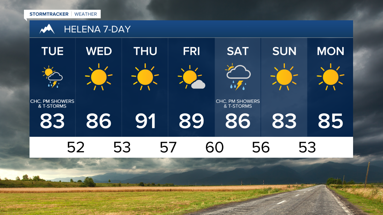
Tomorrow and Thursday will be mostly sunny and dry, and Friday will be partly to mostly sunny and dry as an upper-level ridge is going to be in complete control of our weather. It is also going to be very warm tomorrow through Friday as highs are going to be in the mid to upper 80s and low 90s.
There will be a little bit of a breeze around in some areas tomorrow and Thursday as sustained wind speeds are going to be between 5 and 20 mph. It is then going to be a bit breezy on Friday as sustained wind speeds are going to be between 10 and 20 mph.
On Saturday, it is going to be partly to mostly cloudy and there are going to be some scattered showers and thunderstorms around during the afternoon and evening as another disturbance passes through the state. It is then going to be mainly sunny and mainly dry on Sunday as high pressure builds back into our area.
It will still be warm this weekend, but the temperatures will cool down a few degrees between Saturday and Sunday. Highs on Saturday are going to be in the 80s and low 90s, while highs on Sunday are going to be in the 80s and upper 70s. There is also going to be a bit of a breeze around in some areas this weekend as sustained wind speeds are going to be between 10 and 20 mph.



Have a tremendous Tuesday!
Chief Meteorologist Ryan Dennis
