WEATHER DISCUSSION: On Saturday night and into Sunday morning, expect low temperatures in the low to upper-20s and low-30s with cloudy skies, lower elevation rain/snow mix, and mountain snow. Breezy winds will be expected, with gusts around 40-50 mph.
Brianna Juneau has the full forecast - watch the video:
An upper-level trough and an associated cold front began moving across most of North Central, Central and Southwestern Montana on Saturday afternoon. Cold air from Canada moved into the region behind the cold front, lowering snow levels across the area and bringing a rain/snow mix to most lower elevations of North Central Montana and rain to the valleys of Central and Southwestern Montana and heavy mountain snow.

On Sunday the upper-level trough remains over the area in the morning. Due to the cold front, Sunday temperatures will be below average with high temperatures expected in the low to upper-30s and low to mid-40s.
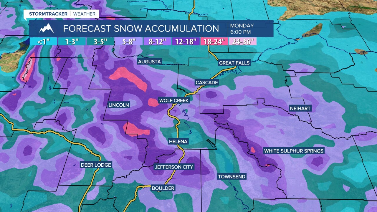
Expect cloudy skies and morning rain/snow mix and mountain snow. Across most locations, there will be a precipitation lull between noon Sunday and Sunday evening. Most lower elevation locations will see the best chances of snow accumulation Sunday night into Monday morning.
On Monday, an upper-level ridge remains over the region, allowing the area to dry out for the most part. On Tuesday, the upper level ridge remains, allowing temperatures to begin to warm up across the area with mostly dry weather. Wednesday through Friday, temperatures warm up even more with some with daily precipitation chances.
