

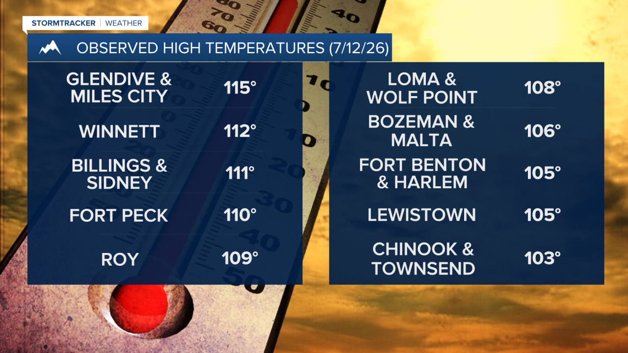


Happy Monday everyone! It was an extremely hot weekend as highs were in the 90s, 100s, and 110s, and multiple locations set a new all time record high temperature yesterday in south-central and southeastern Montana. The worst of the heat is now over with, but it will continue to remain very warm to hot this week, with today being the hottest day of the week.

Here is today's forecast:
A HEAT ADVISORY remains in effect for most of north-central Montana and the Bozeman/Helena areas until 9pm Monday and for portions of northeastern Montana until 2am Tuesday.

An EXTREME HEAT WARNING remains in effect for southeastern Montana and portions of northeastern and south-central Montana until 12am/2am Tuesday.

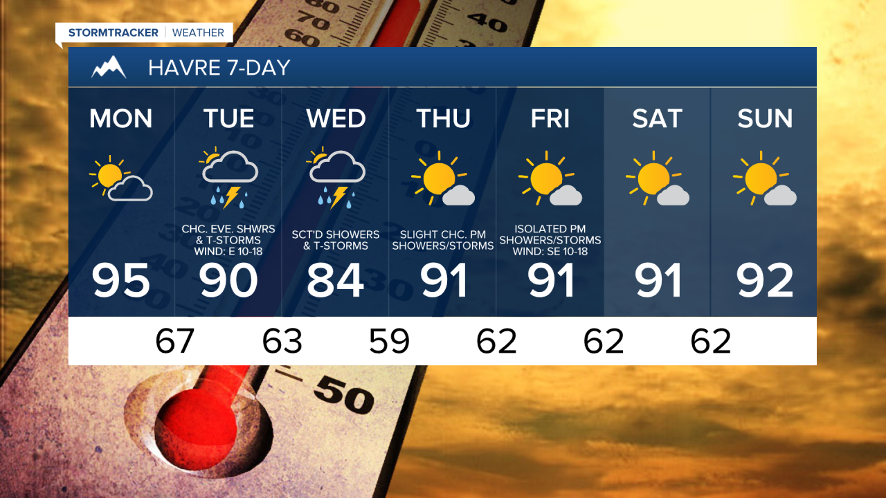
It is going to be hot again today, although in several locations, it will be a little cooler today than it was yesterday, as highs are going to be in the 90s and mid to upper 80s. It is also going to be partly to mostly sunny today, with more clouds the further west you are and more sunshine the further east you are. Most locations will be dry today, but a few isolated showers and thunderstorms are possible this evening and tonight, and a couple of these thunderstorms may be severe with damaging winds (58+ mph).

There will be scattered showers and thunderstorms around tomorrow, generally during the evening, tomorrow night, and Wednesday as a stronger disturbance passes through our area. A few of the thunderstorms that develop later on tomorrow may be strong to severe with damaging winds (58+ mph), large hail (1+” in diameter) and/or heavy rainfall. It is also going to be partly to mostly cloudy tomorrow through Wednesday.

Cooler temperatures are expected tomorrow and Wednesday as highs are going to be back in the 80s and low 90s tomorrow and the mid to upper 70s and low to mid 80s on Wednesday. There is also going to be a breeze around in eastern portions of north-central Montana tomorrow as sustained wind speeds are going to be between 10 and 20 mph.
On Thursday, it is going to be partly to mostly sunny and there will be a few scattered showers and thunderstorms around during the afternoon and evening. It is also going to be hot and a little breezy on Thursday as highs are going to be in the mid to upper 80s and low 90s and sustained wind speeds are going to be between 5 and 20 mph.
Friday will be a mostly sunny and hot day as highs are going to be in the mid to upper 80s and low to mid 90s. There will also be a few showers around Friday afternoon/evening, generally along the Hi-Line and in the mountains.
This weekend will feature a good amount of sunshine and mostly dry conditions, just a few isolated showers and thunderstorms around. It is also going to be hot again this weekend, although it will be cooler than it was this past weekend as highs are going to be in the mid to upper 80s and low to mid 90s.


Have a great Monday!
Chief Meteorologist Ryan Dennis
