


A LAKE WIND ADVISORY is in effect from 6am until 6pm Saturday for Fort Peck Lake.

We are going to have partly cloudy to mostly clear skies (via increasing clouds) tonight. It is also going to be mild tonight as lows are going to be in the mid to upper 50s and low 60s, and there will be a little breeze around tonight in some locations.
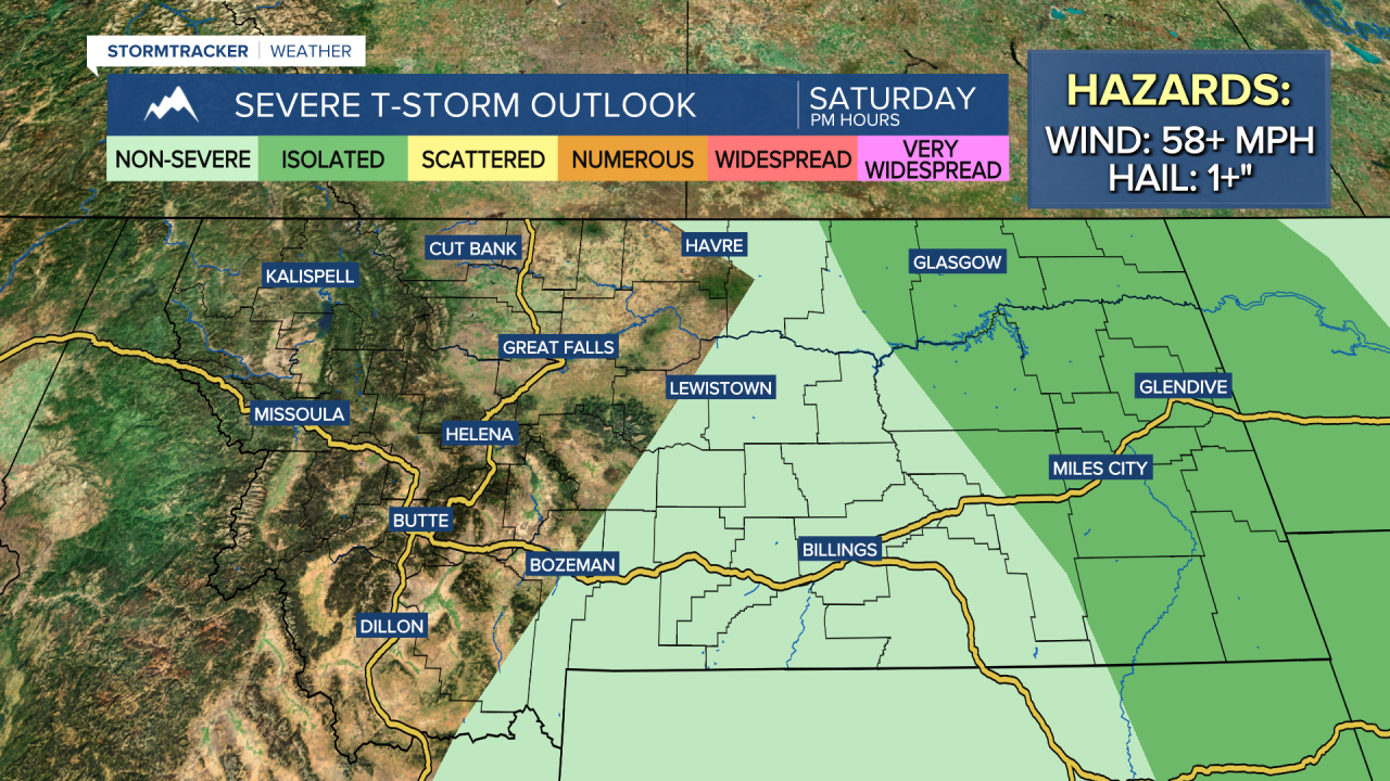
For tomorrow, we are going to have partly cloudy skies (via decreasing clouds) with some isolated showers and thunderstorms around, generally along the eastern half of the Hi-Line. A few severe thunderstorms with damaging winds (58+ mph) and/or large hail (1+”) will also be possible later on tomorrow in far eastern Montana.
It is also going to be warm tomorrow as highs are going to be in the mid to upper 70s and low to mid 80s, and there will be some haze around, especially around the Helena area. Along the Rocky Mountain Front, it is going to be gusty tomorrow as sustained wind speeds are going to be between 15 and 30 mph, and wind gusts up to 40 mph are possible. Out across the plains, it will be breezy in some areas tomorrow as sustained wind speeds are going to be between 10 and 20 mph, and a few gusts over 30 mph will be possible at times.
On Sunday, we are going to have partly to mostly cloudy skies with some isolated showers and thunderstorms around, generally along the Hi-Line and in the mountains and generally during the PM hours. We are also going to have pleasant temperatures on Sunday as highs are going to be in the 70s and low to mid 80s. There is also only going to be a little breeze (5-20 mph) around on Sunday.
Unsettled weather returns for the beginning of next week as we are going to have a chance to see some showers and thunderstorms on Monday and there are going to be scattered showers and thunderstorms around on Tuesday as an upper-level trough impacts our area. We are also going to have mostly to partly cloudy skies on these two days in most locations. Much cooler temperatures are also expected on these two days as highs are going to be in the 70s and mid to upper 60s in most spots. It is also going to be a little breezy on Monday and Tuesday as sustained wind speeds are going to be between 5 and 20 mph.
On Wednesday, we are going to have mostly sunny skies with a few isolated showers and thunderstorms around as the upper-level trough departs our area. Lots of sunshine and mostly dry conditions are then expected on Thursday and Friday. The temperatures are also going to warm back up over these three days as highs are going to be in the mid to upper 70s and low to mid 80s on Wednesday and the 80s and low to mid 90s on Thursday and Friday.


