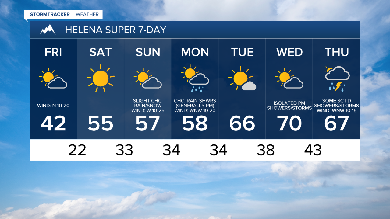
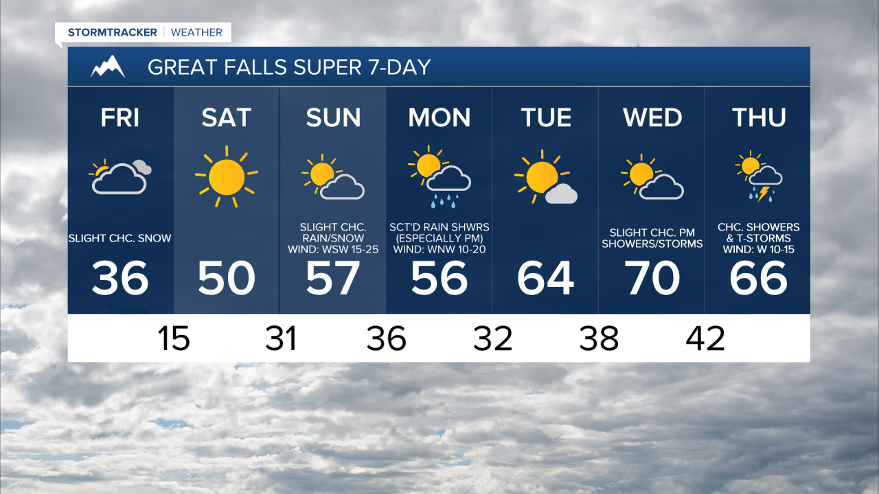
We are going to have partly cloudy skies tonight with a few isolated snow showers around, generally in northeastern Montana and in the mountains. It is also going to be cold again tonight as lows are going to be in the mid to upper teens and low to mid 20s in most locations. There is also going to be a breeze around throughout the night tonight in northeastern Montana as sustained wind speeds are going to be between 10 and 25 mph. Elsewhere, we are going to have diminishing wind this evening, with just a little breeze around overnight.
For tomorrow, we are going to have partly to mostly cloudy skies with a few isolated snow showers around, especially in the mountains. It is also going to be cold again tomorrow as highs are only going to be in the mid to upper 30s and low to mid 40s in most locations. There is also going to be a breeze around in some areas tomorrow as sustained wind speeds are going to be between 10 and 25 mph, and the strongest wind is going to be in northeastern Montana.
We are then going to have beautiful weather on Saturday as we are going to have lots of sunshine, dry conditions, little to no wind (sustained wind speeds between 5 and 20 mph), and warmer temperatures as highs are going to be in the mid to upper 40s and low to mid 50s in most locations.
On Sunday, we are going to have partly cloudy skies with a few isolated rain and snow showers around, generally in the mountains, as a disturbance passes through our area. We are also going to have gusty winds around on Sunday as sustained wind speeds are going to be between 10 and 30 mph, and wind gusts over 40 mph are possible. It is also going to be warmer on Sunday than it is going to be on Saturday as highs are going to be in the 50s and low to mid 60s.
There are then going to be scattered rain and mountain snow/rain showers around on Monday, especially during the afternoon and evening, as another disturbance passes through our area. It is also going to be breezy and cool on Monday as sustained wind speeds are going to be between 10 and 25 mph, and high temperatures are going to be in the 50s in most locations. We are also going to have partly cloudy skies on Monday.
On Tuesday, we are going to have partly to mostly sunny skies, dry conditions, and warmer temperatures as highs are going to be in the 60s. We are then going to have partly to mostly cloudy skies on Wednesday with a few isolated showers and thunderstorms around during the afternoon/evening as another disturbance begins to impact our area. It is also going to be warm on Wednesday as highs are going to be in the mid to upper 60s and low to mid 70s.
There are then going to be some scattered rain showers and thunderstorms around on Thursday as another disturbance passes through our area. We are also going to have partly to mostly cloudy skies and mild temperatures on Thursday as highs are going to be in the 60s and low 70s in most locations.