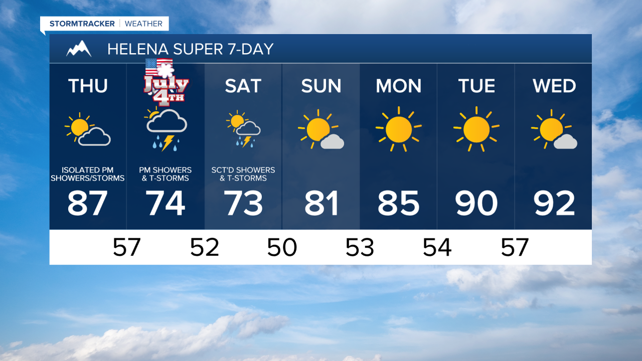
There are going to be some scattered showers and thunderstorms around this evening and tonight, generally before midnight, as some monsoonal moisture continues to stream into our area. A couple of these thunderstorms will be severe with damaging winds (up to 70 mph). We are also going to have partly to mostly cloudy skies and mild/warm temperatures tonight as lows are going to be in the 50s and low to mid 60s. There is also going to be a breeze around tonight along the Rocky Mountain Front as sustained wind speeds are going to be between 10 and 20 mph.
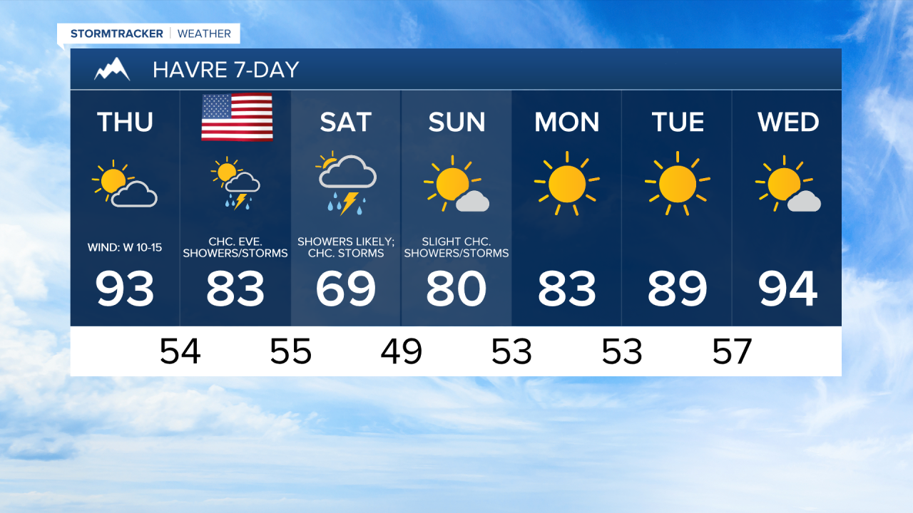
For tomorrow, we are going to have partly cloudy skies with some scattered showers and thunderstorms around during the afternoon/evening to the south and east of Helena and in/around Judith Basin County and Fergus County. Elsewhere, it will be mainly dry tomorrow. It is also going to be slightly cooler, but still pretty hot tomorrow as highs are going to be in the 80s and low to mid 90s. Gusty winds are also expected tomorrow along the Rocky Mountain Front and in Glacier County as sustained wind speeds are going to be between 10 and 30 mph, and it is going to be a bit breezy tomorrow east of the Rocky Mountain Front as sustained wind speeds are going to be between 10 and 20 mph.
The 4th of July will not be a wash-out, but definitely have the rain jacket handy if you are going to be outdoors at all during the second part of the day. Showers and thunderstorms are likely around Helena Friday afternoon/evening and there are going to be scattered showers and thunderstorms around in north-central Montana Friday afternoon and Friday evening as a disturbance begins to impact our area. These showers and thunderstorms will continue Friday night, which may impact some of the fireworks shows. We are also going to have increasing clouds throughout the day on Friday, resulting in partly to mostly cloudy skies for most of us.
On Saturday, showers are likely in north-central Montana and there are going to be scattered showers around the Helena area as this disturbance continues to impact our area. Some thunderstorms are also possible on Saturday. We are also going to have partly to mostly cloudy skies on Saturday, with the cloud cover decreasing some during the afternoon and evening.
Cooler temperatures are expected on Friday and Saturday as highs are going to be back in the 70s and low to mid 80s on Friday and the mid to upper 60s and low to mid 70s on Saturday. There is also going to be a bit of a breeze around in eastern portions of north-central Montana on Friday as sustained wind speeds are going to be between 10 and 20 mph.
We are then going to have mostly sunny skies on Sunday with some isolated showers and thunderstorms around, generally during the afternoon and evening. We are also going to have near average temperatures on Sunday as highs are going to be in the mid to upper 70s and low 80s.
Beautiful weather is expected for the first half of next week as an upper-level ridge is going to be in control of our weather. From Monday through Wednesday, we are going to have lots of sunshine and mostly dry conditions (just a few isolated showers/storms around). The temperatures are also going to warm up a lot over these three days as highs are going to be in the low to mid 80s on Monday; the mid to upper 80s and low 90s on Tuesday; and the 90s on Wednesday.