



Good Morning! Today is Tuesday, August 11, 2026.
The Sand Creek Fire in southwestern Montana continued to grow yesterday and crossed over the top of Maverick Mountain yesterday evening. At this time, it is unclear whether the fire has caused any damage to Maverick Mountain Ski Area or Elkhorn Hot Springs, but we will keep you updated as more information becomes available.
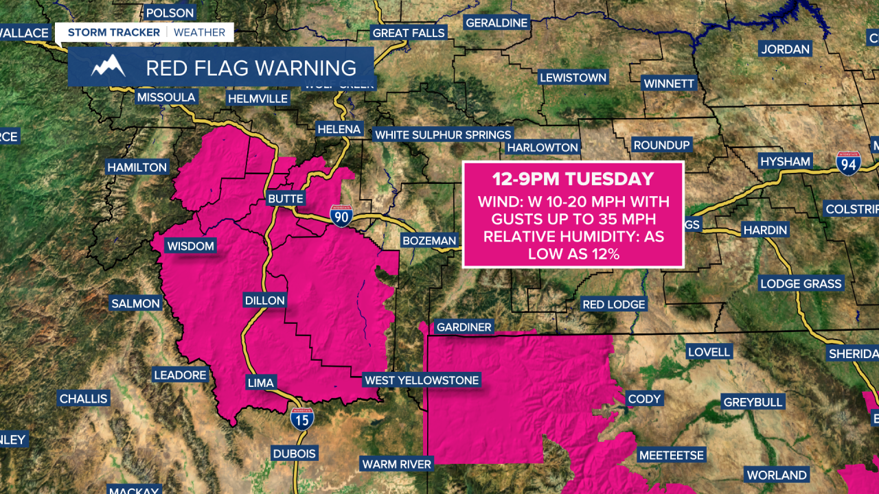
As of this morning, the Sand Creek Fire has burned 19,682 acres and is just 1% contained. Hot, dry, and breezy conditions are expected to fuel additional fire growth today. A RED FLAG WARNING is in effect for southwestern Montana from 12pm to 9pm.
It will be another smoky day across much of the state. Visibility will be reduced, and air quality may be unhealthy for sensitive groups or unhealthy for everyone at times. An AIR QUALITY ALERT remains in effect for all of western and southwestern Montana through at least 9am this morning, although I expect that alert to be extended. Aside from the smoke and haze, conditions will remain mainly sunny and dry today.

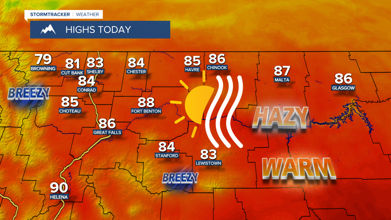
Temperatures will stay warm, with afternoon highs climbing into the 80s and lower 90s. Areas along the Continental Divide and Rocky Mountain Front will become breezy this afternoon, with sustained winds of 10 to 20 mph. Elsewhere, only a light breeze is expected.
Here is today's forecast:
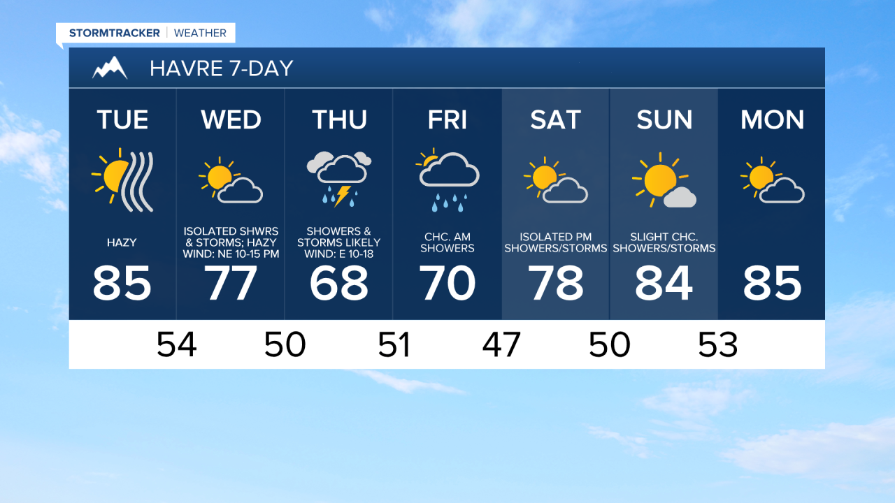
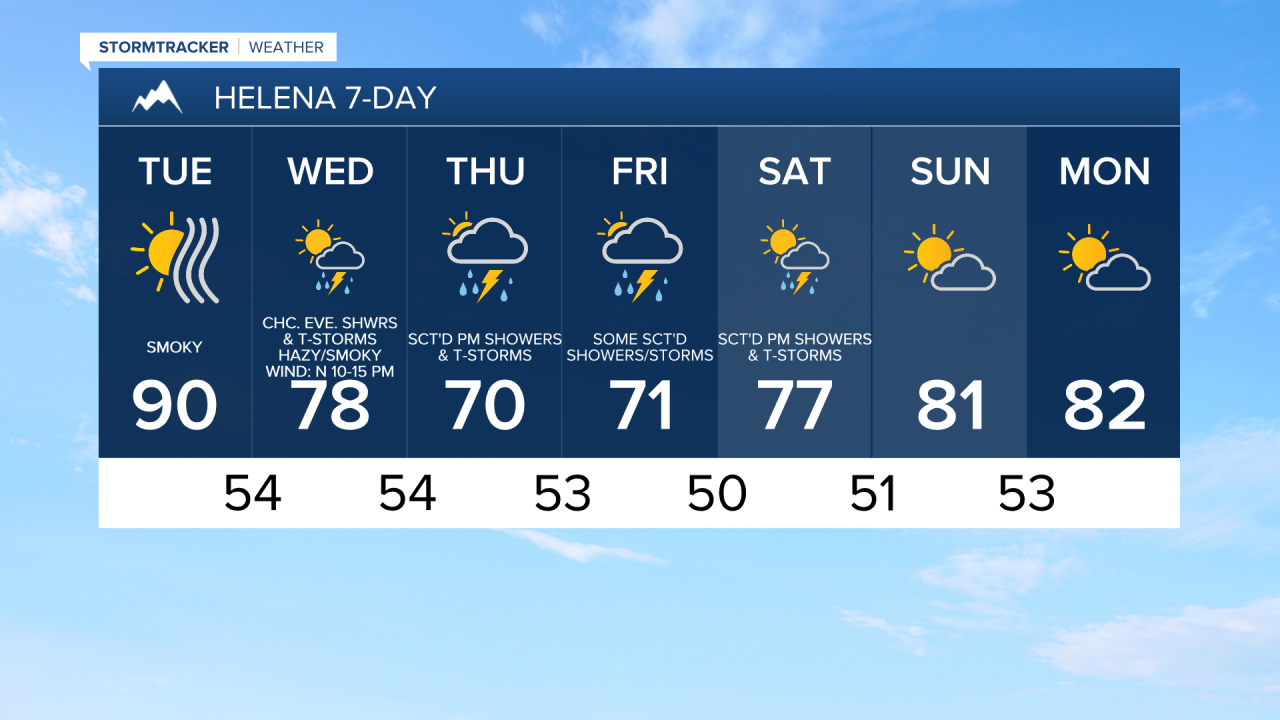
Smoke conditions should improve somewhat tomorrow, though hazy skies will persist. Air quality will generally fall within the moderate category, although periods of unhealthy air for sensitive groups remain possible. A cold front will begin pushing cleaner air into Montana from north to south later tomorrow into tomorrow night.
Tomorrow will be partly to mostly cloudy, with a few showers and thunderstorms developing during the late afternoon and evening hours. It will be cooler and a little breezy tomorrow as highs will be in the 70s and upper 60s and sustained winds will range from 5 to 20 mph.
Scattered showers and thunderstorms are expected tomorrow night and Thursday, with Thursday shaping up to be the wettest day Montana has seen in several weeks. There will also be a breeze around in some areas tomorrow night as sustained wind speeds will be between 10 and 20 mph. It will also be a lot cooler on Thursday as highs are going to be in the 60s and low 70s in most locations.
Friday will remain mostly cloudy, with additional scattered showers and thunderstorms, especially around the Helena area, in the higher terrain, and east of I-15 in north-central Montana. Afternoon highs will be in the mid to upper 60s and low 70s.
Temperatures will begin to warm back up this weekend as another ridge of high pressure builds into the region. Highs Saturday will reach the 70s and low 80s, while Sunday's highs will climb into the upper 70s and low to mid 80s.
On Saturday, there will be scattered afternoon and evening showers and thunderstorms around the Helena area, and there will be a few showers and thunderstorms around later in the day across north-central Montana. Skies will be partly cloudy. On Sunday, it is going to be partly to mostly sunny and there will be a few isolated showers and thunderstorms around during the afternoon and evening.


Have a tremendous Tuesday!
Chief Meteorologist Ryan Dennis
