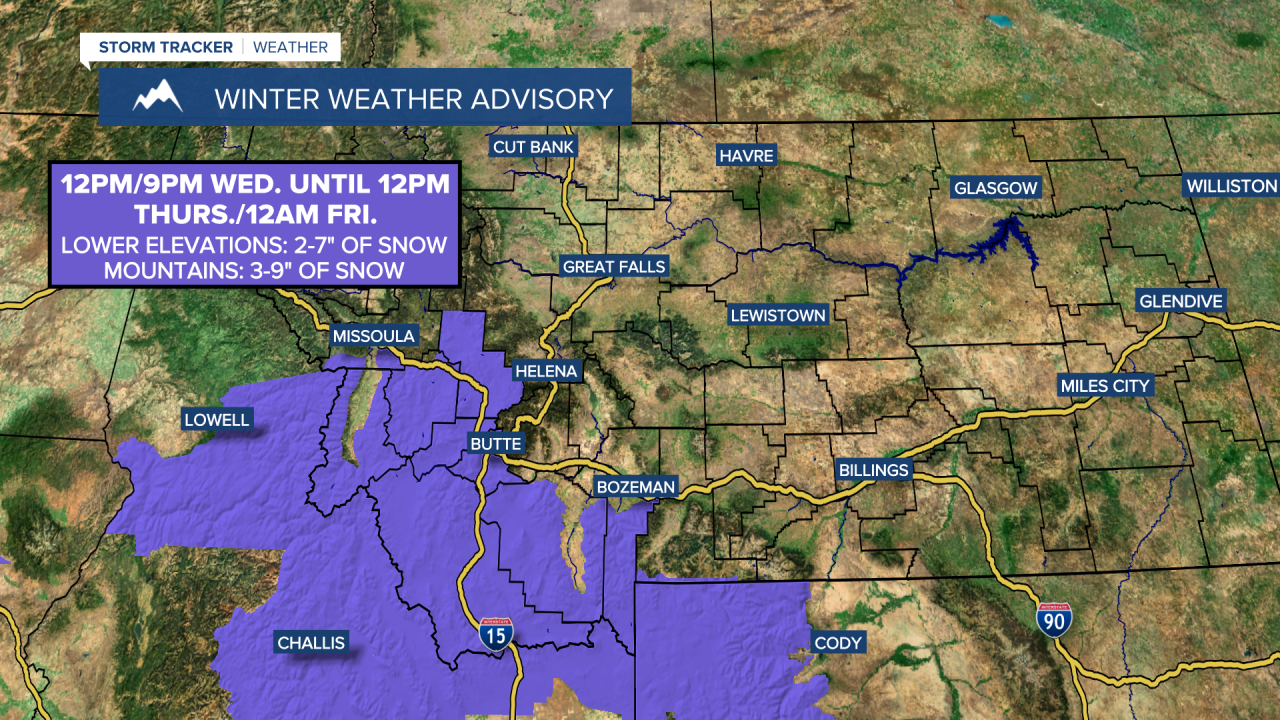
A WINTER WEATHER ADVISORY is in effect for portions of western and southwestern Montana from 12pm/9pm Wednesday until 12pm Thursday/12am Friday. 2 to 7 inches of snow accumulation is expected in the lower elevations, and 3 to 9 inches of snow accumulation is expected in the mountains.
We are going to have partly to mostly cloudy skies tonight with some areas of fog around along the Hi-Line east of I-15. A few isolated snow showers are also possible tonight, but most locations are going to remain dry. It is also going to be frigid tonight along the central and eastern half of the Hi-Line as lows are going to be in the single digits above/below zero. Elsewhere, it is going to be chilly tonight as lows are going to be in the teens and low to mid 20s. There is also going to be a little bit of a breeze around in spots tonight as sustained wind speeds are going to be between 5 and 15 mph.
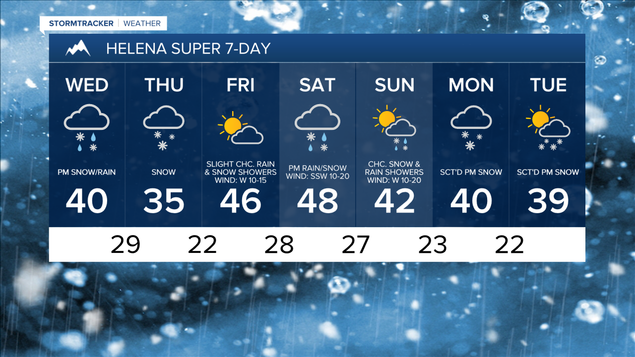
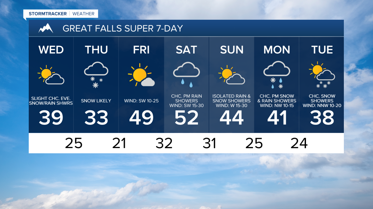
For tomorrow, we are going to have partly cloudy skies and mostly dry conditions in north-central Montana, and mostly cloudy skies with developing rain and snow during the afternoon and evening around the Helena area. There are then going to be areas of snow around tomorrow night and Thursday as a storm system passes by our area to the south. We are also going to have overcast skies tomorrow night and Thursday.
Along the Hi-Line, up to 2 inches of snow accumulation is possible by Thursday evening. South of the Hi-Line, a coating to 4 inches of snow accumulation is expected in the lower elevations, and 2 to 6 inches of snow accumulation is expected in the mountains by Thursday evening. This snow is going to create slippery road conditions, so please be careful when driving.

It is also going to be chilly on Wednesday and Thursday as highs are going to range from the mid 20s to the low 40s. The wind is also not going to be a huge issue on these two days, but there is going to be a little bit of a breeze around in spots as sustained wind speeds are going to be between 5 and 20 mph.
The wind is then going to pick up as we head into Friday and this weekend. On Friday, it is going to be breezy in some areas as sustained wind speeds are going to be between 10 and 25 mph, and wind gusts up to 40 mph are going to be possible at times. Widespread gusty to strong winds are then expected this weekend as sustained wind speeds are going to be between 15 and 30 mph, and wind gusts over 50 mph are going to be possible at times.
The temperatures are also going to be warmer on Friday and Saturday than they are going to be tomorrow and Thursday as highs are going to range from the mid 30s to the mid 50s, with the coldest temperatures in northeastern Montana. It is then going to be a bit cooler on Sunday as highs are going to be back in the 30s and low to mid 40s.
On Friday, we are going to have partly cloudy to mostly sunny skies with some isolated rain and snow showers around, generally in the mountains. Rain and snow is then likely Saturday afternoon/evening around the Helena area, and there are going to be a few scattered rain and mountain snow showers around Saturday afternoon/evening in north-central Montana. Mostly cloudy skies are also expected on Saturday. We are then going to have partly cloudy skies with a chance of snow and rain showers on Sunday.
For next Monday and Tuesday, there are going to be scattered areas of snow around the Helena area, and there is a chance of snow showers in north-central Montana as a couple disturbances pass through our area. We are also going to have partly to mostly cloudy skies on these two days. The temperatures are also going to continue to be well below average for this time of year on these two days as highs are going to range from the upper 20s to the low 40s.