



Good Morning! Today is Wednesday, August 19, 2026. Here is today’s forecast:
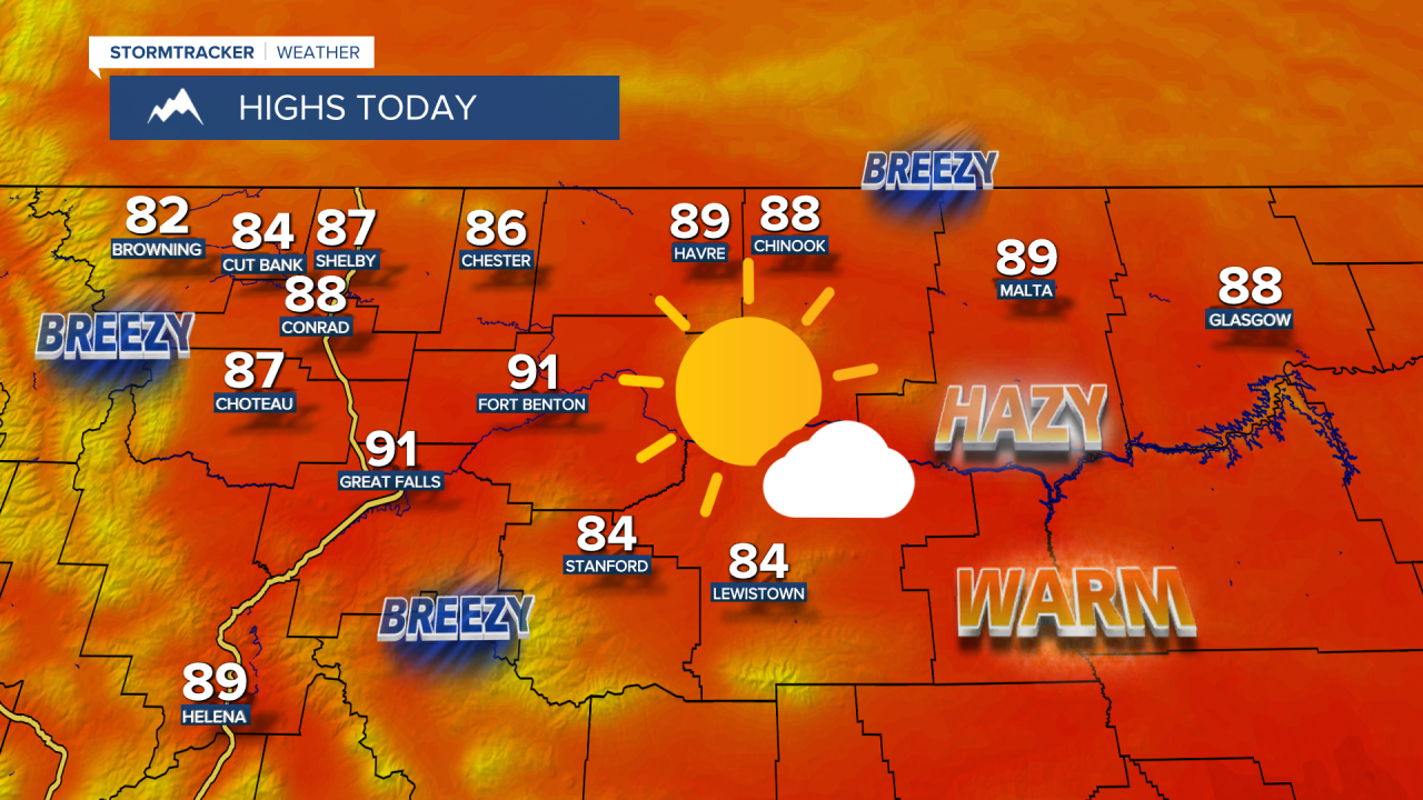
It is going to be mostly sunny to sunny and dry today through Friday as an upper-level ridge is going to be in control of our weather. There are also going to be areas of haze around for at least the next few days, so the visibility will be reduced, but only minor impacts to the air quality are expected.
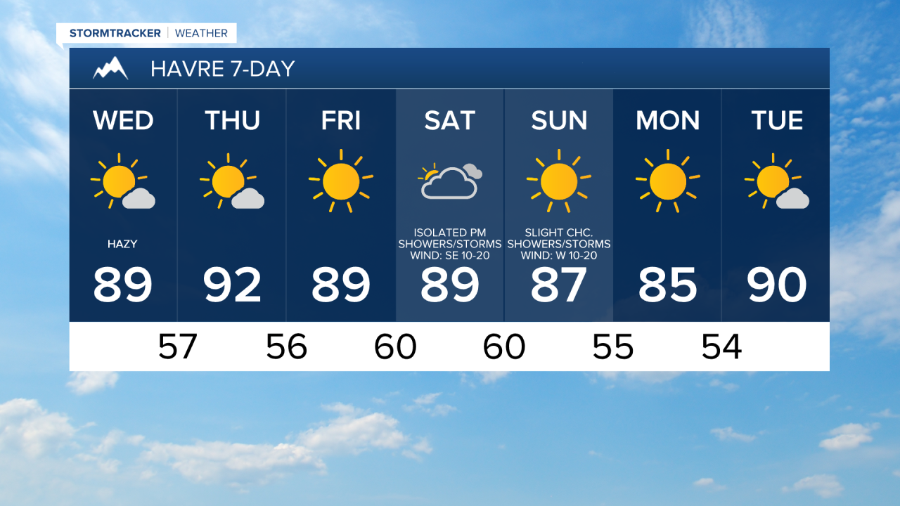
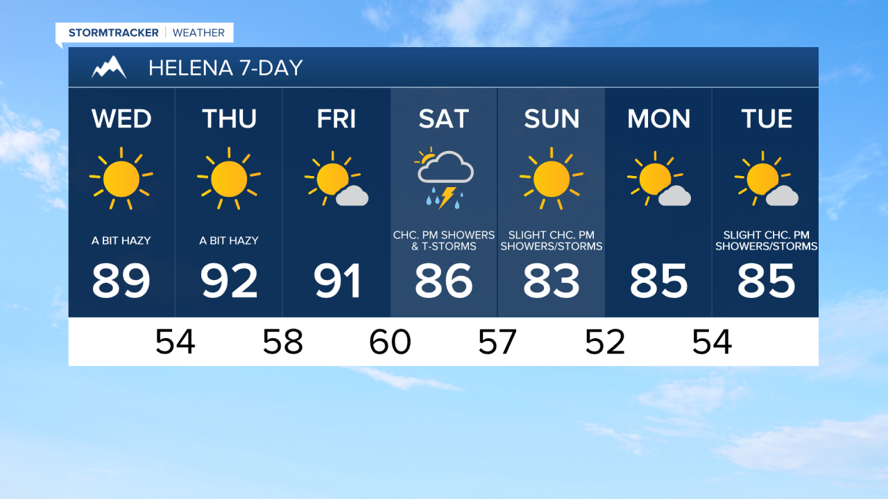
It is also going to be hot for the rest of this week as highs are going to be in the mid to upper 80s and low to mid 90s in most locations. There will be a little bit of a breeze around today as sustained wind speeds are going to be between 5 and 20 mph. Tomorrow, there will be little to no wind around in most areas, but it will be a bit breezy (10-20 mph) along the Divide and the Rocky Mountain Front.
On Saturday, it is going to be partly to mostly cloudy and there are going to be a few scattered showers and thunderstorms around, generally during the afternoon and evening, as an upper-level trough begins to approach our area. On Sunday, it is going to be mostly sunny and there are going to be some isolated showers and thunderstorms around as this trough passes through our area.
It will remain very warm this weekend as highs are going to be in the 80s and low 90s in most locations. There is also going to be a little bit of a breeze around on Saturday as sustained wind speeds are going to be between 5 and 20 mph. It is then going to be breezy on Sunday as sustained wind speeds are going to be between 10 and 25 mph, and this wind is going to elevate the fire danger.
An upper-level ridge will be in control of our weather again early next week, which means it will be mostly sunny, mostly dry, and very warm as highs are going to be in the 80s and low 90s.


Have a wonderful Wednesday!
Chief Meteorologist Ryan Dennis
