

We are going to have clear skies and mild temperatures tonight as lows are going to be in the 50s and low 60s in most locations. It is also going to be a bit breezy tonight along the Rocky Mountain Front as sustained wind speeds are going to be between 10 and 20 mph.
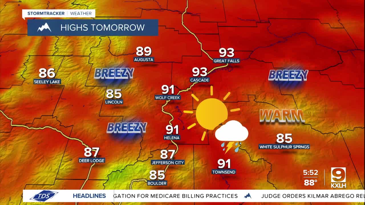
Tomorrow will be another mainly sunny and dry day in north-central Montana, although a couple showers/storms are possible tomorrow evening and early tomorrow night in Fergus County and Judith Basin County. Around Helena, we are going to have mostly sunny skies tomorrow (via increasing PM clouds) with a few scattered showers and thunderstorms around during the afternoon and evening.
Tomorrow is also going to be the hottest day that we are going to have for the rest of this month as highs are going to be in the mid to upper 80s and low to mid 90s. It is also going to be gusty tomorrow along the Rocky Mountain Front as sustained wind speeds are going to be between 15 and 30 mph, and wind gusts up to 45 mph are possible. East of the Rocky Mountain Front, it is going to be a bit breezy tomorrow as sustained wind speeds are going to be between 10 and 20 mph, and a few gusts over 30 mph are possible.
An unsettled weather pattern is expected this weekend and next week as we are going to have daily chances of showers and thunderstorms due to unstable southwesterly flow aloft since Montana will be in between an upper-level trough (to our northwest) and an upper-level ridge (to our southeast).

A lot of this weekend will be dry, but there will be some scattered showers and thunderstorms around each afternoon and evening, so make sure you keep an eye to the sky if you are going to be outdoors at all. A couple of these thunderstorms may also be severe with damaging winds (58+ mph) and/or large hail (1+” in diameter). We are also going to have partly to mostly sunny skies (via increasing clouds) this weekend.
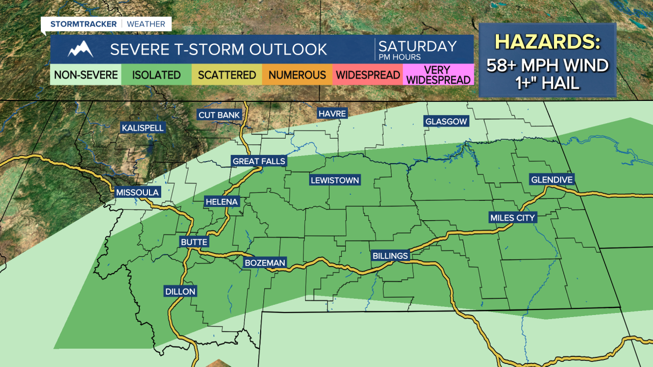
It is also going to be warm this weekend as highs are going to be in the 80s and low 90s on Saturday and the 80s and upper 70s on Sunday. There will also be a bit of a breeze (10-20 mph) around this weekend along the Rocky Mountain Front, with just a little breeze (5-20 mph) out across the plains.
There are then going to be more scattered showers and thunderstorms around on Monday, especially during the afternoon/evening and especially in the mountains and in locations east of I-15. We are also going to have partly cloudy skies on Monday. For Tuesday and Wednesday, we are going to have partly to mostly sunny skies (via increasing clouds) with a few scattered PM showers and thunderstorms around, especially in the mountains. We are then going to have partly cloudy skies on Thursday with some isolated showers and thunderstorms around.
Temperatures next week will be near to a little bit below average for the end of July as highs are going to be in the 80s and upper 70s in most locations. It is also going to be a bit breezy in some areas on Tuesday and Wednesday as sustained wind speeds are going to be between 10 and 20 mph.


