


Good Morning! Today is Monday, November 16, 2026.
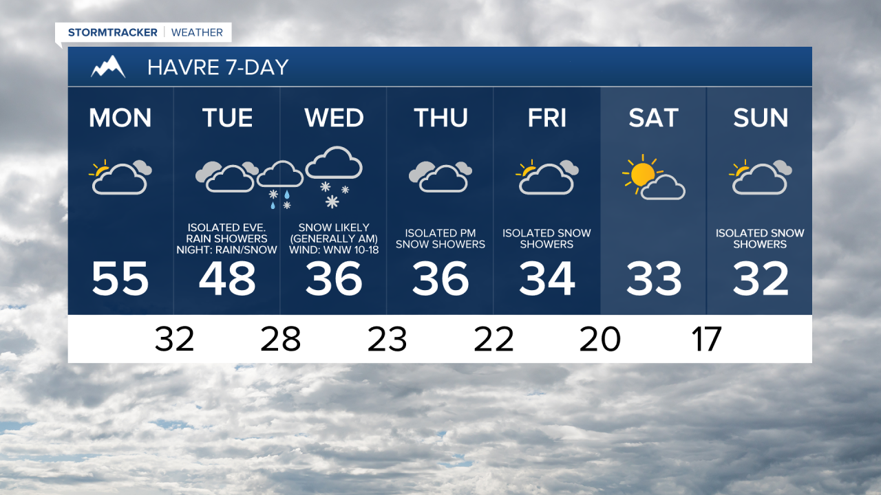
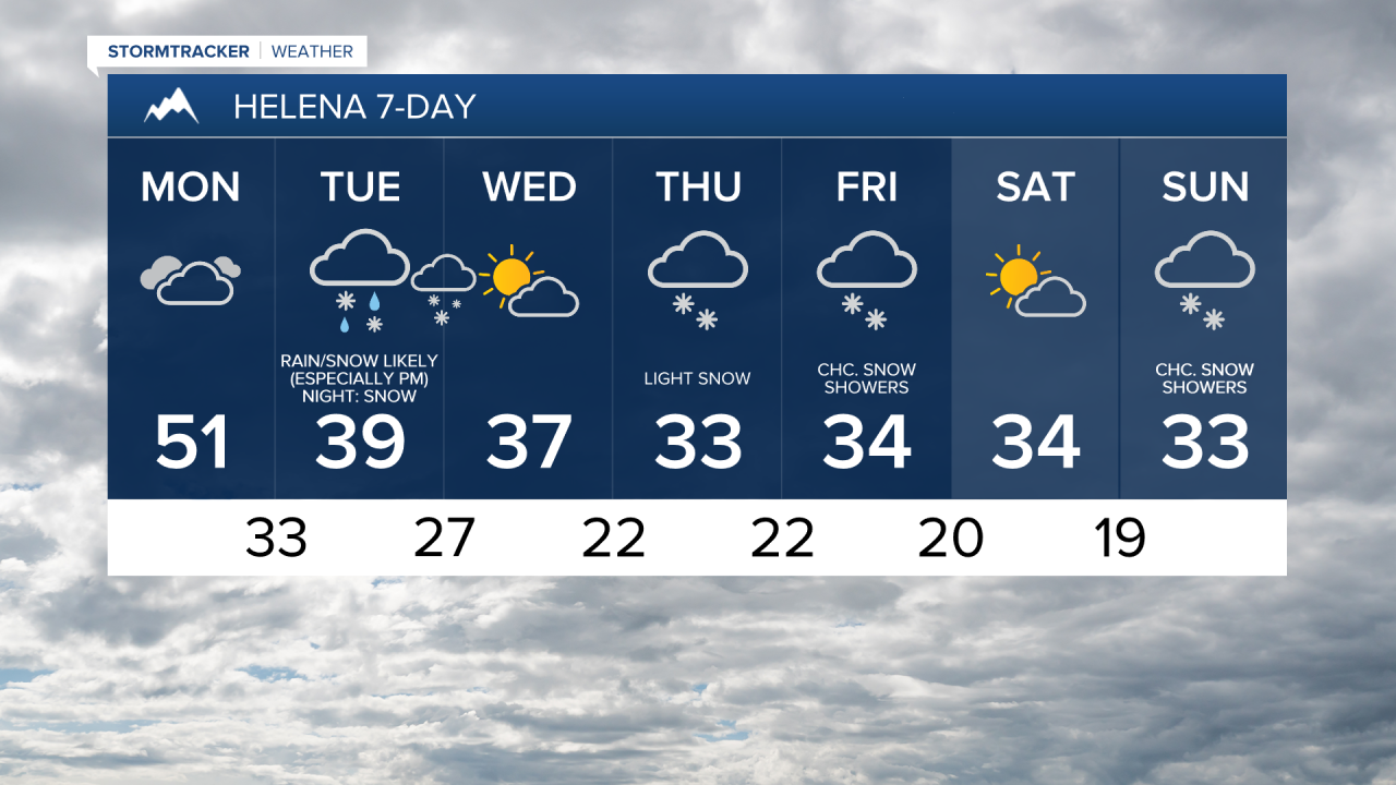
Around and west of I-15, it will be overcast today with a few isolated rain and snow showers around, generally along the Divide and the Rocky Mountain Front. East of I-15, partly to mostly cloudy skies and dry conditions are expected today. Highs today will be in the 50s and mid to upper 40s and there will just be a little breeze along the Rocky Mountain Front.
There will be some rain and snow around tonight, generally in locations around and west of I-15. Around Helena and west of a line from Havre to Lewistown in north-central Montana, rain/snow is likely tomorrow, especially during the afternoon and evening. In the lower elevations, precipitation will start out as rain, but will switchover to snow as colder air moves in. East of a line from Havre to Lewistown, mostly dry conditions are expected tomorrow.
Widespread precipitation is likely tomorrow night, with precipitation shifting eastward as the night goes on. Rain will transition over to snow from west to east in the lower elevations as the night goes on. There will be areas of snow around Wednesday morning in locations east of I-15, but this snow will move out as the morning goes on, with just a few lingering snow showers around during the afternoon and evening. Skies will clear out some as Wednesday goes on as well.
In the lower elevations, many areas will receive <3” of snow, but in the lower elevations west of I-15 and near the mountains in central Montana, 2-6” of snow is expected. In the mountains, snow amounts will range from 3-12”. The bulk of the snow accumulation will occur Tuesday evening through Wednesday morning, and this is when the biggest travel impacts are expected. Definitely give yourself some extra time for the morning commute on Wednesday.

Temperatures begin to cool down tomorrow, with highs ranging from the mid 30s near the Rockies to the mid 50s in northeastern Montana. It will also be a little breezy in some areas tomorrow, with sustained winds of 5 to 20 mph. Wednesday will be chilly and breezy with highs only in the 30s and sustained winds of 10 to 25 mph. The strongest wind on Wednesday will be in locations east of I-15.
Another round of some light snow is expected on Thursday, especially in central Montana. It will also be overcast and chilly on Thursday as highs will only be in the 30s.
There will be a few snow showers around on Friday, generally in the mountains and in locations east of I-15. Skies will be mostly cloudy to overcast. Saturday will then be partly to mostly sunny and mostly dry. On Sunday, it will be mostly cloudy and a few scattered snow showers are possible. It will remain chilly on these three days as highs are only going to be in the 30s.


Have a great week!
Chief Meteorologist Ryan Dennis
