



Good Morning! Today is Thursday, November 19, 2026.
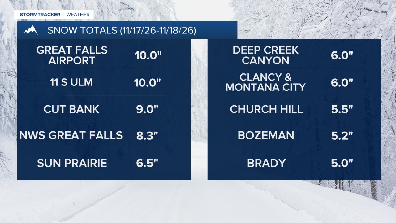
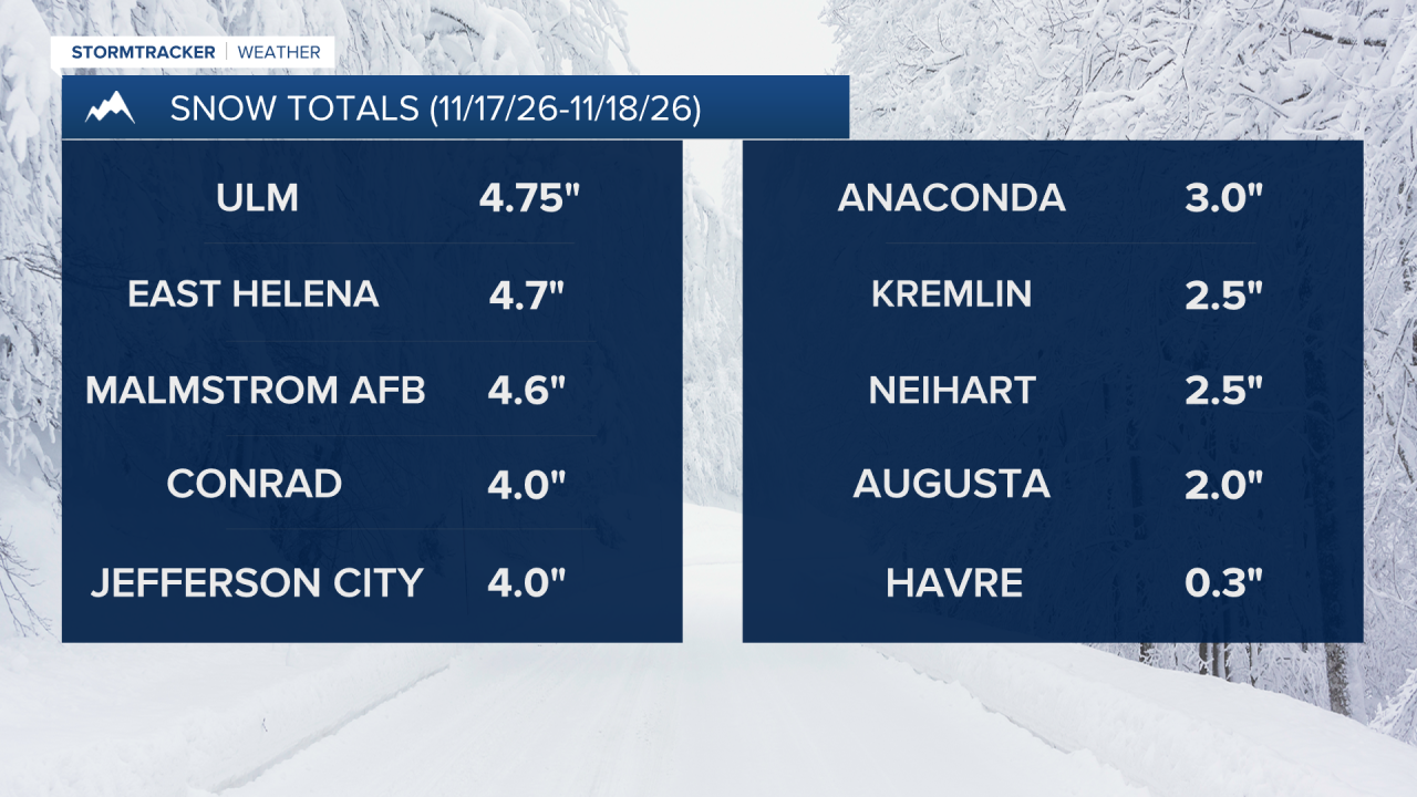
A storm brought widespread rain and snow to the state Tuesday into Wednesday. As with every storm, snow totals ranged significantly across the state, with some areas not even seeing a flake, while other areas received close to a foot of snow. In the Great Falls area, snow totals ranged from about 4” near Malmstrom to about 10” near the airport.
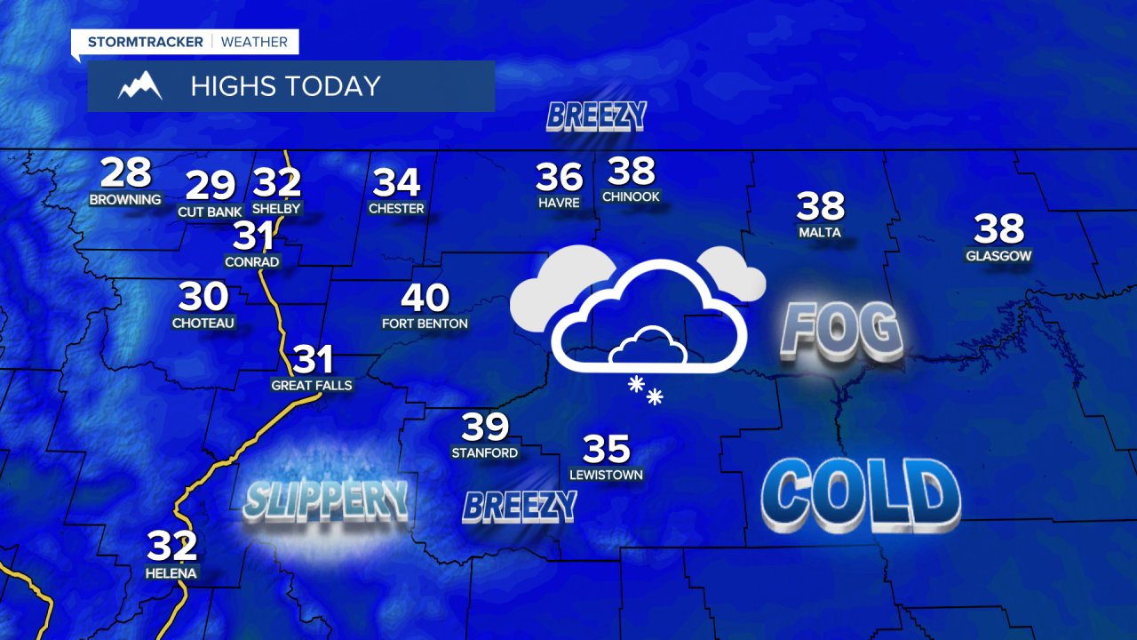
Roads are still slick in some areas this morning and there are areas of freezing fog around, some of which is dense with visibility at or below a quarter mile, so use caution when driving and give yourself some extra time to get to work and school. It will be mostly cloudy to overcast today and there will be areas of fog around, especially this morning. Many locations will be dry today, but there will be flurries and isolated snow showers around. There will be a little breeze around in some areas today, with sustained winds of 5 to 20 mph, and it will be cold today, with highs in the 30s and upper 20s.
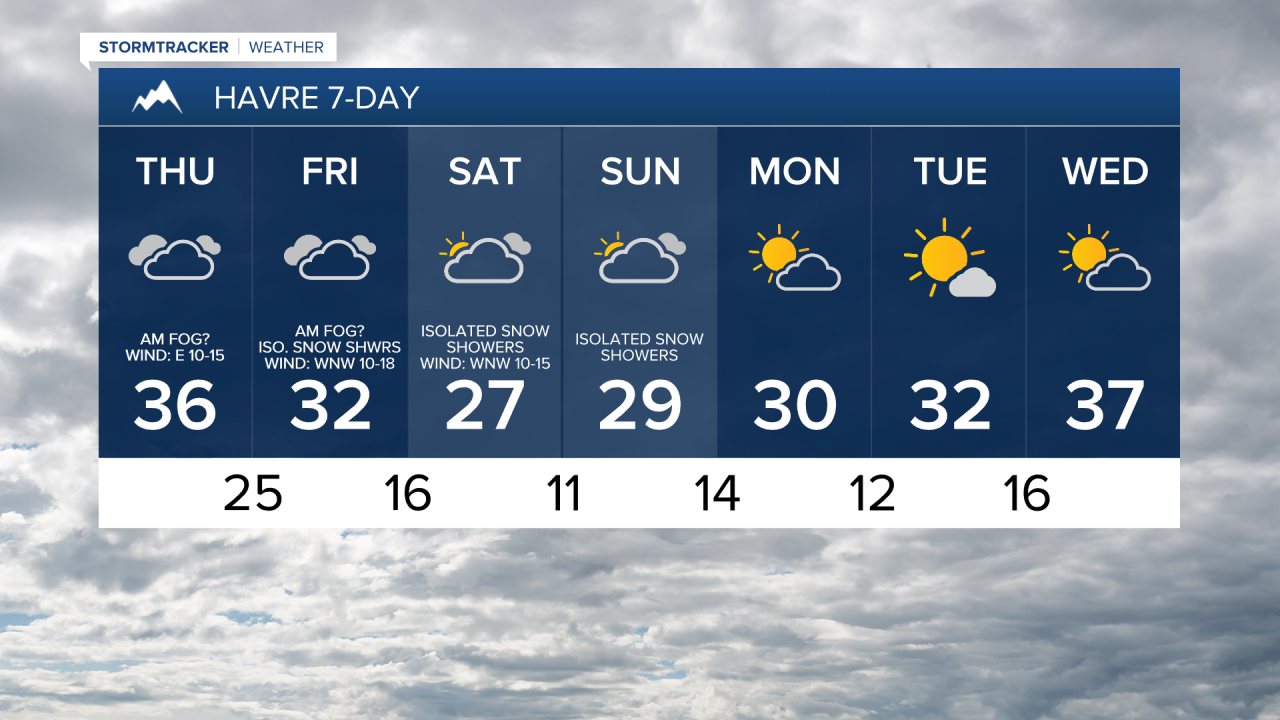
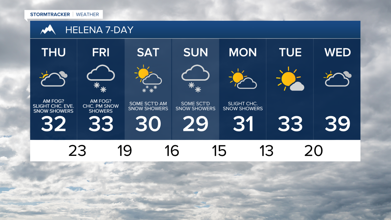
Areas of freezing fog are expected again tomorrow morning. It is also going to be mostly cloudy to overcast tomorrow and there will be some scattered snow showers around, especially during the evening. Another round of light snow is expected in some areas tomorrow night as a disturbance passes through our area. On Saturday, expect decreasing clouds with some scattered snow showers around, generally during the morning and generally across central Montana.
Light snow accumulations are possible through Saturday, with the highest snow amounts expected across western and southern portions of north-central Montana. In the lower elevations, up to 3” of snow is possible, while in the mountains, up to 6” of snow is possible, with the bulk of the accumulation coming Friday evening through Saturday morning.

It will continue to be cold tomorrow and Saturday as highs will be in the mid to upper 20s and low to mid 30s in most locations. There will also be a bit of a breeze around tomorrow east of I-15, with sustained winds of 10 to 20 mph.
Some more snow showers are possible on Sunday as another disturbance impacts our region. It will also be mostly cloudy and cold on Sunday as highs will only be in the 20s and low 30s.
Mostly dry conditions are expected Monday through Wednesday. On Monday and Wednesday, skies will be partly to mostly cloudy, while on Tuesday, skies will be partly to mostly sunny. It will remain cold next week, but the temperatures will warm up some as the week goes on. On Monday, highs will be in the mid to upper 20s and low to mid 30s. Highs will then be in the 30s on Tuesday and the mid to upper 30s and low 40s on Wednesday. The wind will also pick up some next week, with breezy conditions (10-20 mph) returning to some areas on Wednesday.


Have a tremendous Thursday!
Chief Meteorologist Ryan Dennis
