

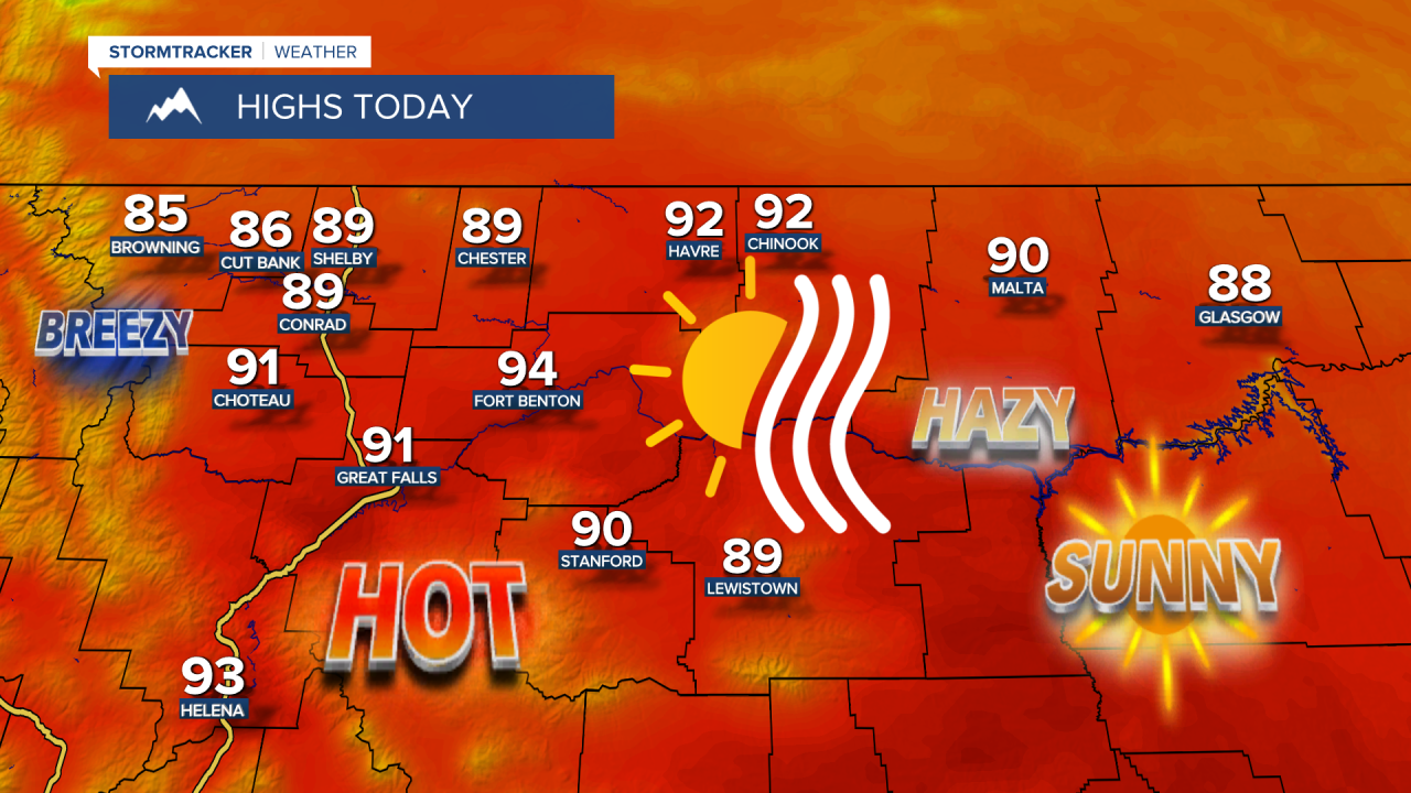


Good Morning! Today is Thursday, August 20, 2026. Here is today’s forecast:
It is going to be mostly sunny to sunny and mainly dry today and tomorrow, just a few showers/storms in northeastern Montana late tonight and tomorrow morning, as an upper-level ridge remains in control of our weather. There are also going to be areas of haze around for at least the next couple of days, so the visibility will be reduced and there will be minor impacts to the air quality as the air quality will be in the “moderate” category at times.
It is also going to be hot today and tomorrow as highs are going to be in the mid to upper 80s and low to mid 90s in most locations. There will also be just a little breeze around in most locations today and tomorrow as sustained wind speeds are generally going to be between 5 and 15 mph.
A lot of locations will remain dry this weekend, but there will be a few scattered showers and thunderstorms around on both Saturday and Sunday, generally during the PM hours and especially in the mountains, as an upper-level trough passes through our region. It is also going to be partly to mostly cloudy on Saturday and partly to mostly sunny on Sunday.
It will continue to be very warm this weekend as highs are going to be in the in the 80s and low to mid 90s in most locations. There is going to be a little bit of a breeze around on Saturday as sustained wind speeds are going to be between 5 and 20 mph. It is then going to be gusty in some areas on Sunday as sustained wind speeds are going to be between 10 and 25 mph, and this wind is really going to elevate the fire danger.
Monday will feature lots of sunshine and dry conditions as an upper-level ridge will be in control of our weather once again. On Tuesday and Wednesday, it is going to be mostly sunny and there will be some isolated showers and thunderstorms around, generally in the mountains, as a couple weak disturbances traverse the state.
It will continue to be warm next week as highs are going to be in the 80s in most locations. There will also be a little bit of a breeze around on Monday as sustained wind speeds are going to be between 5 and 20 mph.


Have a tremendous Thursday!
Chief Meteorologist Ryan Dennis
