


Good Morning and Happy Thursday! There were some scattered showers and thunderstorms around overnight, generally along the Hi-Line, but this morning, we are waking up to mostly clear skies and dry conditions throughout all of central and north-central Montana. An upper-level ridge will build into our area today and remain in complete control of our weather through Monday, which means you can expect a good amount of sunshine, mainly dry conditions, and hot temperatures for the next several days.
Here is today's forecast:
We are going to have beautiful weather today with mostly sunny skies and mostly dry conditions, just a few isolated showers and thunderstorms around this afternoon and evening in northeastern Montana. It is also going to be very warm again today as highs are going to be in the 80s and low 90s. Along the Rocky Mountain Front and the Continental Divide, it will be breezy today as sustained wind speeds are going to be between 10 and 25 mph. Elsewhere, it is going to be a little breezy today as sustained wind speeds are going to be between 5 and 20 mph.
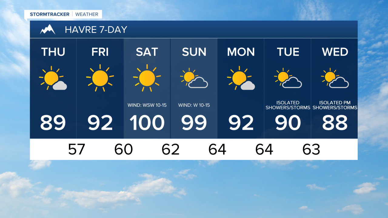
On Friday, it is going to be mainly sunny and hot as highs are going to be in the mid to upper 80s and low to mid 90s. Most locations will be dry tomorrow, but there will be some isolated showers and thunderstorms around during the evening, generally around the Helena area and maybe around the Great Falls area as we approach sunset. It is also going to be a bit breezy tomorrow along the Rocky Mountain Front and the Divide as sustained wind speeds are going to be between 10 and 20 mph.
This weekend will be the hottest weekend that we have had so far this year as highs are going to be in the 90s and 100s. An EXTREME HEAT WATCH is in effect for all of eastern Montana and a lot of central Montana for a lot of this weekend. If you will be outdoors at all this weekend, make sure you stay hydrated, wear light and loose-fitting clothing, and wear sunscreen. Also, make sure you regularly check on those that are more susceptible to heat illnesses, including the elderly, young children, and pets.

On Saturday, it is going to be mainly sunny and dry. It is also going to be breezy in some areas on Saturday as sustained wind speeds are going to be between 10 and 20 mph. On Sunday, it is going to be partly to mostly sunny and dry with just a little breeze (5-20 mph).
Monday will be another mostly sunny, mostly dry, and hot day as highs are going to be in the mid to upper 80s and low to mid 90s. The temperatures will then cool down some as we head into the middle of next week as the ridge shifts eastward, allowing some monsoonal moisture to work its way into the state. Highs on Tuesday and Wednesday will be back in the 80s in most locations. There are also going to be a few scattered showers and thunderstorms around on these two days.


Have a tremendous Thursday!
Chief Meteorologist Ryan Dennis
