



Good Morning! Today is Friday, August 21, 2026. Here is today's forecast:
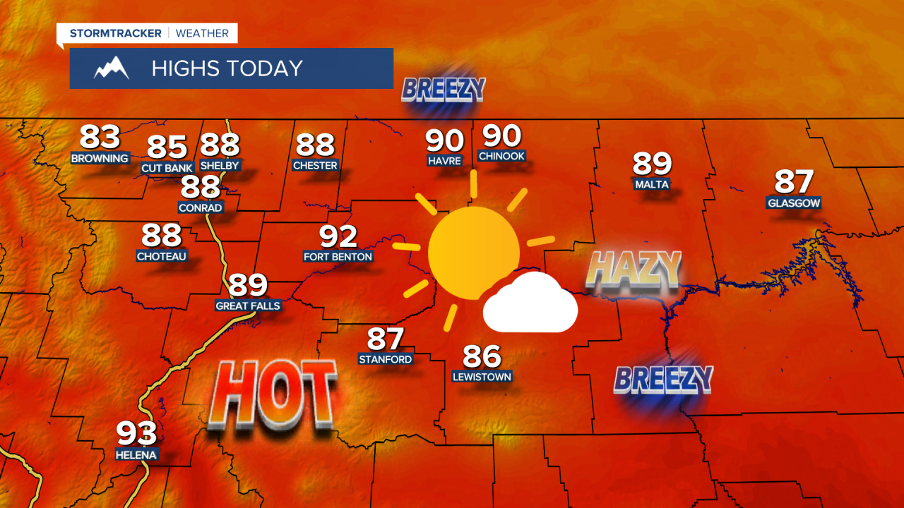
It is going to be mostly sunny to sunny, a bit hazy, and mainly dry again today as an upper-level ridge remains in complete control of our weather. It is also going to be hot again today as highs are going to be in the mid to upper 80s and low to mid 90s in most locations. There is also going to be a little bit of a breeze around in some areas today as sustained wind speeds are going to be between 5 and 20 mph.
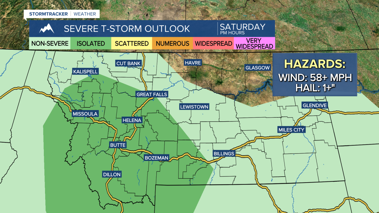
There are going to be some scattered showers and thunderstorms around tomorrow, generally during the late afternoon and evening and generally around the Helena area and in western/southern portions of north-central Montana, and there are going to be some scattered showers and thunderstorms around on Sunday, mainly during the afternoon and evening and generally in locations east of I-15. It is also going to be partly to mostly cloudy tomorrow and partly to mostly sunny on Sunday.
A few of the storms that develop this weekend may be severe with damaging winds (58+ mph) and/or large hail (1+” in diameter), so make sure you keep an eye to the sky if you will be outdoors at all. Locations in southwestern Montana and in portions of western and central Montana have the best chance to see a few severe thunderstorms on Saturday, while locations in southwestern and portions of central and eastern Montana have the best chance to see a few severe thunderstorms on Sunday.

It is going to continue to be hot this weekend as highs are going to be in the 80s and low to mid 90s. There is going to be a good breeze around tomorrow in eastern portions of north-central Montana as sustained wind speeds are going to be between 10 and 25 mph. Elsewhere, there will be a little breeze around tomorrow as sustained wind speeds are going to be between 5 and 20 mph. On Sunday, it is going to be windy (15-30 mph) along the Divide and Rocky Mountain Front, breezy (10-25 mph) in western portions of north-central Montana east of the Rocky Mountain Front and around the Helena area, and a little breezy (5-20 mph) elsewhere.
The combination of breezy/gusty conditions, hot temperatures, dry fuels, and lightning strikes from storms is really going to elevate the fire danger this weekend, so please do your part to not start any new fires.
Next week will be mostly sunny and mostly dry, just some isolated showers and thunderstorms around, as an upper-level ridge is going to be in control of our weather. It is also going to be warm next week as highs are going to be in the 80s and low 90s in most locations.


Have a fantastic Friday and weekend!
Chief Meteorologist Ryan Dennis
