


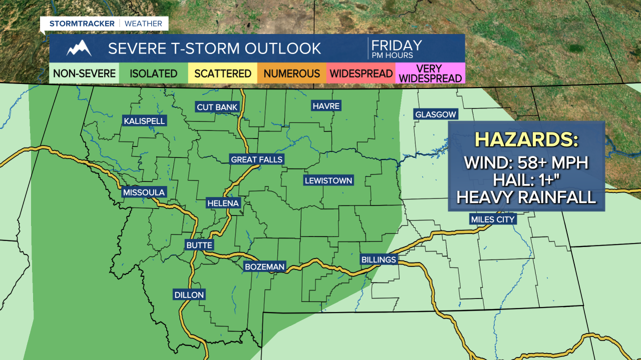
Good Morning and Happy Friday everyone! Another round of scattered showers and thunderstorms is expected late this afternoon, this evening, and tonight as some more monsoonal moisture works its way into the state. The showers/storms will initially develop over the higher terrain before working their way into the lower elevations. The shower/storm activity later today and tonight will be more widespread than yesterday’s shower/storm activity was.
Some of the thunderstorms that develop later today and tonight may be severe with damaging winds (58+ mph) and/or large hail (1+” in diameter). Heavy rainfall is also possible, which may lead to localized flash flooding, and a FLOOD WATCH is in effect for the Horse Gulch Burn Scar from until 12am Saturday. If you will be outdoors at all later on today, make sure you keep an eye to the sky!

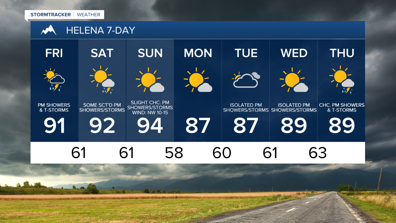
It will be partly to mostly sunny today, with the cloud cover increasing during the afternoon and evening. It is also going to be hot again today as highs are going to be in the 90s and mid to upper 80s. There is also going to be a bit of a breeze around today in locations east of I-15 as sustained wind speeds are going to be between 10 and 20 mph.
This weekend will be another hot one as highs are going to be in the 90s and upper 80s in most locations. If you are going to be outdoors at all, make sure you stay hydrated and wear sunscreen!
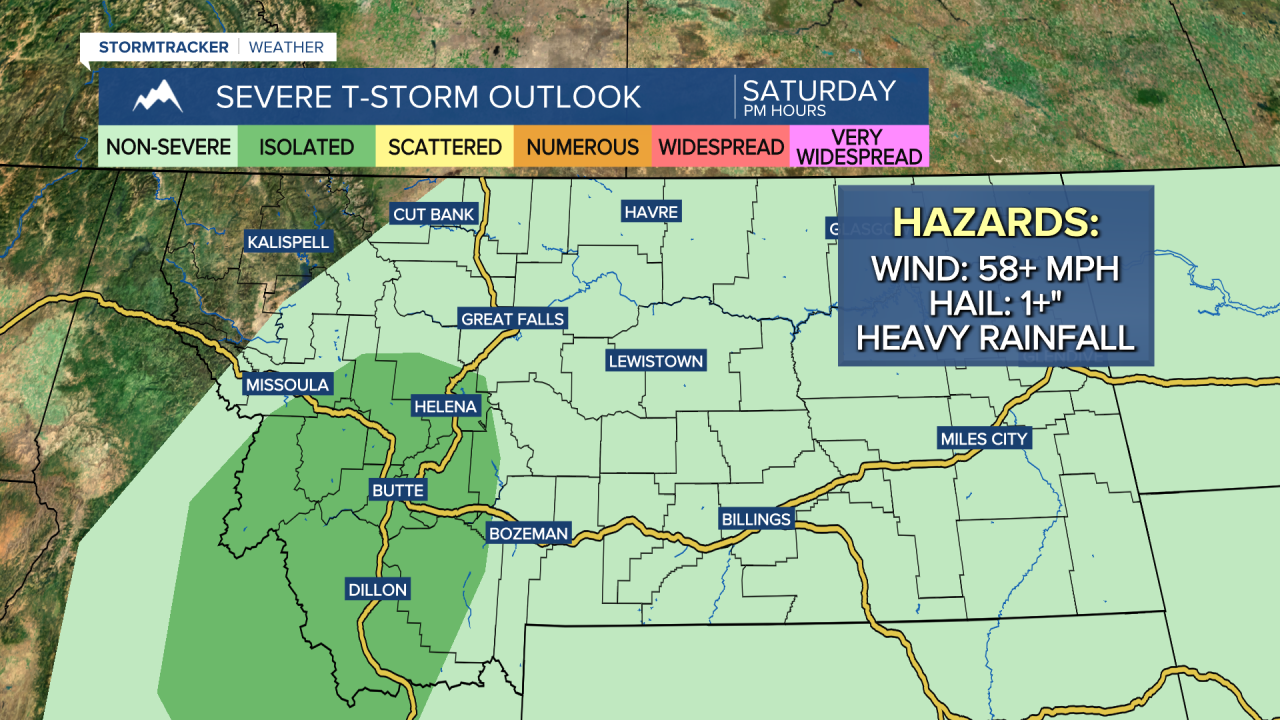
Tomorrow, it is going to be partly to mostly sunny with a few showers and thunderstorms around during the morning in eastern portions of north-central Montana and some scattered showers and thunderstorms around during the afternoon and evening. Tomorrow’s shower/storm activity will be more miss than hit and will not be as widespread as today/tonight’s shower/storm activity, but still be weather aware if you are going to be outdoors at all. A few of the thunderstorms that develop later on tomorrow, especially around the Helena area, may be strong to severe with damaging winds, large hail, and/or heavy rainfall.
On Sunday, it is going to be mainly sunny and mostly dry, just a few isolated showers and thunderstorms around during the afternoon and evening in central Montana. There is also going to be a bit of a breeze around on Sunday as sustained wind speeds are going to be between 10 and 20 mph.
The temperatures will cool down a few degrees for the beginning of next week as highs are going to be back in the 80s Monday and Tuesday. Monday will be mostly sunny and mainly dry. It is then going to be partly to mostly cloudy on Tuesday and there will be some isolated showers and thunderstorms around. There is also going to be a bit of a breeze around in some areas on these two days as sustained wind speeds are going to be between 10 and 20 mph.
Wednesday and Thursday will be partly to mostly sunny and hot as highs are going to be in the mid to upper 80s and low to mid 90s. On Wednesday, there are going to be a few showers and thunderstorms around during the afternoon and evening. There are then going to be some scattered showers and thunderstorms around on Thursday, generally during the afternoon and evening.


Have a fantastic Friday and weekend!
Chief Meteorologist Ryan Dennis
