



Good Morning! Today is Monday, September 28, 2026. Here is today’s forecast:
Sunday morning was the coldest morning since the spring for many locations as lows were in the 20s and low 30s. This morning, it is not nearly as cold as it was yesterday morning, but it is still a bit chilly as temperatures (as of 4:45am) are in the 30s, 40s, and low 50s.
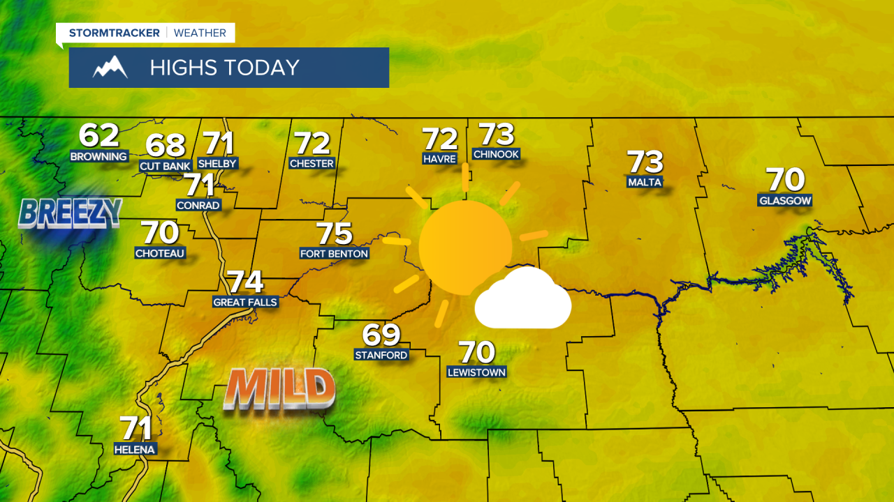
Today, the cloud cover will decrease throughout the day, with mostly sunny to sunny skies expected during the afternoon and evening. While a stray shower can't be ruled out, most locations will remain dry. Highs today will be in the mid to upper 60s and low to mid 70s, so it will be warmer than it was over the weekend. Along the Rocky Mountain Front, it will be breezy today with sustained winds of 10 to 25 mph. Elsewhere, there will just be a little breeze around today with sustained winds of 5 to 20 mph.
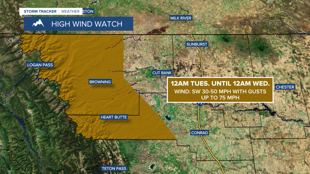
Another round of widespread gusty to strong winds is expected tomorrow, similar to what we experienced on Saturday. Sustained winds in many locations will range from 10 to 30 mph, with gusts over 40 mph possible at times. The strongest winds will occur along the Rocky Mountain Front, where gusts in excess of 60 mph are expected. A HIGH WIND WATCH is in effect for western Glacier County and western Pondera County from midnight Tuesday through midnight Wednesday, as gusts up to 75 mph are possible.
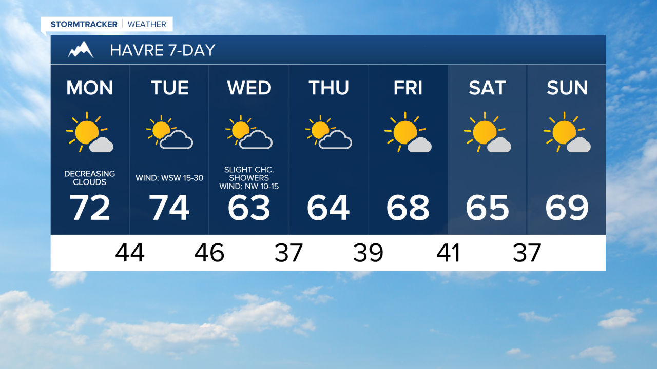
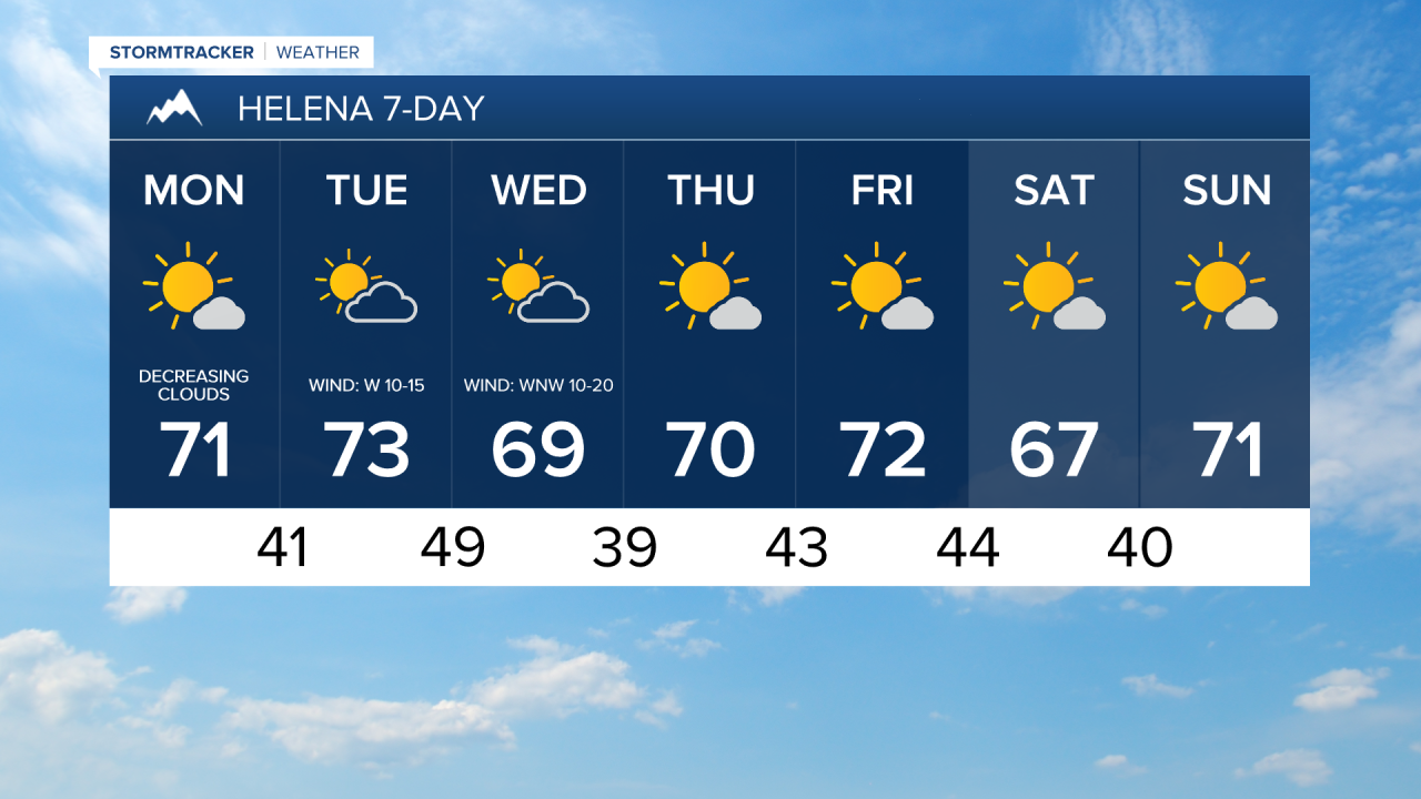
Tomorrow will also be partly cloudy, with more cloud cover across western portions of north-central Montana and more sunshine farther east. Mild temperatures will continue, with highs reaching the upper 60s and low to mid 70s.
A weak front will move through the state on Wednesday. A few showers are possible, but most locations will stay dry. Skies will be partly cloudy, and temperatures will be a bit cooler with highs in the 60s and upper 50s. Breezy conditions will continue with sustained winds of 10 to 20 mph.
Beautiful fall weather is expected for the end of the week and this weekend as an upper-level ridge will be in control of our weather. Thursday and Friday will be partly to mostly sunny and dry, while the weekend looks mostly sunny and dry. Highs on Thursday will be in the 60s and mid to upper 50s, while highs Friday through Sunday will be in the mid to upper 60s and low to mid 70s. There will also just be a little breeze around Thursday through Sunday with sustained winds of 5 to 20 mph.


Have a great week!
Chief Meteorologist Ryan Dennis
