



Good Morning! Today is Thursday, August 13, 2026. Here is today's forecast:
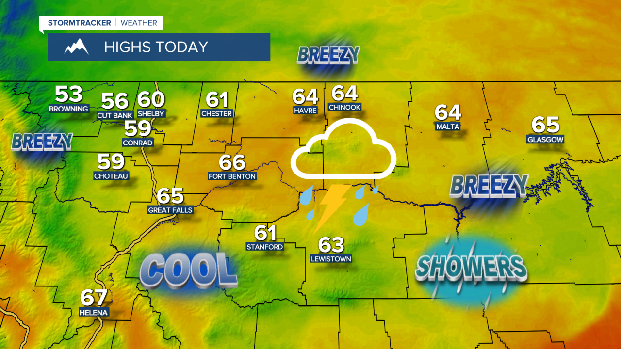
There are going to be scattered showers and thunderstorms around today, tonight, and tomorrow, as a couple disturbances pass through the state, so make sure you keep an eye to the sky and have a rain jacket handy if you are going to be outdoors at all.
Some of the stronger showers and thunderstorms may produce heavy rainfall, which could lead to localized flash flooding, particularly over recent burn scars. A FLASH FLOOD WATCH is in effect for the burn scars in the Pioneer mountains and for the Horse Gulch burn scar from 1pm/6pm Thursday through 12am Friday, as flash flooding and debris flows are possible.

Rainfall totals from this morning through Saturday morning will vary considerably. Some areas may receive less than 0.2” of rain, while others may pick up more than 1”. The greatest precipitation amounts are expected across central and eastern Montana, with the lightest amounts in western Montana. Across central and north-central Montana, a lot of locations will likely receive between 0.15” and 0.75” of rainfall.

Much cooler temperatures are expected today and tomorrow as highs are going to be in the 60s and mid to upper 50s, and these temperatures are well below average for this time of year. It will be breezy today in eastern portions of north-central Montana as sustained wind speeds are going to be between 10 and 25 mph. Elsewhere, there is just going to be a little breeze around today as sustained wind speeds are going to be between 5 and 20 mph.
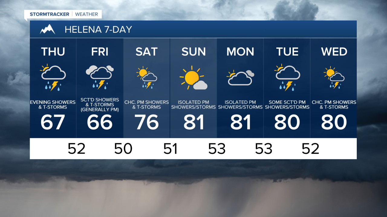
The temperatures will gradually warm back up this weekend as another ridge of high pressure builds into the region. Highs on Saturday will climb into the 70s and low 80s, while Sunday’s temperatures will be in the upper 70s and low to mid 80s.
On Saturday, it is going to be partly to mostly cloudy with some scattered PM showers and thunderstorms around the Helena area and a few isolated showers and thunderstorms around in north-central Montana, generally in the mountains. On Sunday, it is going to be partly to mostly sunny and there will be a few scattered showers and thunderstorms around during the afternoon and evening, generally in central Montana and in the mountains.
The active weather pattern continues next week as multiple disturbances pass through the state. From Monday through Wednesday, it is going to be partly to mostly cloudy and there will be some scattered showers and thunderstorms around each afternoon and evening, especially in the mountains. It is also going to be warm on these three days as highs are going to be in the mid to upper 70s and low to mid 80s.



Have a tremendous Thursday!
Chief Meteorologist Ryan Dennis
