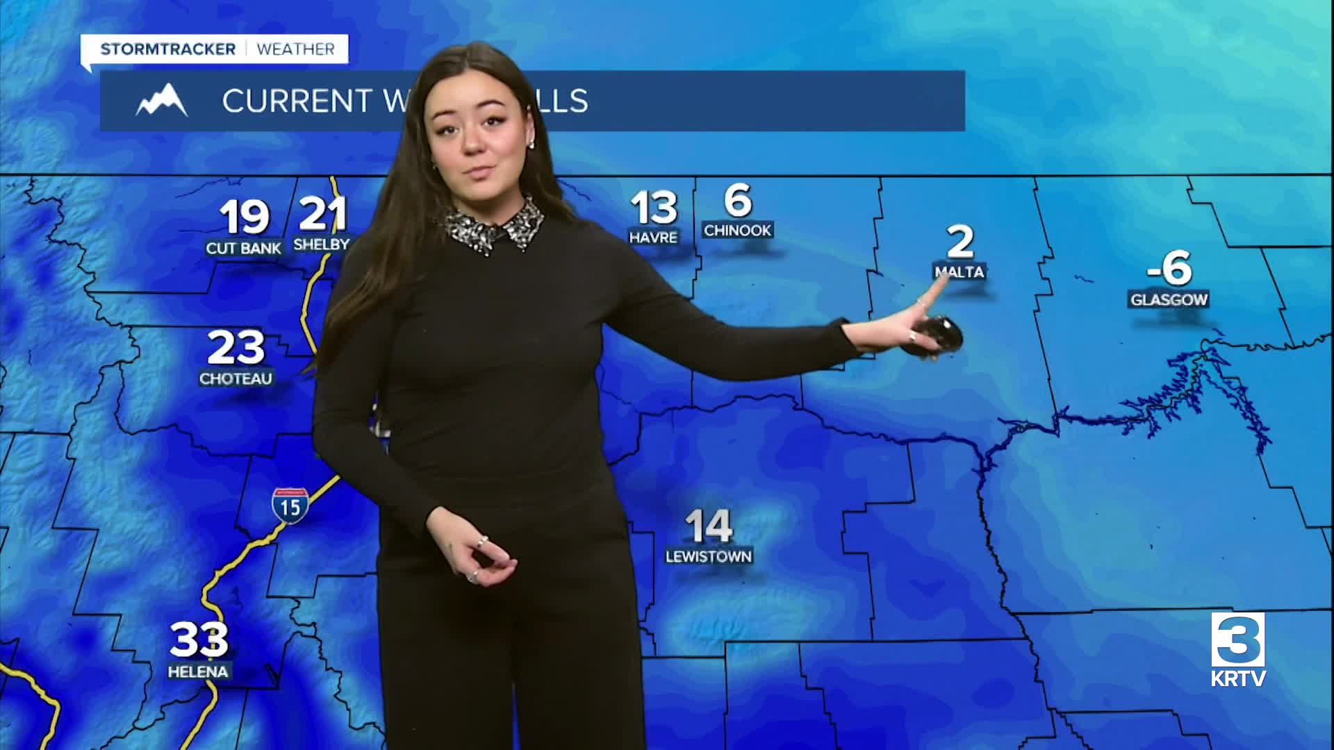

WEATHER DISCUSSION: Temperatures continued to cool down some today, with high temperatures in the 20s, 30s, and 40s. Tonight, expect mostly cloudy/cloudy skies with low temperatures in the teens and 20s for portions of North Central/Central Montana, while Northeastern areas will see single digits and wind chills below zero.
The cold front over the Rocky Mountain Front through the Little Belts will keep bringing decreasing temperatures through tonight. Although moisture is light, isolated and very light snow showers/flurries across Central and North-Central MT are possible through this evening thanks to the cold front. Snow accumulations besides the higher mountain peaks are not expected with precipitation.
The upper-level ridge is still dominating along the west coast of the U.S. for at least the first half of the week. Monday, expect some locations with mostly sunny skies around the Rocky Mountain Front with increasing cloud cover during the day. High temperatures are expected in the 30s and 40s for North Central/Central Montana and in the 20s for Northeastern.
Being on the eastern side of the upper-level ridge will continue this northwest flow aloft pattern through Wednesday. There will be a few upper level waves passing through Tuesday and Wednesday that will bring periods of light snow showers and more gusty winds for mostly North-Central MT.
Heading towards the end of the week, the ridging pattern looks to break down as troughing developing in Canada moves south into the NW U.S. There is higher confidence in colder air moving in Friday and Saturday. How much snow this system will bring, still remains uncertain at this time.
