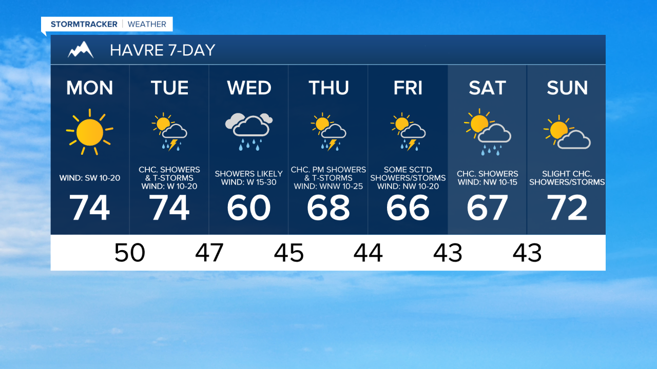
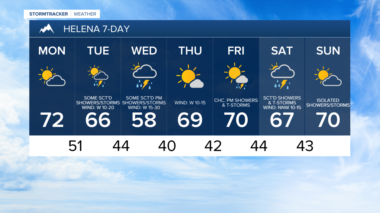
Good Morning and Happy Monday! It is a chilly start to the work week as temperatures are in the 30s and low to mid 40s in most locations this morning, so make sure you take a jacket with you as you head out the door. The temperatures will quickly warm up though and it will be warmer today than it was yesterday as highs are going to be in the mid to upper 60s and low to mid 70s.
Here is the detailed forecast:
In north-central Montana, expect lots of sunshine today. Around Helena and Lewistown, it is going to be partly to mostly sunny today. There is also going to be a breeze around today as sustained wind speeds are going to be between 10 and 20 mph, with stronger wind along the Rocky Mountain Front.
This evening and tonight, the cloud cover is going to increase as a disturbance begins to approach our area. Isolated showers are possible after midnight tonight in north-central Montana, while there will be a few showers around after midnight tonight around Helena. It is also going to be a lot warmer tonight than it was last night as lows are going to be in the mid to upper 40s and low to mid 50s.
Tomorrow will be partly to mostly cloudy and there will be some scattered showers and thunderstorms around, especially during the afternoon and evening. The temperatures will be near average again tomorrow as highs are going to be in the mid to upper 60s and low to mid 70s in most locations. Widespread breezy conditions are also expected tomorrow as sustained wind speeds are going to be between 10 and 25 mph, and gusts up to 40 mph are possible.
Wednesday will be a windy day as a cold front passes through our area. Sustained wind speeds are going to be between 15 and 30 mph, and gusts up to 50 mph are possible. There are also going to be scattered showers and a few thunderstorms around on Wednesday, especially during the afternoon and evening. Cooler temperatures are also expected on Wednesday as highs are going to be in the mid to upper 50s and low to mid 60s.
The temperatures will warm back up to near seasonal averages for the end of the work week as highs are going to be in the mid to upper 60s and low 70s on Thursday and Friday. Thursday will be a drier day, but there will continue to be a few showers and thunderstorms around along the eastern half of the Hi-Line. It will also be partly to mostly sunny on Thursday. On Friday, there are going to be scattered showers and thunderstorms around, generally during the PM hours, as another disturbance begins to impact the state. Breezy conditions are also expected on Thursday as sustained wind speeds are going to be between 10 and 25 mph.
It will feel nice outside this weekend as highs are going to be in the 60s and low 70s. There will also only be a little breeze around. On Saturday, it is not going to be a washout, but there are going to be scattered showers and some thunderstorms around, so similar weather to what we had yesterday. On Sunday, it is going to be partly to mostly cloudy and mostly dry, just some isolated showers/storms around.
Have a great Monday!
Chief Meteorologist Ryan Dennis