A HIGH WIND WATCH is in effect for central/eastern Glacier County, northern Lewis and Clark County, central Pondera County, central Teton County, and western Toole County from 8pm Sunday until 3pm Monday. Sustained wind speeds are going to be between 35 and 45 mph, and wind gusts up to 75 mph are going to be possible at times.

We are going to have partly cloudy to mostly clear skies tonight with a little bit of snow around in the Glacier National Park area. It is also going to be chilly tonight as lows are going to be in the 20s and mid to upper teens in most locations.
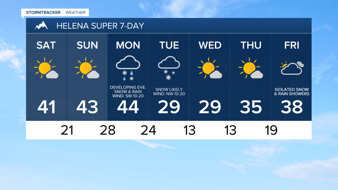
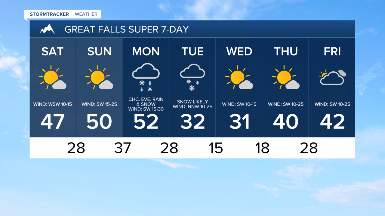
For this weekend, we are going to have beautiful weather as we are going to have mostly sunny skies, mainly dry conditions, and pleasant temperatures (highs ranging from the mid 30s to the low 50s).
On Saturday, it is going to be breezy along the Rocky Mountain Front as sustained wind speeds are going to be between 10 and 25 mph. Elsewhere, there is just going to be a little breeze around on Saturday as sustained wind speeds are going to be between 5 and 20 mph. It is then going to be windy on Sunday along the Rocky Mountain Front as wind gusts over 60 mph are going to be possible at times. East of the Rocky Mountain Front, we are going to have gusty winds around on Sunday as wind gusts over 40 mph are going to be possible at times.
There are then going to be areas of precipitation around from Monday evening through Tuesday as a storm system passes through our area. This precipitation is initially going to begin as a rain/snow mix, but it will changeover to all snow as colder air moves in. Right now, the largest impacts from this storm system are expected to be along the Rocky Mountain Front and in central Montana, including around Great Falls, Helena, and Lewistown. Along the Hi-Line and in northeastern Montana, the precipitation is going to be more showery in nature, so it is not going to be as impactful. In the lower elevations, a few inches of snow accumulation is possible by Wednesday morning, while in the mountains, several inches of snow accumulation is possible by Wednesday morning.
It is also going to be windy on Monday as sustained wind speeds are going to be between 15 and 35 mph, and wind gusts over 50 mph are going to be possible at times. Mild temperatures are also expected on Monday as highs are going to be in the 40s and low to mid 50s. It is then going to be a lot colder on Tuesday as highs are going to be in the mid to upper 20s and low 30s in most locations. A gusty northwesterly breeze is also expected on Tuesday as sustained wind speeds are going to be between 10 and 25 mph.
Mostly sunny skies and mostly dry conditions are then expected on Wednesday and Thursday as high pressure is going to be in control of our weather. We are then going to have mostly cloudy skies on Friday with a few isolated rain and snow showers around as a disturbance begins to approach our area. It is also going to be chilly on Wednesday as highs are going to be in the mid to upper 20s and low to mid 30s. The temperatures are then going to warm up for the end of next week as highs are going to be in the 30s and low 40s on Thursday and the mid to upper 30s and low to mid 40s on Friday. Breezy conditions are also expected on Thursday and Friday as sustained wind speeds are going to be between 10 and 25 mph.