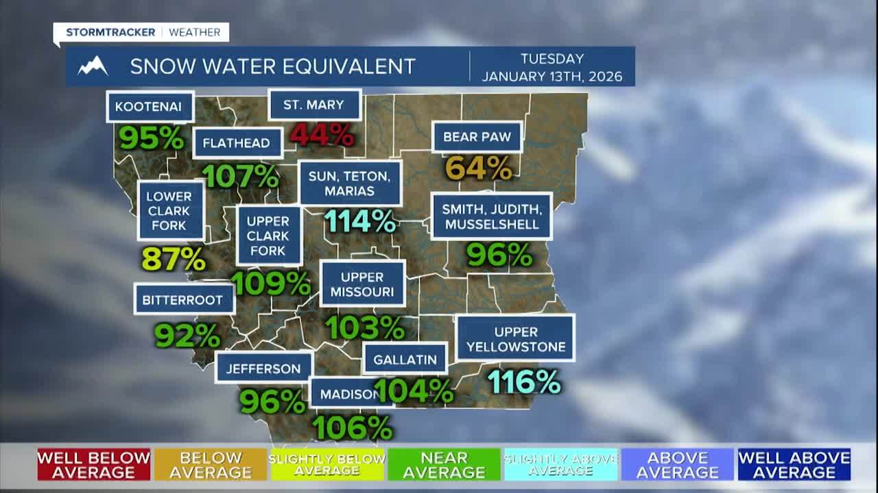

GREAT FALLS — Montana's snowpack presents a tale of two elevations this January, with warm temperatures in the 50s and 60s creating stark contrasts across the state's mountain ranges.
While many major basins are reporting near or above normal snowpack levels, the distribution tells a more complex story.
Erik Johnson reports - watch the video here:
Higher elevations received significant snow from the recent atmospheric river that brought flooding rains to northwest Montana, but lower elevations that typically accumulate substantial snowpack by mid-January are falling behind.
The warm temperatures have caused most precipitation at lower elevations to fall as rain rather than snow, creating concerns about drought conditions and the upcoming fire season. Moderate to extreme drought is currently impacting much of north-central Montana.
However, meteorologists note that it's still relatively early in the snow season, particularly for areas east of the Continental Divide where snowfall often increases later in the winter.
Long-range weather models suggest relief may be coming, with potential statewide snowfall forecast for late next week. The Climate Prediction Center has consistently indicated a transition to colder, potentially snowier conditions during that timeframe.
The additional moisture would be particularly beneficial for lower elevations, which need snow accumulation to help alleviate drought conditions and reduce fire risk for the coming season.
This article has been lightly edited with the assistance of AI for clarity, syntax, and grammar.
