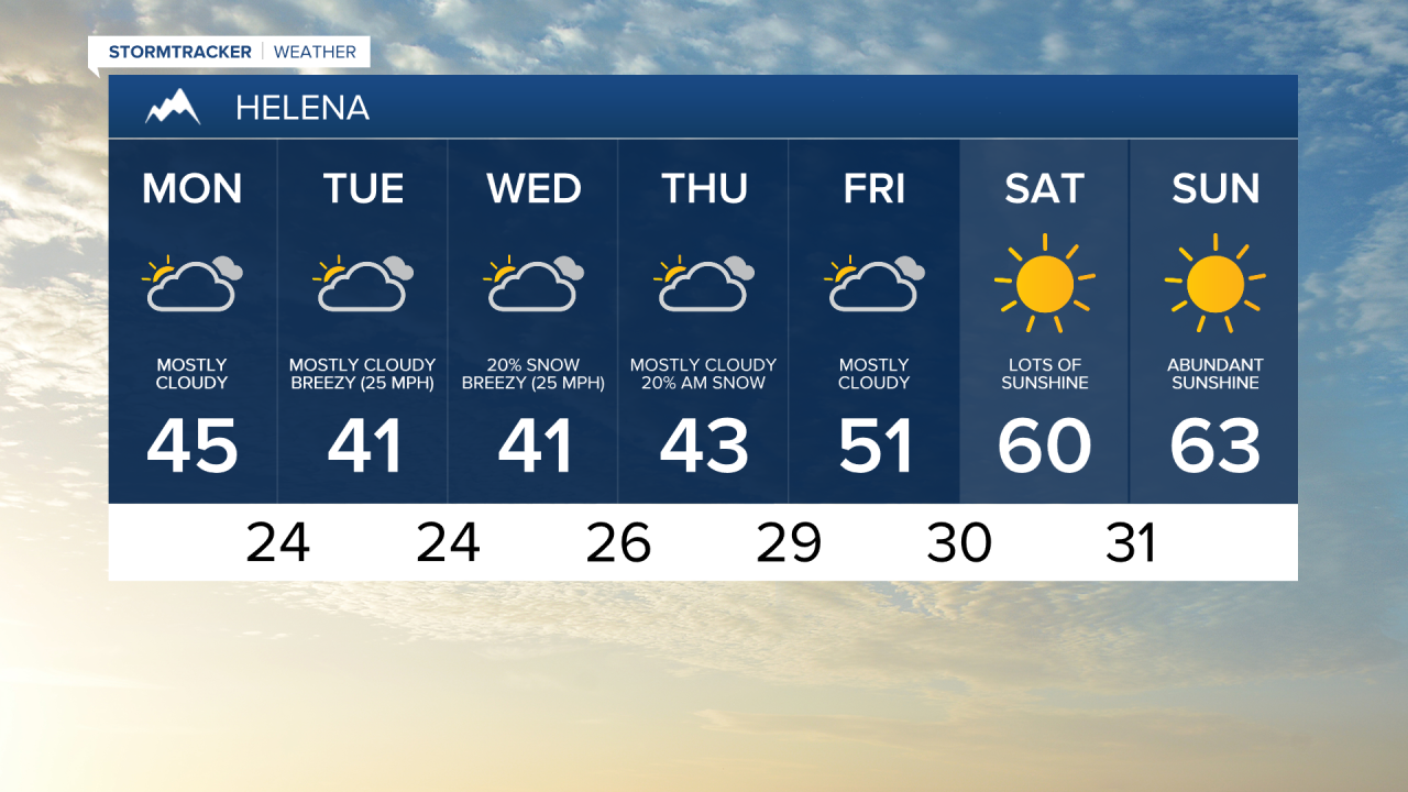
Temperatures are fairly chilly this morning with many areas in the low to mid 20s, not including the wind chill. You will definitely want to grab a jacket as you head out the door.
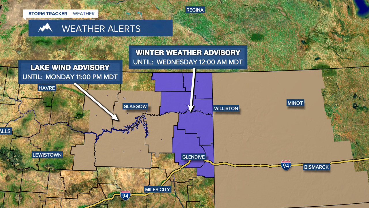
Meanwhile in Eastern Montana a Winter Weather Advisory is in effect for the potential to see an additional 4"-6" of snow through Midnight Wednesday. Winds gusting to 35 mph could also create visibility issues with blowing snow. Be sure to check road reports and take extra time if traveling in this part of the state. A Lake Wind Advisory has also been issued through later tonight for choppy waters on Fort Peck Lake.
Many places will at least see a slight chance of precipitation over the next few days, but it likely won't be the amount we really need to make a significant dent in the drought, but we'll certainly take what we can get. Breezy conditions will also be sticking with us for the next few days, making our chilly temperatures feel even colder. Temperatures will rebound by this weekend with sunny skies and highs back into the 60s.