Once again we'll start the day off with strong wind throughout Central Montana.
Gusts nearing 60 mph are likely along the immediate vicinity of the Rocky Mountain Front.
Much like Tuesday, the strong wind will begin to let up this afternoon.
A cold front is on track to move into the state this evening.
This front will increase the chances for rain and snow for most of Central Montana.
Areas north of Helena should see mostly rain while places south of the Capitol will have a better chance for snow.
There is a potential for snow light snow in Great Falls, however the likelihood is pretty slim.
The areas that do see snow likely wont pick up more than an inch or two.
The light rain and snow will taper off Thursday morning throughout Central Montana, but will likely stick around a bit longer for the Hi-Line.
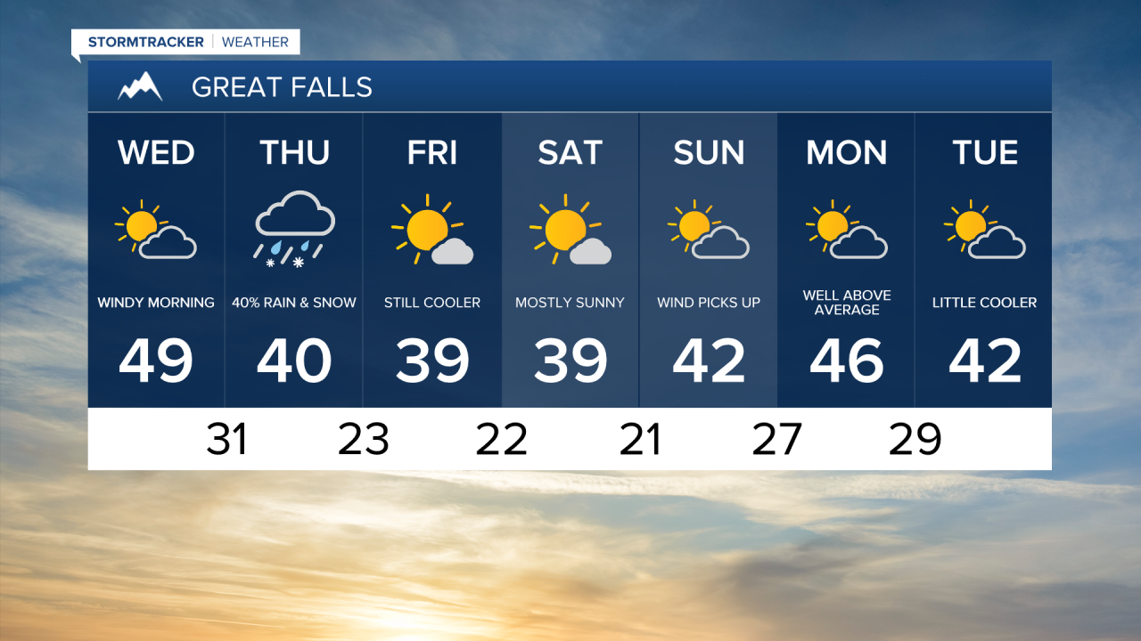
Thursday will trend a bit cooler as a batch of colder air continues to slide through the state.
Although still above average, temperatures will trend a bit closer to normal on Friday as the colder air remains camped out over the state.
Yet another passing cold front is expected to kick up the wind on Saturday.
At this point the cold front is expected to remain dry with the greatest impact being the wind.
Another ridge of high pressure is on track will build as we head into the new work week.
This along with the strong wind will keep temperatures well above average.
Forecast models are hinting at the possibility of a few showers mid week.