

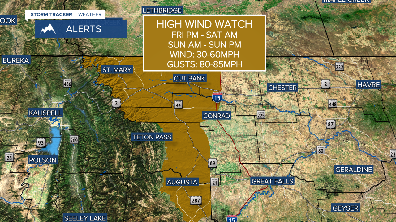


A HIGH WIND WATCH has been issued for the East Glacier area and down the Rocky Mountain Front for Friday night into Saturday, and all day Sunday.
Montana has settled into a pretty quiet pattern recently, but the wind is about to make a lot of noise across much of the state. The upcoming storm track will take numerous low pressures across southern Canada, to the north of Montana. This usually creates significant wind across the mountains and plains of Big Sky Country. The wind increased a bit on Thursday, but the wind will howl starting later Friday. Most of Friday will be decent with partly cloudy skies and mild temperatures in the 50s to around 60. Strong wind will continue Friday night into Saturday morning along the Rocky Mountain Front, the Continental Divide and the plains. Saturday will turn mostly sunny, with the strongest wind shifting to eastern Montana. By late afternoon, most areas will see diminishing wind. Highs will top out in the 50s and 60s. Enjoy that break in the wind because Sunday will be even worse. Gusts on Sunday could top 80mph along the immediate Rocky Mountain Front. Skies will be mostly cloudy with highs in the 50s and 60s. The wind will be lighter on Monday. Most of next week will be dry, with a good deal of sunshine and wind. The wind will not be very strong in the valleys of western Montana. It appears there will not be any precipitation until possibly the weekend of November 14-15th.
Have a great day,
Curtis Grevenitz
Chief Meteorologist
