

As thunderstorms roll across north and central Montana on Friday, June 13, 2025, one person caught video of a funnel cloud.
Cody Hanson shared this video, which was taken near Sunburst in Toole County, about 10 miles south of the US-Canada border.
The main difference between a tornado and funnel cloud is this: a funnel cloud does not make contact with the ground, while a tornado has some sort of interaction with the ground.
A funnel cloud will stay aloft, but once it makes contact with the ground it immediately becomes a tornado.
Typical signs of this interaction with the ground includes debris from the ground being brought aloft or dust circulation on the ground.
Brianna Juneau checks in from Fergus County:
(APRIL 21, 2025) It is only April, but there have now been two confirmed tornadoes in Montana this year, and they happened on back-to-back days.
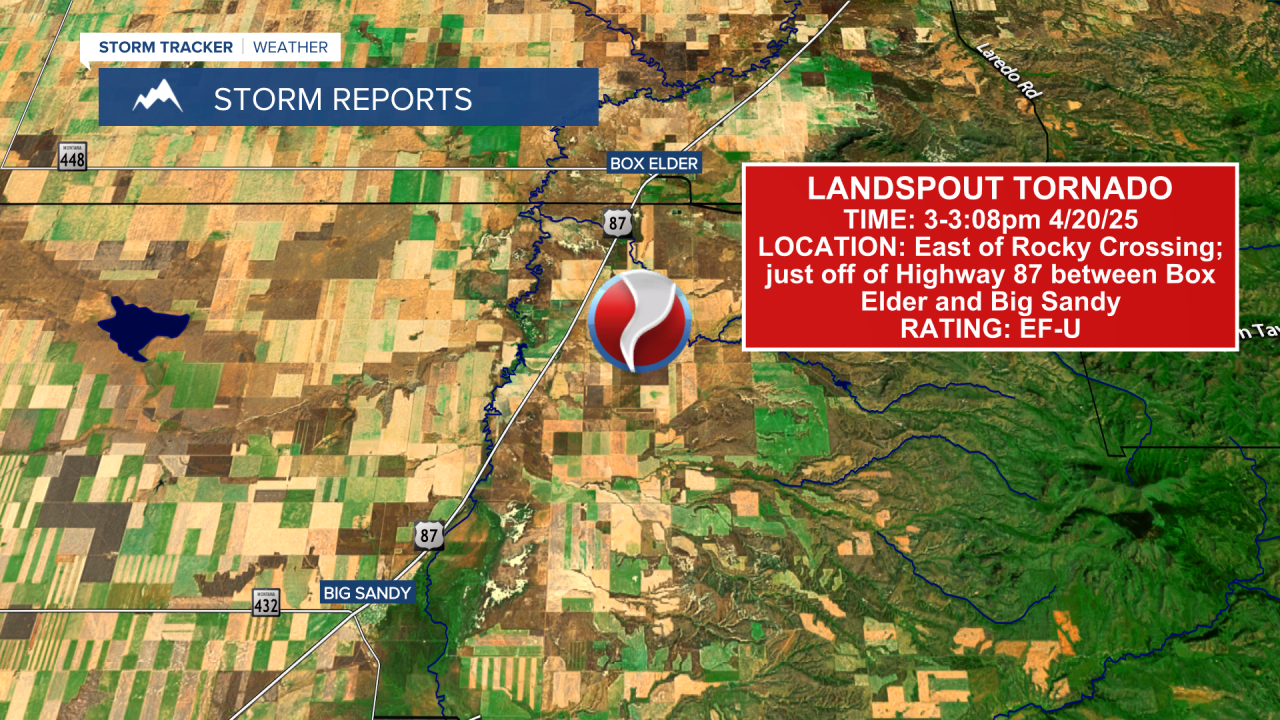
The first tornado occurred in north-central Montana on Sunday, April 20, 2025. This tornado was on the ground on the east side of Highway 87, east of Rocky Crossing, and between Box Elder and Big Sandy. It was on the ground from approximately 3:00pm to 3:08pm.
The second tornado occurred in north-central Montana on Monday, April 21, 2025. This tornado was also on the ground on the east side of Highway 87.
This time the tornado was in between Portage and Floweree, which is just northeast of Great Falls. This tornado was on the ground from approximately 3:43pm to 3:45pm.

Both of these tornadoes were rated EF-U, which means "unknown strength." These two tornadoes occurred over farm fields, and when the National Weather Service in Great Falls went out to survey them, they were unable to find any visible damage that would help them determine how strong the tornadoes were.
Most likely they were EF-0 tornadoes, which means they had wind gusts between 65 and 85 mph.
Both of these tornadoes were landspout tornadoes.
Landspout tornadoes do not occur with supercell thunderstorms. Instead, they typically occur with developing thunderstorms that have no rotating updraft.
Rotation with landspout tornadoes will begin at the surface and then connect up to the thunderstorm, whereas rotation with typical tornadoes will begin in the thunderstorm and then connect to the ground.
Landspouts are typically pretty weak, but can still cause damage.

Montana's tornado season generally spans from late May through early August, so it is pretty rare to have a tornado in April. These tornadoes were the first two confirmed tornadoes in Montana in 2025.
TORNADOES IN MONTANA
While most people associate tornadoes with the central plains and the southeast U.S., they do occasionally happen in Montana.
The two key ingredients for tornado formation are low-level moisture and wind shear. Wind shear is the change in wind direction with height up to the mid-levels of the atmosphere.
Patrick Gilchrist, the warning coordination meteorologist for the National Weather Service in Glasgow, said, "When it comes to tornadoes in Montana, it's really about moisture. So to get tornado development, we really want a moist layer right at the surface of the Earth at the lowest levels. That is provided actually by the Gulf of Mexico."
The likelihood of tornadoes increases in eastern Montana, due to the proximity to the Gulf of Mexico, not the change in topography. Higher terrain in western Montana actually acts as ignition for severe weather outbreaks as it forces the air to move vertically creating lift in the atmosphere. The severe weather outbreaks can often last through the night, traveling as far as Minnesota.
While tornadoes are less common in central Montana, the threat still exists. There have been a few notable events in recent history. An F2 moved through Lewistown back in 1999 and a series of F3 tornadoes southeast of Big Sandy in Chouteau County back in 1988.
The Enhanced Fujita Scale replaced the Fujita Scale in February 2007.
Damage assessments are utilized in determining the tornadoes scale, which can be difficult given the rural nature of eastern Montana.
Unlike those in "Tornado Alley" in the central part of the country, most Montana tornadoes are relatively small and usually touch down in sparsely-populated areas.
In 2022, an EF-2 tornado hit the community of Glentana in Valley County, causing property damage (link). The tornado was on the ground for eight miles and had an average path width of 457 yards. The maximum wind speed associated with this tornado was 120 miles per hour.
In 2016, an EF-3 tornado hit the town of Baker in southeast Montana. In 2015, a small tornado hit near Sidney in Richland County in eastern Montana, injuring one person and causing some damage.
In June 2010, a tornado hit Billings, causing significant damage to the MetraPark facility. Just several weeks later, two people were killed when a tornado struck a family ranch near Reserve in northeastern Montana.
