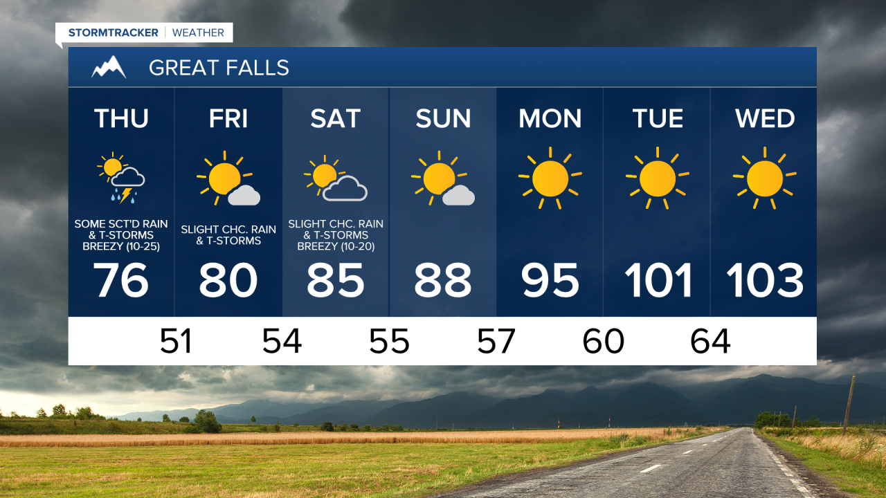
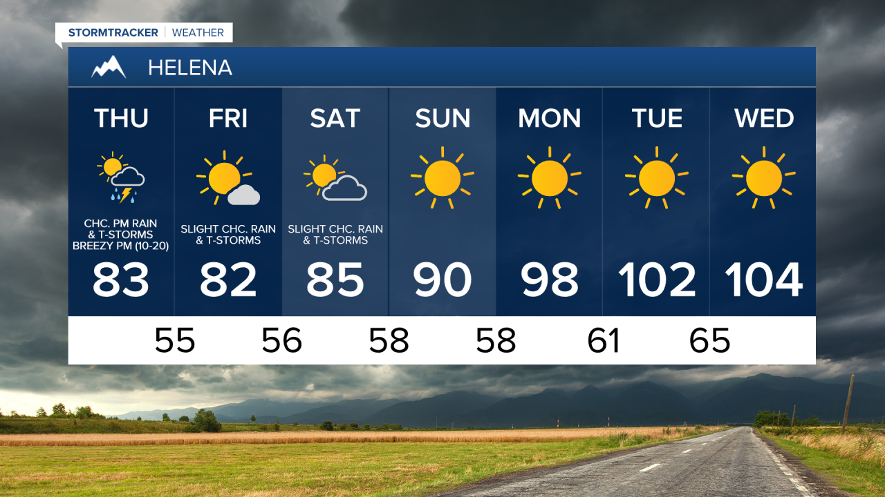
There are going to be some scattered rain showers and thunderstorms around this evening and tonight as an upper-level disturbance works its way through our area. This upper level disturbance is going to be moving towards the east, so locations in central Montana will dry out as the night goes on, while locations in eastern Montana will get wetter as the night goes on. There are then going to be some more scattered rain showers and thunderstorms around tomorrow, generally after 10am, as a cool front works its way through our area. These showers and thunderstorms are then going to gradually taper off tomorrow night as this cool front leaves our area. This cool front is going to be moving towards the southeast, so the showers and thunderstorms that develop tomorrow will generally move towards the southeast.
The showers and thunderstorms tonight and tomorrow are going to be hit or miss, so not everyone is going to see them. Also, most locations are going to receive less than a tenth of an inch of precipitation between this evening and tomorrow night, although some isolated locations may receive up to a third of an inch of precipitation. Most of the thunderstorms tonight and tomorrow are also going to be non-severe, although heavy rainfall, gusty winds, frequent lightning, and small hail are still possible with any thunderstorms that do develop. Partly cloudy skies are also expected tonight, tomorrow, and tomorrow night.
It is also going to be cool tonight as lows are going to be in the low to mid 50s in central Montana and the upper 50s and low 60s in eastern Montana. We are then going to have a wide range of temperatures tomorrow as highs are going to be in the mid to upper 70s in most locations in north-central Montana, and the mid 80s in most locations in south-central and eastern Montana. It is also going to be breezy tomorrow, especially during the afternoon and evening, as sustained wind speeds are going to be between 10 and 25 mph.
There is then a slight chance that we could see a couple rain showers and/or thunderstorms on Friday and Saturday, but most locations are going to remain dry on these two days. We are also going to have mostly sunny skies on Friday and partly cloudy skies on Saturday. It is also going to feel pretty nice outside on both of these days as highs are going to be in the upper 70s and low to mid 80s in most locations. There is also going to be a bit of a breeze around on Saturday, especially during the afternoon and evening, as sustained wind speeds are going to be between 10 and 20 mph.
Lots of sunshine and dry conditions are then expected on Sunday, Monday, Tuesday, and Wednesday as high pressure is going to be in control of our weather. The temperatures are also going to warm up a lot over these four days as highs on Sunday are going to be in the mid to upper 80s and low 90s; highs on Monday are going to be in the mid to upper 90s; and highs on Tuesday and Wednesday are going to be in the 100s. New record high temperatures may also be set in some locations on Tuesday and Wednesday. The heat next week is also going to be very dangerous, so make sure you try and limit your time outdoors during the heat of the day, and if you do have to be outside at all, make sure you stay hydrated and take frequent breaks in the shade or AC.