Temperatures have cooled off over the last 24 hours with the passage of a cold front. Many areas are 10 to 20 degrees cooler than this same time yesterday, however the highs and lows are still slightly above average for this time of year.
Our temperatures will remain right around the 50 degree mark through the rest of the weekend and into next week until a system moves through Monday night. That system will give us a slight chance of some snow showers, but also cool us off into the upper 40s for Tuesday, which aligns more with our average high this time of year.
Temperatures will rebound slightly and return to the low 50s until another system moves in Wednesday night. This system will again give us the chance for some rain and/or snow. The weather pattern will remain unsettled through the end of next week.
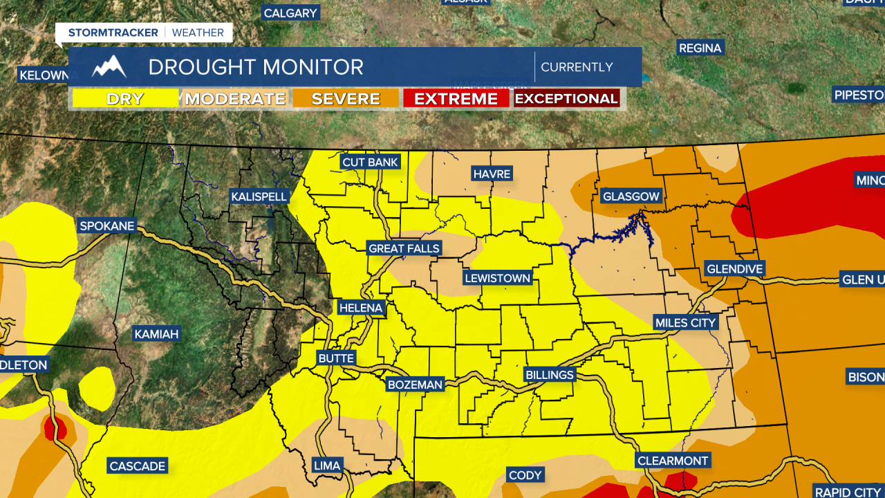
We are keeping an eye on several disturbances as they move through the region late next week. The generally unsettled weather is fairly normal for Spring in Montana and any precipitation would certainly be beneficial for our drought situation which has worsened across parts of the state.
Central Montana and areas along the Hi-Line are dealing with abnormally dry to moderate drought. Meanwhile the severe drought has expanded in Eastern Montana and has reached areas further west than in previous weeks. Extreme drought has made its way into Roosevelt and Richland counties.