

WEATHER DISCUSSION: The cold air has begun to slowly move out of many locations, though it will still be bitterly cold tonight. Expect low temperatures in the single digits and below zero, with wind chills in the negative teens and 20’s, as well as -30’s for eastern locations.
Portions of the Hi-line and Eastern locations are under Cold Weather Advisories (light blue) through 1 pm, that warn of dangerously cold wind chills as cold as -40 below zero. As a reminder, the cold wind chills could cause frostbite on exposed skin in as little as 15 minutes. Wind chill values can lead to hypothermia with prolonged exposure.
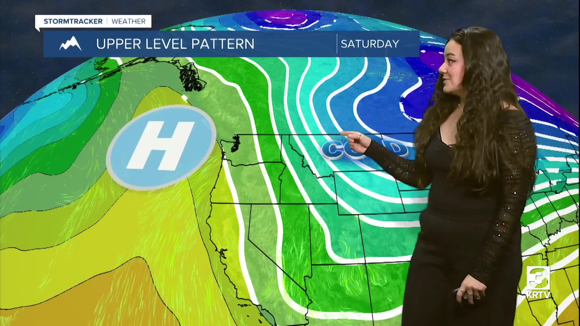
Northwesterly flow is currently hanging out over the region, bringing primarily light snow to mountain adjacent areas with the heaviest amounts in northerly upslope areas. The snowfall will continue through Sunday morning.
On Sunday an upper-level ridge will begin to move over North-central, Central, and Southwestern Montana. This will allow temperatures to begin to warm up with mostly dry weather. Expect high temperatures in the teens and 20’s for North Central and Central locations, and single digits and sub-zero temperatures for Eastern locations. Expect gradually clearing skies – sunny, and winds around 5 to 10 mph with gusts up to 20 mph, that will increase towards the evening.
As the upper-level ridge moves over the region Sunday evening, there will be a strong pressure gradient bringing gusty winds to North-central Montana, with the strongest winds along the Rocky Mountain Front. This will lead to areas of blowing snow across portions of North-central Montana Sunday evening to Monday morning (primarily along the Rocky Mountain Front).
On Monday the upper-level ridge remains over the region, allowing temperatures to warm up to above seasonal averages with continued dry weather. Tuesday through Friday, the upper-level ridge remains over the region with a few passing upper-level shortwaves. Expect mostly dry and warm weather with temperatures returning to the 30s, 40s, and 50s, along with windy conditions at times.
