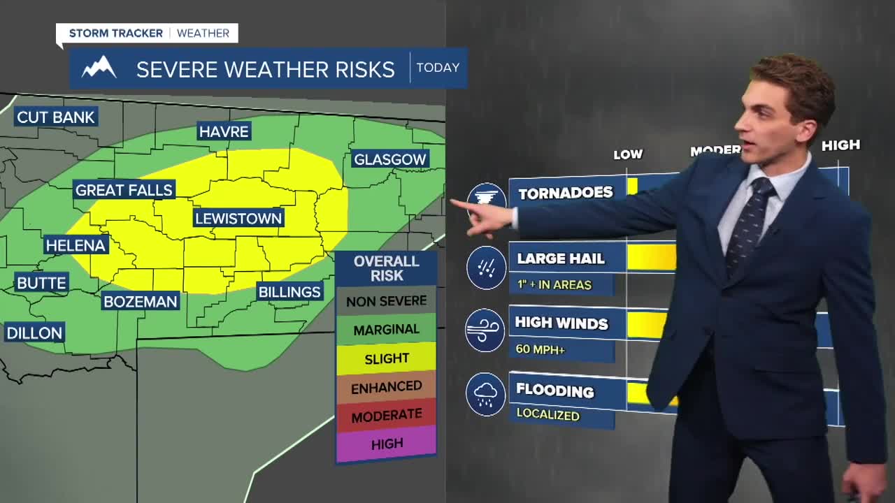


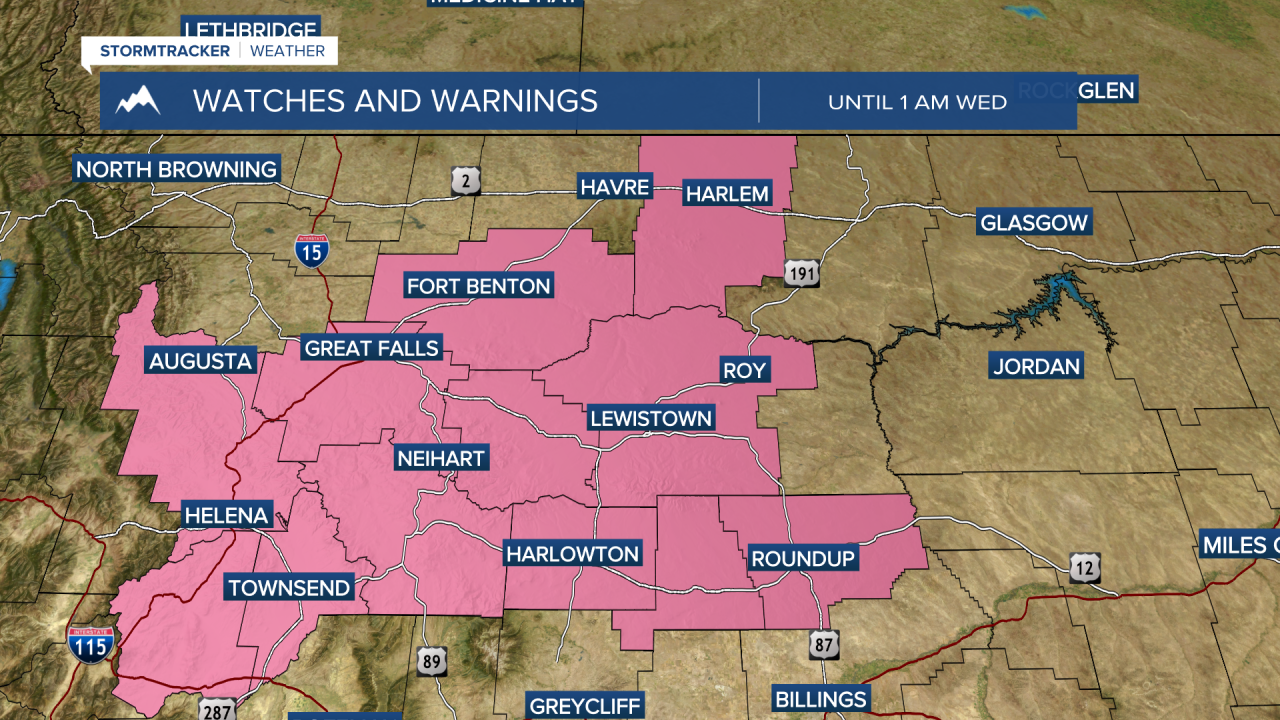
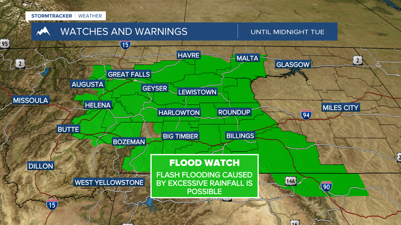
Severe thunderstorms are possible in our area tonight. The Storm Prediction Center has outlined a broad area in central Montana in a slight, level 2/5, risk for severe storms to develop. Storms may bring damaging winds, hail, and flash flooding.
Storms will move through the Helena area around 8 PM. They will continue to move east-northeast through the rest of the night, where the flooding concern maximizes around the Lewistown area. Rain rates of around 1 to 2 inches per hour may be reached.
Another round of showers and storms develops tomorrow morning over the Big Belt and Bridger Mountains and moves eastward through the afternoon, potentially moving over some of the same areas that would've received heavy rain the night before.
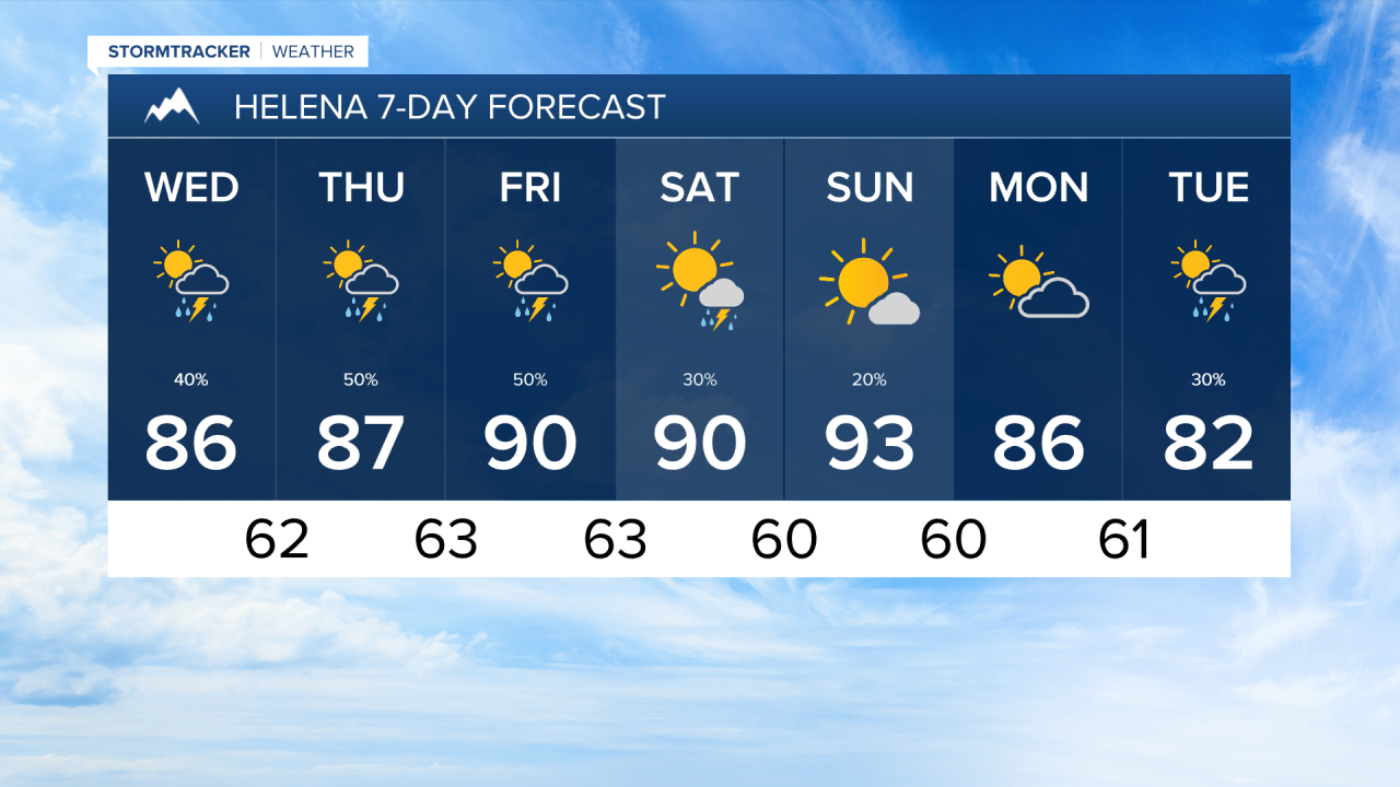
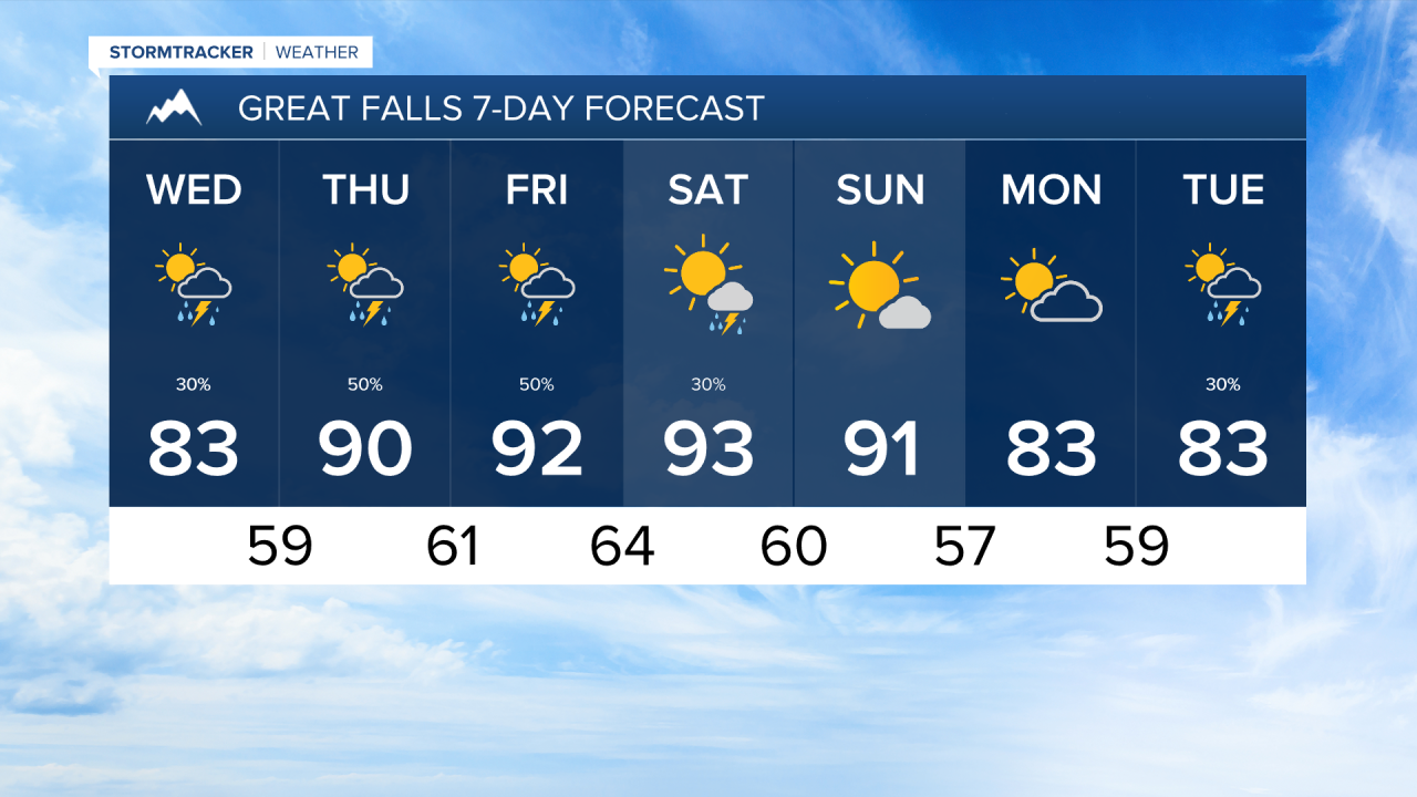
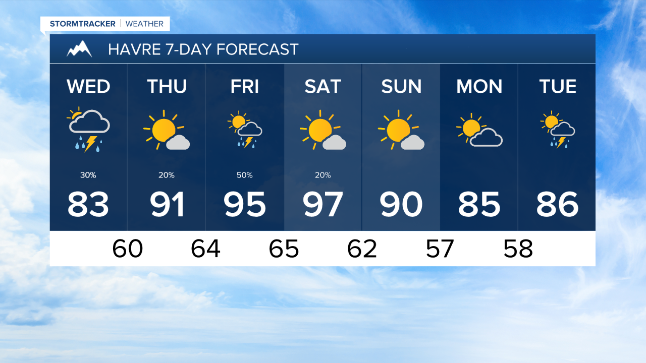
Daily showers and storms are possible through at least Saturday.
——————————————————————————————————————————
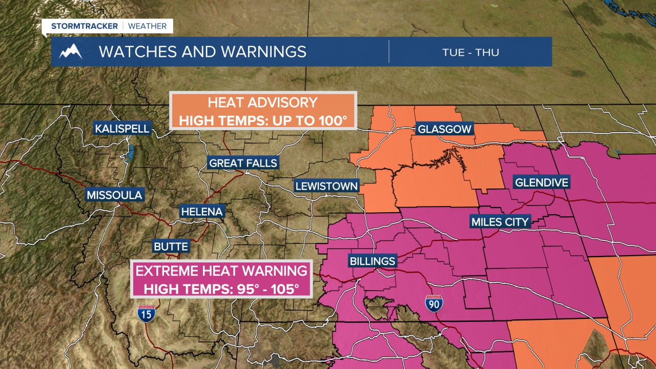
MONTANA WEATHER ALERTS:
——————————————————————————————————————————