



A HIGH WIND WARNING has been issued for parts of the Hi-Line and central Montana for Friday.
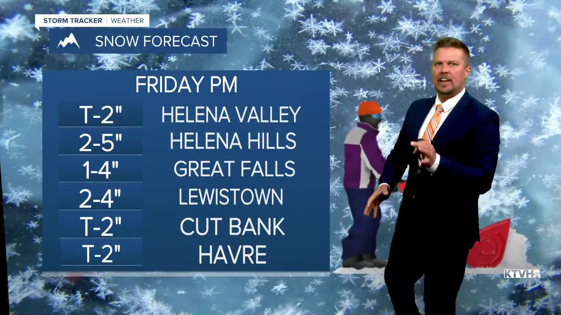
A WINTER WEATHER ADVISORY has been issued for parts of southwest and central Montana for Friday afternoon and evening.
An intense storm will produce heavy rain that will quickly transition to a heavy wet snow with strong wind on Friday, travel conditions will become difficult for some areas.
This storm has moisture, it has energy, and it will meet up with some colder air in Montana on Friday. Friday will be chilly and wet, with many areas seeing steady rain develop through the morning. Highs will be in the 40s to around 50, but temperatures will fall in the afternoon. The snow level will fall as well, with rain mixing with and changing to snow through Friday afternoon and evening. The snow could be heavy at times on Friday afternoon, with a little accumulation possible in the lower elevations. The mountain passes will be slippery and white out conditions are possible with heavy snow and strong wind reducing visibility. The wet snow will taper off through the night, with a few inches likely in the mountains, and a coating up to a few inches in the lower elevations. General hunting season opens on Saturday, and there should be fresh snow in the mountains. It will be a little wet and sloppy as well, Saturday will be partly cloudy and blustery behind the storm. Highs will top out in the 40s and low 50s. Sunday a little light snow is likely across northern Montana. Snow will be very light, but much of the Hi-Line will get some flurries at least. Some light flurries are possible just north of Great Falls, but areas south of there like Helena should be mostly cloudy and mainly dry. Highs will be cold enough for the snow, as highs top out in the 30s to around 40. Sunday night will be pretty chilly with lows in the 10s and 20s. A few areas of light snow are possible into Monday, but there will be little to no accumulation.
Have a great day,
Curtis Grevenitz
Chief Meteorologist
